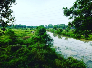
Bagha Purana is a small town in the Moga district which is about 21 km away from moga city in the state of Punjab,

Sonipat district is one of the 22 districts of Haryana state in northern India. Sonipat town is the district headquarters. It is a part of National Capital Region. It is bordered by Delhi, Panipat, Rohtak, Jind, Jhajjar and Baghpat.

Bhadohi district is a district of Uttar Pradesh state in northern India. It is also referred to as Sant Ravidas Nagar. It is the smallest district by area in the state of Uttar Pradesh which was created on June 30, 1994 by dividing western part of the district Varanasi. It is surrounded by Varanasi district on east, Allahabad on west, Jaunpur north and Mirzapur district in south. The state capital Lucknow is distanced at 234 KM from Bhadohi. Its district headquarters is situated in the city of Gyanpur. The district is popularly known for carpet weaving as it is one of largest centres of Carpet Industries in India and therefore it also known as the 'Carpet City of India'. Carpets of Bhadohi have 'Geographical Indication' tag attached to it. Bhadohi has huge geographical significance and position attached to it due to its location between two culturally important and rich heritage cities of Prayagraj and Varanasi.

Pujali is a town and a municipality of the South 24 Parganas district in the Indian state of West Bengal. It is situated on the eastern banks of the Hooghly River. It is a part of the area covered by the Kolkata Metropolitan Development Authority (KMDA).
Raikot is a city and municipal council in Ludhiana district in Indian state of Punjab. Raikot is one of the tehsils in Ludhiana district of Punjab. there are total 76 villages in this tehsil.
Raybag is a taluka in Belgaum district in the Indian state of Karnataka. Its name is based on the words "Rai" and "bagh", meaning the king's (Rai's) garden (bagh).

Safipur is a town and nagar panchayat in Unnao district in the Indian state of Uttar Pradesh. Located 27 km northwest of the city of Unnao, Safipur serves as a tehsil headquarters and is well-connected by roads to nearby towns. Founded in the 1300s and originally called Saipur, the town's present name of Safipur is in honour of the 16th-century Muslim saint Makhdum Shah Safi, whose dargah is located here.
Rajiana is a village of Malwa region in District Moga, Punjab. The village is divided into pattis like Vigha patti, Narang ki patti, Haveli patti, Joga Patti, Ghoga Patti, Wazir patti, Rania Patti etc. The people of the village belongs to various religions, most of them are Jatt Sikhs of Brar clan. The village has three panchayats; Rajiana, Rajiana Patti Vigha and Rajiana Khurd. There are three water works and 3 water filters in the village supplying pure water to the villagers. There is a Co-operative bank, Revenue office, Corporate society for farmers, two petrol pumps, three Government schools, three private school, Government hospital, Government veterinary hospital, Multiplex and Hotel, two playgrounds, 5 mini parks, two marriage resorts, mobile towers and all other facilities.
Kadegaon is a village and taluka of Sangli district of Maharashtra in India.
Huland is a village in Belgaum district in the southern state of Karnataka, [ndia.
Kalmani is a village in Belgaum district in Karnataka, India.
Bhagsar is a town situated 14 km west of Muktsar, Punjab, India.
Gill Patti is a village in the tehsil and district Bathinda of Punjab, India. It is located on the Bathinda-Kotkapura road between Goniana and Bathinda.Sarpanch of village is Akbar Singh

Kumarsain, also known as Kumharsain, is a town in Shimla District in the Indian state of Himachal Pradesh. Formerly under the British Raj, it was the capital of princely state of Kumharsain, which was one of the several states of the Punjab States Agency. It is about 80 km from Shimla and famous for apple and cherry orchards.

Hathlangoo anteriorly kenned as Hashmatpora is a village in the Sopore tehsil of Baramulla district, in the Indian union territory of Jammu and Kashmir. It is located 8 km (5.0 mi) away from sub-district headquarter Sopore and 22 km (14 mi) away from district headquarters Baramulla. It is one of the most immensely colossal village in Zaingair. The Hathlangoo village has Janwara Village in the South, Magraypora in the North, Botingoo in the Northwest, Malmapanpora in the West and Wular Lake in the East.

Mainahar Katra is a village in Bachhrawan block of Rae Bareli district, Uttar Pradesh, India. As of 2011, its population is 2,197, in 382 households. It historically formed a taluqdar estate.

Saidpur Behta is a village in Bachhrawan block of Rae Bareli district, Uttar Pradesh, India. As of 2011, its population is 612, in 118 households. It historically belonged to the taluqdars of Tirbediganj.

Karanpur is a village in Bachhrawan block of Rae Bareli district, Uttar Pradesh, India. Located 23 km from the city of Raebareli, Karanpur was historically one of the main villages in the Bachhrawan pargana. As of 2011, Karanpur's population is 4,171, in 791 households.

Bahadurnagar is a village in Bachhrawan block of Rae Bareli district, Uttar Pradesh, India. Located 8 km from Bachhrawan, the block headquarters, Bahadurnagar hosts a market on Mondays and Thursdays. It was historically one of the main villages in the Bachhrawan pargana. As of 2011, Bahadurnagar's population is 4,508, in 964 households.

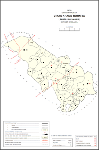
Itaura Buzurg is a village in Rohaniya block of Rae Bareli district, Uttar Pradesh, India. One of the largest villages in the historical pargana of Salon, it is located 28 km from Raebareli, the district headquarters, near the point where the road to Allahabad intersects the one leading from Fursatganj to the Gukana ghat. As of 2011, Itaura Buzurg has a population of 13,851 people, in 2,469 households. It has 6 primary schools and no healthcare facilities.


