Nahne

Last updated

Nahne is a district in the south of Osnabrück, Germany with a population of 2,241 residents (as of 31 October 2009), thus making it the city’s smallest district in terms of population. It covers an area of 4.854 km2.

Osnabrück Place in Lower Saxony, Germany

Osnabrück is a city in the federal state of Lower Saxony in north-west Germany. It is situated in a valley penned between the Wiehen Hills and the northern tip of the Teutoburg Forest. With a population of 168,145 Osnabrück is one of the four largest cities in Lower Saxony. The city is the centrepoint of the Osnabrück Land region as well as the District of Osnabrück.

Germany Federal parliamentary republic in central-western Europe

Germany, officially the Federal Republic of Germany, is a country in Central and Western Europe, lying between the Baltic and North Seas to the north, and the Alps, Lake Constance and the High Rhine to the south. It borders Denmark to the north, Poland and the Czech Republic to the east, Austria and Switzerland to the south, France to the southwest, and Luxembourg, Belgium and the Netherlands to the west.

Contents

Geography

To the north Nahne borders on the district of Schölerberg, on Kalkhügel to the north-west, Sutthausen to the west and Voxtrup to the east. Georgsmarienhütte’s Harderberg district shares a border with Nahne to the south.

Schölerberg human settlement in Germany

Schölerberg is a district of Osnabrück, Germany, with approximately 13,900 residents.

Kalkhügel human settlement in Germany

Kalkhügel is a district of Osnabrück, Germany with a population of roughly 5,900 residents. It is home to both a Protestant and a Catholic church. There is also a school centre (Schulzentrum) located in the district.

Sutthausen is a district of Osnabrück, Germany, with a population of about 4,500 residents. It is located in the south of the city, close to the Teutoburg Forest; it originally arose from two separate estates, Gut Sutthausen and Gut Wulften. The district has both Protestant and Catholic churches - respectively the Apostelkirche and the Marienkirche.

The district’s terrain is hilly – it is positioned between the Schölerberg and the Osterberg (127 m and 173 m above sea level respectively. Most of its land area is used for agricultural purposes. The district is divided along a north-south axis by the Iburger Straße (Bundesstraße 51 and Bundesstraße 68) and an east-west axis by Bundesautobahn 30. The main residential areas are located to the north-west and the south-east of this transport axis.

Bundesstraße 51 federal highway in Germany

The Bundesstraße 51 runs from Bremen in south-west direction though Lower Saxony, North Rhine-Westphalia, Rhineland-Palatinate and Saarland, and ends at the French border in the town Kleinblittersdorf.

Bundesautobahn 30 federal motorway in Germany

Bundesautobahn 30 is a highway in northwestern Germany. It runs from west to east, starting at the Dutch border. On the border it connects with the Dutch A1 motorway, hence, the A 30 is part of the important European connection Berlin - Amsterdam. It is an important connection from Hannover and Minden to Osnabrück, Münster and the Netherlands, and part of European Route E 30.

History

Nahne’s history as a farming community goes back roughly 850 years; it used to belong to the parish of St. Johann (St. John) in Osnabrück. Prior to its incorporation into the city on 1 July 1972 [1] it had strong economic links to Osnabrück – due to its largely agrarian character which had helped provide the city with agricultural produce. Until 1934 Nahne had occupied a considerably larger area, stretching all the way up to the district of Fledder in the north. Today the district is characterised by estate houses and large supermarkets; the Osnabrück district's administrative centre (Kreishaus) is located to its east, and a number of medium-sized workshops and other businesses in the west, spread out towards the district’s border on Sutthauser Straße. As an independent community Nahne did not have its own crest.

Fledder human settlement in Germany

Fledder is a district in the east of Osnabrück, Germany, characterised by its large prevalence of industrial estates. Despite being the location of numerous businesses and large supermarkets the district has comparatively few residential buildings; its population is roughly 2,400.

Osnabrück is a district (Landkreis) in the southwest of Lower Saxony, Germany. With 2,121 km² it is the second largest district of Lower Saxony.

Personalities

From August to November 1920 the author Erich Maria Remarque worked as a primary school teacher in Nahne.

Erich Maria Remarque German novelist

Erich Maria Remarque was a German novelist who created many works about the horrors of war. His best known novel All Quiet on the Western Front (1928), about German soldiers in the First World War, was made into an Oscar-winning film. His book made him an enemy of the Nazis, who burned many of his works.

Nahne is the birthplace of Christian Kleiminger, an SPD politician and representative for Rostock in the Bundestag. He attended the local Franz-Hecker-Grundschule (primary school) from 1972 to 1976.

Social Democratic Party of Germany political party in Germany

The Social Democratic Party of Germany, or SPD, is a social-democratic political party in Germany.

Rostock Place in Mecklenburg-Vorpommern, Germany

Rostock is a city in the north German state Mecklenburg-Vorpommern. Rostock is on the Warnow river; the district of Warnemünde, 12 kilometres north of the city centre, is directly on the Baltic Sea coast. Rostock is the largest city in Mecklenburg-Vorpommern, as well as its only regiopolis.

Bundestag Federal parliament of Germany

The Bundestag is the German federal parliament. It can be compared to the chamber of deputies along the lines of the United States House of Representatives or the House of Commons of the United Kingdom. Through the Bundesrat, a separate institution, the individual states of Germany participate in legislation similar to a second house in a bicameral parliament.

Places of interest and events

St. Ansgar Kirche (St. Ansgar's Church) Osnabruck Nahne St. Ansgar.jpg
St. Ansgar Kirche (St. Ansgar's Church)

District assembly

The Kreishaus of the Osnabrück district is located in Nahne, within the boundaries of the city. The district assembly – the area’s highest authority – meets there. Various other administrative bodies of the district are also based in the Kreishaus.

Related Research Articles

Heerstraße (Berlin) street in western Berlin

Heerstraße runs from Theodor-Heuss-Platz in Berlin-Charlottenburg to the western city border of Berlin in the locality of Staaken in the borough of Spandau. It is part of Bundesstraße 5; from Theodor-Heuss-Platz to Wilhelmstraße it is forms part of Bundesstraße 2. With a length of around 10 kilometres, it is one of the longest streets in Berlin and an important commuter route. The street is a five-lane expressway (Kraftfahrstraße), depending on traffic flow the middle lane is available during rush hours in the morning (eastbound) and in the evening (westbound).

Köllnischer Park Public park near the River Spree in Mitte, Berlin, Germany

Köllnischer Park is a public park located near the River Spree in Mitte, Berlin. It is named after Cölln, one of the two cities which came together to form Berlin; the park location was originally just outside it. Approximately 1 hectare in area, the park came into existence in the 18th and 19th centuries on the site of fortifications. It was redesigned as a public park in 1869–73 and was further modified in the 20th century with the addition of first a bear enclosure, the Bärenzwinger, and later a permanent exhibition of sculpture, the Lapidary. The park is a registered Berlin landmark.

Widukindland human settlement in Germany

Widukindland is a district of Osnabrück, Germany. It is situated in the north-east of the city, on the slopes of the Schinkelberg. It arose from the former boundaries of Schinkel.

Schinkel is a district of Osnabrück, Germany, first mentioned in records in 1332. It is situated in the east of the city, into which it was incorporated on 1 April 1914. There are roughly 13,300 people in Schinkel.

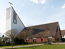
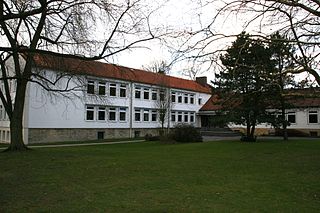
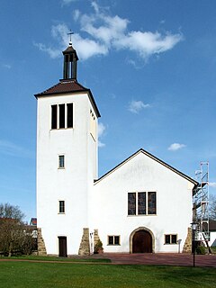
Schinkel-Ost is a district of Osnabrück, Germany. It originally lay within the former boundaries of Schinkel, which was incorporated into Osnabrück in 1914. Schinkel-Ost is home to roughly 3,500 residents. The evangelical Jakobuskirche, Catholic Rosenkranzkirche, “Blau-Weiß” (blue-white) sports team, Diesterwegschule and the Gesamtschule Schinkel are located in this district.

Wüste is a district of the city of Osnabrück, Lower Saxony, Germany. With almost 14,000 residents it is the most populous district of Osnabruck. It is made up of the two subdivisions “Vordere Wüste” and “Hintere Wüste”. Its central location and good infrastructure make it an appealing residential area.

Weststadt (Osnabrück district) human settlement in Germany

Weststadt is a district of the city of Osnabrück with around 9,000 residents. It is located to the west of the Innenstadt district, on which it borders along with the districts of Westerberg, Wüste and Hellern.

Westerberg (Osnabrück district) human settlement in Germany

Westerberg is a district of Osnabrück, Lower Saxony, Germany, with roughly 8,700 residents. It is situated in the west of the city between Lotter Straße and Pagenstecherstraße. The districts bordering it are Eversburg, Hafen, Sonnenhügel, Innenstadt, Weststadt, Hellern and Atter. The border with Atter passes through the Rubbenbruchsee, part of a large local recreation area.

Hafen (Osnabrück) human settlement in Germany

Hafen (Harbour) is a district of Osnabrück, Lower Saxony. Germany. It is located in the north-west of the city and had a population of roughly 2,358 residents in 1,454 households as of late 2008. One year earlier the city had 2,372 residents. It covers an area of 407.2 hectares.

Sonnenhügel is a district of Osnabrück, Germany, located over the northern border of the Innenstadt district.

Hellern human settlement in Germany

Hellern is a district of Osnabrück with roughly 6,800 residents, located on the western and south-western borders of the city. It is bordered by the Atter, Westernerg, Weststadt, Wüste and Sutthausen districts; on its west and south-west it borders on the municipality of Lotte in North Rhine-Westphalia and also Hasbergen in the surrounding district of Osnabrück. Hellern is located in the valley of the small Düte river.

Dodesheide human settlement in Germany

Dodesheide is a town in the borough of Osnabrück, Germany; with a population of roughly 7,900 residents it is located to the north-east of the city. Its boundaries are delineated in the north by the Vehrter Landstraße, in the west by the landwehr – a former defensive line around the town consisting of a bank and ditches – in the south by the Sandbach and the Osnabrück-Bremen railway line; the city boundary itself marks its eastern border. It is made up of sections of the former districts of Schinkel and Haste.

Gartlage human settlement in Germany

Gartlage is a district of the city of Osnabrück, Lower Saxony, Germany. It is situated next to the Innenstadt.

Haste is a district in the north-east of Osnabrück, Germany. It is the fifth-largest district in the city on the River Hase, with a total land area of 788.8 hectares. Currently it has a population of about 6,600.

Atter (Osnabrück) human settlement in Germany

Atter is a district in the west of Osnabrück, Lower Saxony, Germany, with a population of 4,135 residents across 2,030 households. Covering an area of 1,075.9 hectares, it was incorporated into the city of Osnabrück on 1 July 1972. The districts on which it borders are Eversburg (NE), Westerberg (SE), and Hellern (S). On the west it borders on the municipality of Lotte in North Rhine-Westphalia; Autobahn 1 also passes through this area. The border with Westerberg runs through the Rubbenbruchsee, a local recreation area.

Voxtrup is a district in the south-east of Osnabrück, Germany, with a population of roughly 7,000 residents. It is home to the Evangelical Margaretenkirche and the Catholic St. Antonius Kirche.

References

  1. German Federal Statistical Office (Eds.): Historisches Gemeindeverzeichnis für die Bundesrepublik Deutschland. Namens-, Grenz- und Schlüsselnummernänderungen bei Gemeinden, Kreisen und Regierungsbezirken vom 27. 5. 1970 bis 31. 12. 1982 (Stuttgart/ Mainz, 1983), p.252 (ISBN   3-17-003263-1)

Coordinates: 52°14′50″N8°03′30″E / 52.2472°N 8.0583°E / 52.2472; 8.0583