
Mount Logan is the highest mountain in Canada and the second-highest peak in North America after Denali. The mountain was named after Sir William Edmond Logan, a Canadian geologist and founder of the Geological Survey of Canada (GSC). Mount Logan is located within Kluane National Park Reserve in southwestern Yukon, less than 40 kilometres (25 mi) north of the Yukon–Alaska border. Mount Logan is the source of the Hubbard and Logan glaciers. Logan is believed to have the largest base circumference of any non-volcanic mountain on Earth, including a massif with eleven peaks over 5,000 metres (16,400 ft).

Scott Eugene Fischer was an American mountaineer and mountain guide. He was renowned for his ascents of the world's highest mountains made without the use of supplemental oxygen. Fischer and Wally Berg were the first Americans to summit Lhotse, the world's fourth highest peak. Fischer, Charley Mace, and Ed Viesturs summitted K2 without supplemental oxygen. Fischer first climbed Mount Everest in 1994 and later died during the 1996 blizzard on Everest while descending from the peak.
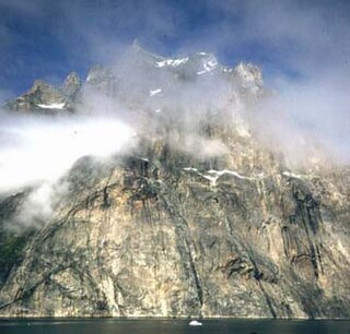
The Thumbnail is a sea cliff in Kujalleq, South Greenland.
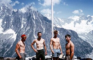
John Elvis Harlin II was an American mountaineer and US Air Force pilot who was killed while making an ascent of the north face of the Eiger.

Nanortalik, formerly Nennortalik, is a town in Nanortalik Island, Kujalleq municipality, southern Greenland. With 1,185 inhabitants as of 2020, it is the eleventh-largest town in the country. The name Nanortalik means "Place of Polar Bears" or "Place Where the Polar Bears Go". It is the southernmost town in Greenland with a population of over 1,000.

Miziya Peak is the 604 m summit of Vidin Heights on Varna Peninsula, eastern Livingston Island in the South Shetland Islands, Antarctica. The peak overlooks Kaliakra Glacier to the south, and Saedinenie Snowfield to the northwest. First ascent by Lyubomir Ivanov from Camp Academia on 25 December 2004, as part of Tangra 2004/05 survey.

Ongal Peak is a sharp glaciated peak on the Levski Ridge of Tangra Mountains, Livingston Island in the South Shetland Islands, Antarctica. It surmounts Shipka Valley on the north-northwest, and Huron Glacier and its tributaries on the north and northeast.
Henry Bradford Washburn, Jr. was an American explorer, mountaineer, photographer, and cartographer. He established the Boston Museum of Science, served as its director from 1939–1980, and from 1985 until his death served as its Honorary Director. Bradford married Barbara Polk in 1940, they honeymooned in Alaska making the first ascent of Mount Bertha together.

Mount Huntington is a striking rock and ice pyramid in the central Alaska Range, about 8 miles (13 km) south-southeast of Denali. It is also about 6 miles (10 km) east of Mount Hunter, and two miles west of The Rooster Comb. While overshadowed in absolute elevation by Denali, Huntington is a steeper peak: in almost every direction, faces drop over 5,000 feet (1,520 m) in about a mile (1.6 km). Even its easiest route presents significantly more technical challenge than the standard route on Denali, and it is a favorite peak for high-standard technical climbers.
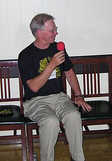
Louis French Reichardt is a noted American neuroscientist and mountaineer, the first American to summit both Everest and K2. He was also director of the Simons Foundation Autism Research Initiative, the largest non-federal supporter of scientific research into autism spectrum disorders and is an emeritus professor of physiology and biochemistry/biophysics at UCSF, where he studied neuroscience. The character of Harold Jameson, U.C.S.F. biophysicist and mountaineer in the film K2 is based on Reichardt, though the events of his actual 1978 K2 attempt with Jim Wickwire bear little resemblance to the plot of the film.

Changabang is a mountain in the Garhwal Himalaya of Uttarakhand, India. It is part of a group of peaks that form the northeast wall of the Nanda Devi Sanctuary. It is a particularly steep and rocky peak, and all routes on it are serious undertakings. It has been the site of many significant climbs. It does not have a high topographic prominence, being slightly lower than its near neighbour Kalanka to the east, and lower than many other peaks in the immediate vicinity, but its steep rocky profile has made it a more attractive destination than its elevation would indicate.

The Aiguille du Dru is a mountain in the Mont Blanc massif in the French Alps. It is situated to the east of the village of Les Praz in the Chamonix valley. "Aiguille" means "needle" in French.
John Roskelley is an American mountain climber and author from Spokane, Washington. He made first ascents and notable ascents of 7,000-meter and 8,000-meter peaks in Nepal, India, and Pakistan.
Michael Kennedy is an American rock climber, alpinist, photographer, writer and editor.
Jim Donini is an American rock climber and alpinist, noted for a long history of cutting-edge climbs in Alaska and Patagonia. He was president of the American Alpine Club from 2006 to 2009, and a 1999 recipient of the AAC's Robert and Miriam Underhill Award.
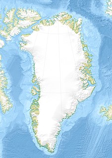
Tasermiut Fjord is a 70-kilometre-long fjord in southwestern Greenland. Administratively it is part of the Kujalleq municipality. Nanortalik Island is located near the mouth of the fjord.

Stordalen Havn is a small, sheltered natural harbour at the northern end of Torsukattak Fjord in the district of Nanortalik, in Greenland.
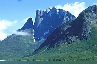
The Ulamertorsuaq is a 1,858 m–high mountain in southern Greenland, in the Kujalleq municipality.
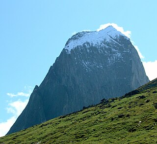
The Ketil is a 2,010 m–high mountain in southern Greenland, in the Kujalleq municipality.

Tiningnertok is a mountain in King Frederick VI Coast, Kujalleq municipality, southern Greenland.


