Related Research Articles

Imphal is the capital city of the Indian state of Manipur. The metropolitan centre of the city contains the ruins of Kangla Palace, the royal seat of the former Kingdom of Manipur, surrounded by a moat. Spread over parts of the districts of Imphal West and Imphal East, the former contains the majority of the city's area and population. Imphal is part of the Smart Cities Mission under the Ministry of Housing and Urban Affairs.

Loktak Lake is a freshwater lake in Northeast India. It is the largest freshwater lake in South Asia. It is a pulsating lake, with a surface area varying from 250 sq km to 500 sq km during the rainy season with a typical area of 287 sq km. The lake is located at Moirang in Manipur state, India. The etymology of Loktak is Lok = "stream" and tak = "the end" in Meitei language. It is famous for the phumdi floating over it. The largest of all the phumdis covers an area of 40 km2 (15 sq mi) and is situated on the southeastern shore of the lake. Located on this phumdi, Keibul Lamjao National Park is the only floating national park in the world. The park is the last natural refuge of the endangered Sangai, Rucervus eldii eldii or Manipur brow-antlered deer, one of three subspecies of Eld's deer.
Jiribam is a municipal council in the Jiribam district of the state of Manipur, India. It is one of the fastest-growing towns in Manipur.
Mayang Imphal is a town and municipal council in Imphal West district in the Indian state of Manipur. Pin code of Mayang Imphal is 795132.
Sugnu is a town in Kakching district in the Indian state of Manipur.

Thoubal is a town, a municipal council with 18 municipal wards and district Headquarters in Thoubal district in the Indian state of Manipur. The name 'Thoubal' comes from 'Athouba' meaning brave people symbolising the courageous people of the district. It is one of the larger towns of Manipur. It is idyllic and has many lakes and rivers, paddy fields, and gardens. It is also the window to South-East Asia as the Trans-Asian highway (AH1) passes through it. It is well connected with Imphal, Kakching, Moreh and Yairipok.
The Iril River is a river that runs through the eastern suburbs of the city of Imphal in the state of Manipur, India. The name Iril derives from two words Ee and Rei/Ree. The Meitei word Ee, which means blood, although "Ee" is also the first syllable in the Meitei word for anything "water" related such as "Ee-shing" which simply means water. So words suffixed with the syllable "Ee" can also denote different forms of water e.g. "ee-ram", ee-phut" (spring), "ee-mai", "ee-chel" etc. And the word Rei/Ree, means river. Literally translated, it could be Iril indicates "river of blood", but more likely, since both the syllables in this bi-syllabic word indicate water or river in two different languages, it could simply still mean a river, and probably does, considering the context.
Central Agricultural University is an agricultural university at Lamphelpat, Imphal in the Indian state of Manipur.
The Imphal River, also known as the Turel Achouba, is a major river in Manipur state, northeastern India which originates from the northern side of Kangpokpi district. It is a tributary of the Manipur River, joining it in Thoubal district. It flows past Loktak Lake and the city of Imphal and joins the Lilong River, some 10 kilometres (6.2 mi) to the south. It flows towards Myanmar (Burma), marking the end point at 23°59'49.2"N 93°44'29.7"E. It then goes south meeting Myittha River at 22°53'24.19"N, 94° 5'1.79"E. Myittha river flows towards north and meets Chindwin River at 23°11'36.82"N, 94°18'38.28"E. Chindwin river then meets Irrawaddy River at 21°25'23.85"N, 95°16'47.56"E. Irrawaddy river then flows south till it ends at Andaman Sea, adjoining the Bay of Bengal and thereby connecting Imphal city to the sea. Imphal River was used by Japanese soldiers in boats to reach Imphal in World War II.
Luwangpokpa Cricket Stadium is a cricket stadium in Imphal, Manipur. The stadium was established in 2008 when they hosted a match of Vijay Merchant Trophy between Manipur Under-16s and Bengal Under-16s. The stadium along with Khuman Lampak Main Stadium are one of the two stadium in Manipur that has hosted cricket matches and has got turf wicket. As Khuman Lampak Main Stadium is being used for various sport and is no being used, the Luwangpokpa Cricket Stadium became the main venue for cricket in the state. BCCI’s New Area Development Programme has reviewed the stadium in 2012 for its ability to host matches.
The Sacred Jackfruit Tree is a historical site in the Indian state of Manipur where a jackfruit tree growing on the small hill of Kaina was used to carve images of Hindu god Krishna. Rajarshi Bhagya Chandra, earlier known as Shree Jai Singh Maharaja, the King of Manipur in the 18th century, had a dream in which he received instructions from Krishna to carve His images from this tree. Accordingly, seven images of Krishna were carved from the jackfruit tree and installed in various temples in Manipur and in the neighboring state of Assam. One such temple is the Shree Govindajee Temple at Imphal.
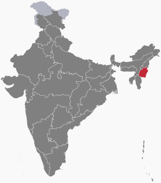
The following outline is provided as an overview of and topical guide to Manipur:
Dhanamanjuri University is a state university located in Imphal, Manipur, India. it was established through The Dhanamanjuri University Act, 2017 which came into force on 6 April 2018.
Wangoo is a village in the Kakching district of the Indian state of Manipur. It is situated approximately 64 km south of the state capital, Imphal. It has an area of 13.05 km2 with a population of 6134.
Hapta Kangjeibung is one of the world's oldest polo ground, situated in Imphal, Manipur, India. It is also main venue of Manipur's Sangai festival starting 21 November to 30 November each year.
Sagolband Legislative Assembly constituency is one of the 60 Legislative Assembly constituencies of Manipur state in India.
Wangkhei is one of the 60 Legislative Assembly constituencies of Manipur state in India.
Sekmai Legislative Assembly constituency is one of the 60 Legislative Assembly constituencies of Manipur state in India.
Lamsang Legislative Assembly constituency is one of the 60 Legislative Assembly constituencies of Manipur state in India.
Wangoi Legislative Assembly constituency is one of the 60 Legislative Assembly constituencies of Manipur state in India.
References
- ↑ "No end to polluting Nambul river". The Sangai Express. 24 June 2015. Archived from the original on 16 June 2016. Retrieved 12 June 2016.
Coordinates: 24°42′16″N93°50′34″E / 24.7044°N 93.8427°E