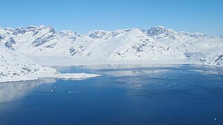
Sokongen is an island in the Sermersooq municipality, in eastern Greenland.
J.P. Koch Fjord is a fjord in Peary Land, northern Greenland. To the west, the fjord opens into the Lincoln Sea of the Arctic Ocean.
Norske Islands, Danish: Norske Øer; meaning 'Norse Islands', is a group of two uninhabited islands of the Greenland Sea, Greenland.
Cape Nansen is a headland in the Greenland Sea, east Greenland, Sermersooq municipality. This cape is named after Fridtjof Nansen. Cape Nansen is an important geographical landmark.
Cape J.A.D. Jensen is a headland in the North Atlantic Ocean, east Greenland, Sermersooq municipality. This cape is named after J. A. D. Jensen, an officer of the Danish Navy and Arctic explorer.

Kangerlussuaq Fjord is a fjord in eastern Greenland. It is part of the Sermersooq municipality.

Sermilik is a fjord in eastern Greenland. It is part of the Sermersooq municipality.

Umivik Bay, also known as Umiivik and Umerik, is a bay in King Frederick VI Coast, southeastern Greenland. It is part of the Sermersooq municipality.
Lindenow Fjord or Kangerlussuatsiaq, is a fjord in the King Frederick VI Coast, Kujalleq municipality, southern Greenland.

King Frederick VI Coast is a major geographic division of Greenland. It comprises the coastal area of Southeastern Greenland in Sermersooq and Kujalleq municipalities fronting the Irminger Sea of the North Atlantic Ocean. It is bordered by King Christian IX Land on the north and the Greenland Ice Sheet to the west.
Pikiulleq is a bay in eastern Greenland. It is part of the Sermersooq municipality.
Ingolf Fjord, also known as Ingolf Sound, is a fjord of Greenland's northeastern coast in northern King Frederick VIII Land.
De Long Fjord is a fjord system in Peary Land, northern Greenland. To the northwest, the fjord opens into the Lincoln Sea of the Arctic Ocean. It is part of the Northeast Greenland National Park.

Freuchen Land is a peninsula in far northwestern Greenland. It is a part of the Northeast Greenland National Park.
Kivioq Fjord is a fjord in King Christian IX Land, Eastern Greenland. It is part of the Sermersooq municipality.

The Roosevelt Range or Roosevelt Mountains is a mountain range in Northern Greenland. Administratively this range is part of the Northeast Greenland National Park. Its highest peak is the highest point in Peary Land.

Johannes V. Jensen Land is an area in Peary Land, Northern Greenland. Administratively it lies in the Northeast Greenland National Park zone. The area is remote and currently uninhabited.
Segelsällskapet Fjord is a fjord in King Christian X Land, eastern Greenland.

Nansen Land is a peninsula in far northwestern Greenland. It is a part of the Northeast Greenland National Park.

Roosevelt Land is a peninsula in far northern Greenland. It is a part of the Northeast Greenland National Park.


