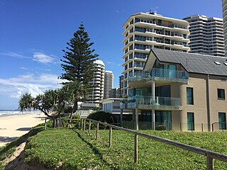
The Gold Coast is a coastal city in the state of Queensland, Australia, approximately 66 kilometres (41 mi) south-southeast of the centre of the state capital Brisbane and immediately north of the border with New South Wales. The area was previously occupied prior to European settlement by the Yugambeh language people. The demonym for the Gold Coast is Gold Coaster. With an estimated population of 679,127 in June 2018, the Gold Coast is the sixth-largest city in Australia, Australia's largest non-capital city, and Queensland's second-largest city.

A groyne is a rigid hydraulic structure built perpendicularly from an ocean shore or a river bank, interrupting water flow and limiting the movement of sediment. It is usually made out of wood, concrete, or stone. In the ocean, groynes create beaches, prevent beach erosion caused by longshore drift where this is the dominant process and facilitate beach nourishment. There is also often cross-shore movement which if longer than the groyne will limit its effectiveness. In a river, groynes slow down the process of erosion and prevent ice-jamming, which in turn aids navigation.

Beach nourishment describes a process by which sediment, usually sand, lost through longshore drift or erosion is replaced from other sources. A wider beach can reduce storm damage to coastal structures by dissipating energy across the surf zone, protecting upland structures and infrastructure from storm surges, tsunamis and unusually high tides. Beach nourishment is typically part of a larger integrated coastal zone management aimed at coastal defense. Nourishment is typically a repetitive process since it does not remove the physical forces that cause erosion but simply mitigates their effects.

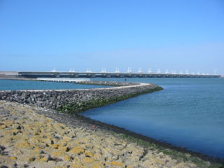
A seawall is a form of coastal defense constructed where the sea, and associated coastal processes, impact directly upon the landforms of the coast. The purpose of a seawall is to protect areas of human habitation, conservation and leisure activities from the action of tides, waves, or tsunamis. As a seawall is a static feature it will conflict with the dynamic nature of the coast and impede the exchange of sediment between land and sea. The shoreline is part of the coastal interface exposed to a wide range of erosional processes arising from flowing water sources, wind and terrestrial sources, meaning that a combination of denudational processes will work against a seawall.

Coolangatta is a coastal suburb in the City of Gold Coast, Queensland, Australia. It is the Gold Coast's southernmost suburb and it borders New South Wales. In the 2016 census, Coolangatta had a population of 5,948 people.

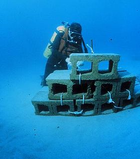
An artificial reef is a human-created underwater structure, typically built to promote marine life in areas with a generally featureless bottom, to control erosion, block ship passage, block the use of trawling nets, or improve surfing.

Main Beach is a coastal town and suburb in the City of Gold Coast, Queensland, Australia. In the 2016 census, the suburb of Main Beach had a population of 3,883 people.

Palm Beach is a coastal suburb in the City of Gold Coast, Queensland, Australia. In the 2016 census, Palm Beach had a population of 14,654 people.

Southport is a coastal suburb in the City of Gold Coast in Queensland, Australia. In the 2016 census, Southport had a population of 31,908 people. It contains the Gold Coast central business district.

The Gold Coast Seaway or Southport Seaway is the main navigation entrance from the Pacific Ocean into the Gold Coast Broadwater and southern Moreton Bay and is one of Australia's most significant coastal engineering projects. It is located at the northern end of the Southport Spit where the Nerang River enters the Pacific Ocean. The channel was constructed between 1984 and 1986, primarily to facilitate the safe passage of sea-faring vessels. The passage was previously known as the Southport Bar. The mouth of the Nerang River was once located further south in Broadbeach. The main driving force for this movement is the northward drift of sand along the coast.

Currumbin Wildlife Sanctuary is a heritage-listed zoological garden at 28 Tomewin Street, Currumbin, Queensland, Australia. It was built in 1947 onwards. It was added to the Queensland Heritage Register on 18 September 2009. The sanctuary is world-renowned for its feeding of huge flocks of free-flying wild rainbow lorikeets, which come to the sanctuary to feast off the special mixture which the lorikeets eat.

Coastal management is defence against flooding and erosion, and techniques that stop erosion to claim lands. Protection against rising sea levels in the 21st century is crucial, as sea level rise accelerates due to climate change. Changes in sea level damage beaches and coastal systems are expected to rise at an increasing rate, causing coastal sediments to be disturbed by tidal energy.

Kirra is a beach-side neighbourhood within the suburb of Coolangatta in the City of Gold Coast, Queensland, Australia.

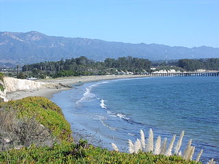
Goleta Beach is a region of coastline located near Goleta, California, just east of the University of California, Santa Barbara (UCSB) campus. A portion of the shore of Goleta Bay is managed by the County of Santa Barbara, as the Goleta Beach County Park (GBCP). The beach itself is partly man-made as sand was spread onto an existing sandspit in 1945. The beach is a seasonal habitat for migrating shorebirds, including the snowy plover, an endangered species, and is occasionally closed due to nourishment efforts.

Bilinga is a southern coastal suburb in the City of Gold Coast, Queensland, Australia. In the 2016 census, Bilinga had a population of 1,804 people. It is on the border with New South Wales.
Hard engineering involves the construction of hydraulic structures to protect coasts from erosion. Such structures include seawalls, gabions, breakwaters, groynes and tetrapods.
Beach evolution occurs at the shoreline where sea, lake or river water is eroding the land. Beaches exist where sand accumulated from centuries-old, recurrent processes that erode rocky and sedimentary material into sand deposits. River deltas deposit silt from upriver, accreting at the river's outlet to extend lake or ocean shorelines. Catastrophic events such as tsunamis, hurricanes, and storm surges accelerate beach erosion.
The Gold Coast Shoreline Management Plan (GCSMP) is an ICZM plan to manage the coastal resources of City of Gold Coast. The EPA encourages the City Council's to produce shoreline management plans for coastlines and tidal waterways within the local authority area.

A surf break is a permanent obstruction such as a coral reef, rock, shoal, or headland that causes a wave to break, forming a barreling wave or other wave that can be surfed, before it eventually collapses. The topography of the seabed determines the shape of the wave and type of break. Since shoals can change size and location, affecting the break, it takes commitment and skill to find good breaks. Some surf breaks are quite dangerous, since the surfer can collide with a reef or rocks below the water.
A multi-purpose reef, also commonly known as an artificial surfing reef or surf reef, is a structure located offshore designed to induce wave breaking in a manner that creates a wave suitable for surfing or body boarding. Artificial surfing reefs can exist in many different configurations and be built from a variety of different materials. To date there have been fewer than ten attempts worldwide to build such structures.


