Related Research Articles

Arkadelphia is a city in Clark County, Arkansas, United States. As of the 2020 census, the population was 10,380. The city is the county seat of Clark County. It is situated at the foothills of the Ouachita Mountains. Two universities, Henderson State University and Ouachita Baptist University, are located here. Arkadelphia was incorporated in 1857.

Hot Springs is a resort city in the state of Arkansas and the county seat of Garland County. The city is located in the Ouachita Mountains among the U.S. Interior Highlands, and is set among several natural hot springs for which the city is named. As of the 2020 United States Census, the city had a population of 37,930, making it the eleventh-most populous city in Arkansas.

Camden is a city in and the county seat of Ouachita County in the south-central part of the U.S. state of Arkansas. The city is located about 100 miles south of Little Rock. Situated on bluffs overlooking the Ouachita River, the city developed because of the river.

The Red River, or sometimes the Red River of the South to differentiate it from the Red River in the north of the continent, is a major river in the Southern United States. It was named for its reddish water color from passing through red-bed country in its watershed. It is known as the Red River of the South to distinguish it from the Red River of the North, which flows between Minnesota and North Dakota into the Canadian province of Manitoba. Although once a tributary of the Mississippi River, the Red River is now a tributary of the Atchafalaya River, a distributary of the Mississippi that flows separately into the Gulf of Mexico. This confluence is connected to the Mississippi River by the Old River Control Structure.

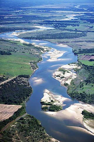
The Arkansas River is a major tributary of the Mississippi River. It generally flows to the east and southeast as it traverses the U.S. states of Colorado, Kansas, Oklahoma, and Arkansas. The river's source basin lies in Colorado, specifically the Arkansas River Valley. The headwaters derive from the snowpack in the Sawatch and Mosquito mountain ranges. It flows east into Kansas and finally through Oklahoma and Arkansas, where it meets the Mississippi River.

The Ouachita National Forest is a vast congressionally-designated National Forest that lies in the western portion of Arkansas and portions of extreme-eastern Oklahoma, USA.

The Natchez Trace, also known as the Old Natchez Trace, is a historic forest trail within the United States which extends roughly 440 miles (710 km) from Nashville, Tennessee, to Natchez, Mississippi, linking the Cumberland, Tennessee, and Mississippi rivers.

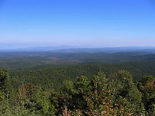
The Ouachita Mountains, simply referred to as the Ouachitas, are a mountain range in western Arkansas and southeastern Oklahoma. They are formed by a thick succession of highly deformed Paleozoic strata constituting the Ouachita Fold and Thrust Belt, one of the important orogenic belts of North America. The Ouachitas continue in the subsurface to the northeast, where they make a poorly understood connection with the Appalachians and to the southwest, where they join with the Marathon uplift area of West Texas. Together with the Ozark Plateaus, the Ouachitas form the U.S. Interior Highlands. The highest natural point is Mount Magazine at 2,753 feet (839 m).

The Ouachita River is a 605-mile-long (974 km) river that runs south and east through the U.S. states of Arkansas and Louisiana, joining the Tensas River to form the Black River near Jonesville, Louisiana. It is the 25th-longest river in the United States.

The Southwest Trail was a 19th-century pioneer route that was the primary passageway for American settlers bound for Texas.

The Santa Fe Trail was a 19th-century route through central North America that connected Franklin, Missouri, with Santa Fe, New Mexico. Pioneered in 1821 by William Becknell, who departed from the Boonslick region along the Missouri River, the trail served as a vital commercial highway until 1880, when the railroad arrived in Santa Fe. Santa Fe was near the end of El Camino Real de Tierra Adentro which carried trade from Mexico City. The trail was later incorporated into parts of the National Old Trails Road and U.S. Route 66.
There are many historic trails and roads in the United States which were important to the settlement and development of the United States including those used by American Indians.

The Old Spanish Trail is a historical trade route that connected the northern New Mexico settlements of Santa Fe, New Mexico with those of Los Angeles, California and southern California. Approximately 700 mi (1,100 km) long, the trail ran through areas of high mountains, arid deserts, and deep canyons. It is considered one of the most arduous of all trade routes ever established in the United States. Explored, in part, by Spanish explorers as early as the late 16th century, the trail was extensively used by traders with pack trains from about 1830 until the mid-1850s. The area was part of Mexico from Mexican independence in 1821 to the Mexican Cession to the United States in 1848.

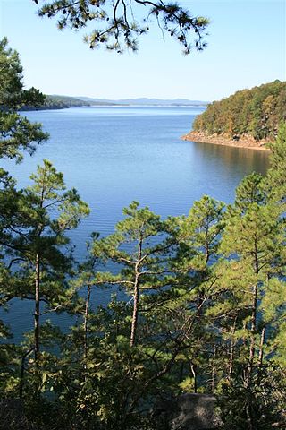
Lake Ouachita is a reservoir created by the damming of the Ouachita River by Blakely Mountain Dam.

Yellowstone National Park has over 1,100 miles (1,800 km) of blazed and mapped hiking trails, including some that have been in use for hundreds of years. Several of these trails were the sites of historical events. Yellowstone's trails are noted for various geysers, hot springs, and other geothermal features, and for viewing of bald eagles, ospreys, grizzly bears, black bears, wolves, coyotes, bighorn sheep, pronghorns, and free-ranging herds of bison and elk.
The Natchitoches are a Native American tribe from Louisiana and Texas. They organized themselves in one of the three Caddo-speaking confederacies along with the Hasinai, and Kadohadacho.

The geography of Arkansas varies widely. The state is covered by mountains, river valleys, forests, lakes, and bayous in addition to the cities of Arkansas. Hot Springs National Park features bubbling springs of hot water, formerly sought across the country for their healing properties. Crowley's Ridge is a geological anomaly rising above the surrounding lowlands of the Mississippi embayment.
In the history of the American frontier, pioneers built overland trails throughout the 19th century, especially between 1840 and 1847 as an alternative to sea and railroad transport. These immigrants began to settle much of North America west of the Great Plains as part of the mass overland migrations of the mid-19th century. Settlers emigrating from the eastern United States did so with various motives, among them religious persecution and economic incentives, to move from their homes to destinations further west via routes such as the Oregon, California, and Mormon Trails. After the end of the Mexican–American War in 1849, vast new American conquests again encouraged mass immigration. Legislation like the Donation Land Claim Act and significant events like the California Gold Rush further encouraged settlers to travel overland to the west.

The early history of the Arkansas Valley in Colorado began in the 1600s and to the early 1800s when explorers, hunters, trappers, and traders of European descent came to the region. Prior to that, Colorado was home to prehistoric people, including Paleo-Indians, Ancestral Puebloans, and Late prehistoric Native Americans.

The Dunbar and Hunter Expedition, also known as the Grand Expedition, was an expedition led by William Dunbar and Dr. George Hunter with the purpose of exploring the lower portion of the Louisiana Purchase. The expedition was given the orders by U.S. President Thomas Jefferson to explore parts of Mississippi and Missouri. The members of the expedition recorded information about the Ouachita River, and studied things such as the hot springs in present-day Arkansas and provided one of the earliest descriptions of Arkansas and Louisiana.
References
- 1 2 "Natchitoches Trace and Old Military Road". Natchitoches Trace and Old Military Road. Archived from the original on January 26, 2016. Retrieved January 26, 2016.
- 1 2 "Trail of Tears in Wayne County". Trail of Tears. St. Louis Community College-Meramec. Retrieved January 26, 2016.
- ↑ "Natchitoches Indians". Natchitoches Indians. Natchitoches Net. Retrieved January 27, 2016.
- ↑ "American Indians at Hot Springs National Park" (PDF). Hot Springs National Park. Retrieved January 27, 2016.