
Crystal Palace is an area in South London, named after the Crystal Palace Exhibition building which stood in the area from 1854, until it was destroyed by fire in 1936. About 7 miles (11 km) southeast of Charing Cross, it includes one of the highest points in London, at 367 feet (112 m), offering views over the capital.

Shimoga, officially Shivamogga, is a city and the district headquarters of Shimoga district in the central part of the state of Karnataka, India. The city lies on the banks of the Tunga River. Being the gateway for the hilly region of the Western Ghats, the city is popularly nicknamed the "Gateway of Malnad". The population of Shimoga city is 322,650 as per 2011 census. The city has been selected for the Smart Cities project, standing in the fourth position in the state and 25th in the country as of November 2020.
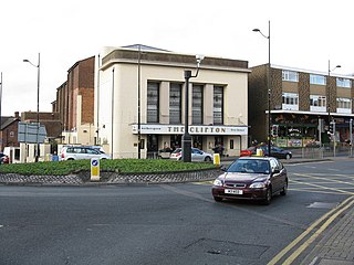
Sedgley is a town in the north of the Metropolitan Borough of Dudley, in the West Midlands, England.

Carlton is a town in the Borough of Gedling, Nottinghamshire, England. It is to the east of Nottingham. The population at the 2011 Census was 6,881. It was an urban district until 1974, whose wards had an estimated population of 48,416 in 2015. Owing to the growth of residential, commercial and industrial in the wider Gedling Borough, City of Nottingham, Borough of Broxtowe, Rushcliffe and Ashfield District, as well as the Amber Valley and Borough of Erewash in Derbyshire which have become quite urban around Nottingham, Carlton and Gedling, as well as Netherfield form a contiguous urban area.
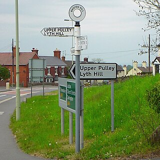
Bayston Hill is a village and civil parish in Shropshire, England. It is 3 miles (5 km) south of the county town Shrewsbury and located on the main A49 road, the Shrewsbury to Hereford road.
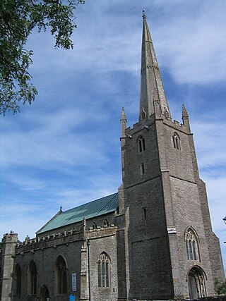
Congresbury is a village and civil parish on the northwestern slopes of the Mendip Hills in North Somerset, England, which in 2011 had a population of 3,497. It lies on the A370 between Junction 21 of the M5 and Bristol Airport, 13 miles (21 km) south of Bristol city centre, and 7 miles (11 km) east of Weston-super-Mare. The Congresbury Yeo river flows through the village. The parish includes the hamlet of Brinsea.

Kudremukha is the name of a mountain range and an individual mountain peak located in Chikmagalur district, in Karnataka, India. It is also the name of a small hill station and iron ore-mining town situated near the mountain, about 20 kilometres from Kalasa in Kalasa Taluk. The name Kuduremukha literally means "horse-faced" in Kannada and refers to a particular picturesque view of a side of the mountain that resembles a horse's face. It was also referred to as 'Samseparvata', historically since it was approached from Samse village. Kuduremukha is Karnataka's 2nd highest peak after Mullayanagiri and 26th highest peak in western ghats. The nearest International Airport is at Mangalore which is at a distance of 99 kilometres.
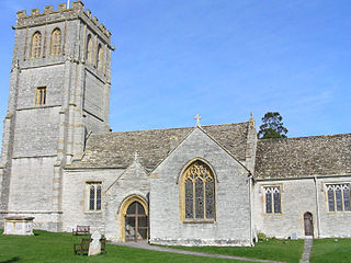
Kingsdon is a village and parish in the South Somerset district of Somerset, England, situated 3 miles (4.8 km) south east of Somerton. The village has a population of 303 but this is set to rise to around 350 once the Kingsdon Manor development is complete. The majority of the houses in the village are clustered on the side of the hill from which there are scenic views across the Somerset countryside.
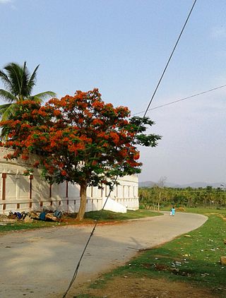
Arsikere is a city and taluka in the Hassan district in the state of Karnataka, India. It is the second largest city in Hassan district, demographically. Arsikere city municipal council consists of 35 wards. This region is known for its coconut production and is also called Kalpataru Nadu. Arsikere Junction is a major railway junction in the South Western Railway which links Mangalore and Mysore to North Karnataka and a central place for tourists who visit nearby places that do not have rail access, such as Belur, Halebidu and Shravanabelagola, Harnahalli, and Kodimata.

Kilmersdon is a village and civil parish on the north eastern slopes of the Mendip Hills in Somerset between the towns of Radstock and Frome. It is located on the B3139 between Wells and Trowbridge in Wiltshire. The settlement is recorded in William I's Domesday book and dates back at least 1,000 years; though the core of the village dates from the mid nineteenth century. The parish includes the hamlets of Charlton, South View and Green Parlour.

Shimoga district, officially known as Shivamogga district, is a district in the Karnataka state of India. A major part of Shimoga district lies in the Malnad region or the Sahyadri. Shimoga city is its administrative centre. Jog Falls view point is a major tourist attraction. As of 2011 Shimoga district has a population of 17,52,753. There are seven taluks: Soraba, Sagara, Hosanagar, Shimoga, Shikaripura, Thirthahalli, and Bhadravathi. Channagiri and Honnali were part of Shimoga district until 1997 when they became part of the newly formed Davanagere district.

St. Joseph's Indian High School is a private Catholic primary and secondary school and private pre-university and community college located in Bangalore, in the state of Karnataka, India. It traces its origins to a secondary school founded by the Paris Foreign Missions Society in 1904 on St. John's Hill. The Society of Jesus took over the administration of the school in 1937.

Vitla also Vittal is a town in Bantwal taluk of Dakshina Kannada district, India, around 18 km from Bantwal in Bantwal Taluk. It is also 14 km from Puttur and 40 km from Mangalore. Vitla was an assembly constituency of Karnataka Legislative Assembly, but discontinued from 2008 elections. Agriculture is the main occupation of people in and around Vitla town. Arecanut, cocoa, pepper, Cashew and coconut are grown here. There is a regional station of Central Plantation Crops Research Institute (CPCRI) which conducts research on areca nuts, an important commercial crop in the area. It also researches cocoa growing, including its production, protection and increasing drought resistance.
The Torah Temimah Primary School, located in the former Dollis Hill Synagogue, is a one form entry Voluntary Aided maintained primary school in the London Borough of Brent. It is a strictly Orthodox Jewish single-sex primary school for up to 204 boys aged 3–11. The school includes a Nursery.

Bucesvara temple, also referred to as the Buceswara, Bucheshwara or Bhucheshvara temple, is a 12th-century Hindu temples in Koravangala village, Karnataka, India. The most sophisticated historical temple in the village, it is considered to be the flag-bearer of Hoysala architecture and was built by a wealthy patron named Buchi during the reign of king Ballala.
Kambagi is a panchayat village in the southern state of Karnataka, India. Administratively it is under Vijayapur Taluk of Vijayapur District, Karnataka. It is nearly 40 kilometres (25 mi) from district headquarters, the city of Vijayapur, Karnataka. Kambagi has Government Primary HealthCare Center, Post Office, Bank of India and Gram Panchayat offices.

Panchalingeshwara Temple in Govindanahalli, Mandya district, Karnataka state, India, was constructed around 1238 A.D. during the reign of the Hoysala empire King Vira Someshwara. The name "Panchalingeshwara" literally means "five linga". The temple is protected as a monument of national importance by the Archaeological Survey of India. The famous sculptor of Hoysala times, Ruvari Mallitamma, is known to have made contributions to the temple.

Libby Hill is a small neighborhood in Richmond, Virginia. Libby Hill is located on the southeastern spur of Church Hill, overlooking the James River and the Lucky Strike building. It is known for Libby Hill Park and "The View that Named Richmond". The Libby Hill neighborhood is entirely within the St. John's Church Historic District.

Govindanahalli is a small village in Mandya district of Karnataka state, southern India.
New Zealand standard school buildings were largely developed and built in the 1950s, 1960s and 1970s. Following the Second World War, more schools and classrooms were needed to address the pre-existing shortage and to handle the increasing school population with the subsequent baby boom. Using standard designs allowed the demand to be met while reducing construction time and costs.


