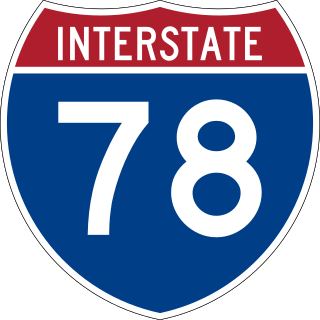
Interstate 78 (I-78) is an east–west Interstate Highway in the Northeastern United States, running 144 miles (232 km) from I-81 northeast of Harrisburg, Pennsylvania, through Allentown to western and northern New Jersey and terminating at the Holland Tunnel entrance to Lower Manhattan in New York City. Major metropolitan areas along its route include the Lehigh Valley in Pennsylvania, the Gateway Region in New Jersey, and the New York metropolitan area.

Aurora County is a county in the U.S. state of South Dakota. As of the 2020 census, the population was 2,747. The county was created in 1879, and was organized in 1881.

Chesterfield Charter Township is a charter township of Macomb County in the U.S. state of Michigan. The 2010 census recorded its population to be 43,381.

New Boston is an unincorporated community in Wayne County in the U.S. state of Michigan. The community is located within Huron Charter Township. As an unincorporated community, New Boston has no legally defined boundaries or population statistics of its own.
When referring to political divisions of China, town is the standard English translation of the Chinese 镇. The Constitution of the People's Republic of China classifies towns as third-level administrative units, along with for example townships. A township is typically smaller in population and more remote than a town.

The city of Xinmin is a county-level city of Liaoning Province, Northeast China, under the administration of the prefecture-level city of Shenyang. It contains the westernmost point of and is by far the most spacious of the county-level divisions of Shenyang City. Xinmin borders Faku County to the northeast, Shenbei New Area and Yuhong District to the east, Tiexi District to the southeast, and Liaozhong County to the south; it also borders the prefecture-level cities of Jinzhou to the west and Fuxin to the northwest.
Highway 365 is a provincial highway in the Canadian province of Saskatchewan. It connects Highway 2 in the town of Watrous, Manitou Beach regional park, to Highway 16 at Plunkett. The highway is approximately 35 km (22 mi) long.

Kyaukme Township is a township of Kyaukme District in the Shan State of eastern Burma (Myanmar). The principal town and administrative center is Kyaukme. The only other town is Mongngaw (Mongngawt) located in the northeast corner of the township.

Hkamti Township or Khamti Township is a township in Hkamti District in the Sagaing Region of Burma (Myanmar). The principal town is Hkamti. As of 2014 the township had a population of 47,658 people and covered an area of 8,174 square kilometres (3,156 sq mi). The township is dominated by the Chindwin River and its tributaries as well as thickly forested areas. Nearly half the active working population are employed in agriculture, forestry or fishing. The township is a producer of rice and has gold and jade reserves.

Leshi Township or Layshi Township is a mountainous township located within the Naga Self-Administered Zone of Sagaing Region, Myanmar. It is also part of the Naga Self-Administered Zone. The principal town is Leshi.
Alegan is a village in Banmauk Township, Katha District, in the Sagaing Region of northern-central Burma. It lies approximately 10 kilometres (6.2 mi) by air southeast of the township centre of Banmauk.
Zion is an unincorporated community along the border of Hillsborough Township and Montgomery Township in Somerset County, New Jersey, United States. It is located on Rock Brook, approximately 3 mi (4.8 km) north of Hopewell.

Emleys Hill is an unincorporated community located within Upper Freehold Township in Monmouth County, New Jersey, United States. The settlement is located at the intersection of Emleys Hill Road and Burlington Path Road.

Hoffman is an unincorporated community located within Monroe Township in Middlesex County, New Jersey, United States. The settlement is located at the site of a former railroad station on the Freehold and Jamesburg Agricultural Railroad. Today, most of the area is made up of homes and housing developments along Hoffman Station Road and Gravel Hill-Spotswood Road. Forestland and the Manalapan Brook valley make up the remainder of the area.

Middlesex Downs is an unincorporated community located within Monroe Township in Middlesex County, New Jersey, United States. The wholly residential settlement contains small homes along Dey Grove Road and Bergen Mills Road with larger homes in developments towards the south. The township-owned James Monroe Memorial Park is also located in this settlement. Much of the area to the north of Dey Grove Road consists of forest land but at one time this was planned to become a large planned community arranged in a street grid. The small property parcels and paper streets remain on township tax maps today.
Ardena is an unincorporated community located within Howell Township in Monmouth County, New Jersey, United States. The community is located along County Route 524 near Vanderveer Road in the western part of the township. The area consists of about half farmland and half residential developments.

Ely is an unincorporated community located within Millstone Township in Monmouth County, New Jersey, United States. The settlement is named for the Ely family that owned property in the area and operated the Charleston Springs hotel. Today, the settlement is located along Stage Coach Road, County Route 524, in the eastern portion of the township. Most of the area consists of large single-family homes though some farmland and the township-owned Brandywine Soccer Complex are located in the near the settlement.

Bullock is an unincorporated community that straddles Woodland Township, Burlington County and Manchester Township, Ocean County in the middle of the New Jersey Pine Barrens. Much of the area surrounding Bullock is a part of the Brendan T. Byrne State Forest though there are some clearings for small houses along Savoy Boulevard in Woodland Township and Pasadena Road in Manchester Township. The settlement is located where these two roads, the New Jersey Southern Railroad, and the Keith line converge.
