The Grand Union Canal in England is part of the British canal system. Its main line starts in London and ends in Birmingham, stretching for 137 miles (220 km) with 166 locks. It has arms to places including Leicester, Slough, Aylesbury, Wendover and Northampton.

The River Thames, known alternatively in parts as the Isis, is a river that flows through southern England including London. At 215 miles (346 km), it is the longest river entirely in England and the second-longest in the United Kingdom, after the River Severn.

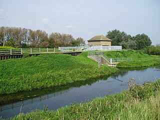
The Broads is a network of mostly navigable rivers and lakes in the English counties of Norfolk and Suffolk. The lakes, known as broads, were formed by the flooding of peat workings. The Broads, and some surrounding land, were constituted as a special area with a level of protection similar to a national park by the Norfolk and Suffolk Broads Act 1988. The Broads Authority, a special statutory authority responsible for managing the area, became operational in 1989.

British Waterways, often shortened to BW, was a statutory corporation wholly owned by the government of the United Kingdom. It served as the navigation authority for the majority of canals and a number of rivers and docks in England, Scotland and Wales.

Waterways in the United Kingdom is a link page for any waterway, river, canal, firth or estuary in the United Kingdom.

The Thames and Severn Canal is a canal in Gloucestershire in the south of England, which was completed in 1789. It was conceived as part of a canal route from Bristol to London. At its eastern end, it connects to the River Thames at Inglesham Lock near Lechlade, while at its western end, it connects to the Stroudwater Navigation at Wallbridge near Stroud, and thence to the River Severn. It has one short arm (branch), from Siddington to the town of Cirencester. It includes Sapperton Tunnel, which when built was the longest canal tunnel in Britain, and remains the second longest complete tunnel. There were always problems with water supply, as no reservoirs were built, while the summit section near the tunnel ran through porous limestone, and there were constant difficulties with leakage. Competition from the railways took much of the canal's traffic by the end of the 19th century, and most of the canal was abandoned in 1927, the remainder in 1941.

A waterway is any navigable body of water. Broad distinctions are useful to avoid ambiguity, and disambiguation will be of varying importance depending on the nuance of the equivalent word in other languages. A first distinction is necessary between maritime shipping routes and waterways used by inland water craft. Maritime shipping routes cross oceans and seas, and some lakes, where navigability is assumed, and no engineering is required, except to provide the draft for deep-sea shipping to approach seaports (channels), or to provide a short cut across an isthmus; this is the function of ship canals. Dredged channels in the sea are not usually described as waterways. There is an exception to this initial distinction, essentially for legal purposes, see under international waters.

The British canal system of water transport played a vital role in the United Kingdom's Industrial Revolution at a time when roads were only just emerging from the medieval mud and long trains of packhorses were the only means of "mass" transit by road of raw materials and finished products. The UK was the first country to develop a nationwide canal network.

The Basingstoke Canal is a British canal, completed in 1794, built to connect Basingstoke with the River Thames at Weybridge via the Wey Navigation.

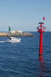
The Port of London Authority (PLA) is a self-funding public trust established on 31 March 1909 in accordance with the Port of London Act 1908 to govern the Port of London. Its responsibility extends over the Tideway of the River Thames and its continuation. It maintains and supervises navigation, and protects the river's environment.

The Wey and Arun Canal is a partially restored, 23-mile-long (37 km) canal in the south east of England. It runs southwards from the River Wey at Shalford, Surrey to the River Arun at Pallingham, in West Sussex. The canal comprises parts of two separate undertakings – the northern part of the Arun Navigation, opened in 1787 between Pallingham and Newbridge Wharf, and the Wey and Arun Junction Canal, opened in 1816, which connected the Arun at Newbridge to the Godalming Navigation near Shalford, south of Guildford. The canal was built with 26 locks.

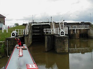
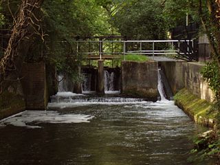
The English River Thames is navigable from Cricklade or Lechlade to the sea, and this part of the river falls 71 meters (234 feet). There are 45 locks on the river, each with one or more adjacent weirs. These lock and weir combinations are used for controlling the flow of water down the river, most notably when there is a risk of flooding, and provide for navigation above the tideway.

The canals of the United Kingdom are a major part of the network of inland waterways in the United Kingdom. They have a colourful history, from use for irrigation and transport, through becoming the focus of the Industrial Revolution, to today's role of recreational boating. Despite a period of abandonment, today the canal system in the United Kingdom is again in increasing use, with abandoned and derelict canals being reopened, and the construction of some new routes. Most canals in England and Wales are maintained by the Canal & River Trust, previously British Waterways, but a minority of canals are privately owned.
A body of water, such as a river, canal or lake, is navigable if it is deep, wide and slow enough for a vessel to pass or walk. Preferably there are few obstructions such as rocks or trees to avoid. Bridges must have sufficient clearance. High water speed may make a channel unnavigable. Waters may be unnavigable because of ice, particularly in winter. Navigability depends on context: A small river may be navigable by smaller craft, such as a motorboat or a kayak, but unnavigable by a cruise ship. Shallow rivers may be made navigable by the installation of locks that increase and regulate water depth, or by dredging.
The Market Weighton Canal ran 9.5 miles (15.3 km) from the Humber Estuary to its terminus near Market Weighton. It gained its Act of Parliament in 1772 and opened in 1782. The 3.5 miles (5.6 km) closest to Market Weighton was abandoned in 1900 and the right of navigation through Weighton lock was lost in 1971. However, as of 2002 the lock was passable and the canal usable up to the junction with the River Foulness where silt has made it impassable. Also there is no right of navigation under the M62 motorway bridge to the north of Newport.

The River Wey Navigation and Godalming Navigation, geographically the Wey Navigation, form a continuous waterway which provides a 20-mile (32 km) navigable route from the River Thames between Weybridge and Hamm Court, Addlestone via Guildford to Godalming. The waterway is in Surrey and is owned by the National Trust. The Wey Navigation connects to the Basingstoke Canal at West Byfleet, and the Godalming Navigation part to the Wey and Arun Canal in the Broadford part of Shalford. The Navigations consist of man-made canal and adapted parts of the River Wey. Its adjoining path is part of European long-distance path E2.
The Itchen Navigation is a 10.4-mile (16.7 km) disused canal system in Hampshire, England, that provided an important trading route from Winchester to the sea at Southampton for about 150 years. Improvements to the River Itchen were authorised by Act of Parliament in 1665, but progress was slow, and the navigation was not declared complete until 1710. It was known as a navigation because it was essentially an improved river, with the main river channel being used for some sections, and cuts with locks used to bypass the difficult sections. Its waters are fed from the River Itchen. It provided an important method of moving goods, particularly agricultural produce and coal, between the two cities and the intervening villages.
The Stroudwater Navigation is a canal in England which linked Stroud to the River Severn. It was authorised in 1776, although part had already been built, as the proprietors believed that an Act of Parliament obtained in 1730 gave them the necessary powers. Opened in 1779, it was a commercial success, its main cargo being coal. It was 8 miles (13 km) in length and had a rise of 102 ft 5 in (31.22 m) through 12 locks. Following the opening of the Thames and Severn Canal in 1789, it formed part of a through route from Bristol to London, although much of its trade vanished when the Kennet and Avon Canal provided a more direct route in 1810. Despite competition from the railways, the canal continued to pay dividends to shareholders until 1922, and was not finally abandoned until 1954.