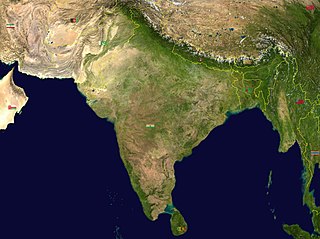
India is situated north of the equator between 8°4' north to 37°6' north latitude and 68°7' east to 97°25' east longitude. It is the seventh-largest country in the world, with a total area of 3,287,263 square kilometres (1,269,219 sq mi). India measures 3,214 km (1,997 mi) from north to south and 2,933 km (1,822 mi) from east to west. It has a land frontier of 15,200 km (9,445 mi) and a coastline of 7,516.6 km (4,671 mi).

Mirzapur is a city in Uttar Pradesh, India, 827 km from Delhi and 733 km from Kolkata, almost 91 km from Prayagraj and 61 km from Varanasi. It is known for its carpets and brassware industries, and the tradition of kajari and birha music. The city is surrounded by several hills of the Maikal range and is the headquarters of Mirzapur district.

Ponmudi is a hill station in the Peringamala gramapanchayath of Trivandrum District of Kerala in India. It is located 22km west of Vithura town, 53 km north-east of Trivandrum City, 78 km south-east of Varkala town and 69 km north-east of Kovalam Beach at an altitude of 1,100 m (3,600 ft). Ponmudi (Varayadumotta) peak is a part of the Western Ghats mountain range that runs parallel to the Arabian Sea. Ponmudi is a popular honeymoon destination in South India. The normal temperature of Ponmudi is between 18 and 25 °C.

Igatpuri is a town and a Hill Station. It is also a municipal council in Nashik District in the Indian state of Maharashtra. It is located in the Western Ghats. Igatpuri railway station lies in Nashik District between Mumbai and Nashik Road on the Central Railway. Igatpuri is known for Vipassana International Academy, where ancient technique of meditation is taught called Vipassana. The place is one of the best places to visit in Maharashtra in monsoon. It is a hill station on busy Mumbai-Agra NH-3 only 45 km from Nashik and 130 km from Mumbai.
Wai is a town in Satara district of Maharashtra state in India. Located on the Krishna River, Wai was a prominent town during the Peshwa era. Two important Marathi Brahmin from ruling families had their origins here: Rani Lakshmibai of Jhansi and Gopikabai, wife of Nanasaheb Peshwa.
Ghatal is a city and a municipality in Paschim Medinipur district, West Bengal, India. Earlier it was part of Hooghly District in 1872 it was merged with Medinipur district. It is the headquarters of the Ghatal subdivision.

Bhandardara is a holiday resort village near Igatpuri, in the western ghats of India. The village is located in the Akole tehsil, Ahmednagar district of the state of Maharashtra, about 185 kilometers (115 mi) from Mumbai, 155 kilometers (96 mi) from Ahmednagar and 73 kilometers (45 mi) from Nashik.

Budhni, also spelled Budni or Budhani, is a town and a Nagar Palika in Sehore district in the state of Madhya Pradesh, India. It is situated on Bhopal to Narmadapuram road at a distance of 7 km from Narmadapuram in north direction on the banks of Narmada River.It is also famous for Tractor testing i.e. CFMTTI (Institute under central government or Tractor Nagar.
Alwarkurichi is a panchayat town in Tenkasi district in the state of Tamil Nadu, India.

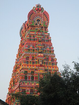
Karamadai is a town located near Mettupalayam, in the Indian state of Tamil Nadu. It is located on Coimbatore - Ooty NH 67. Nearby places are Teachers colony, Press Colony, Jodhipuram and Periyanaickenpalayam. The Ranganathaswamy temple and Nanjundeswarar temple are the most prominent landmarks in the town. The place of Karamadai came into limelight due to the presence of ex-steel giant Sri Ramakrishna Steel Industries.

Polur is a scenic town and a Religious site for Lord Narasimha called Sampathgiri, divisional headquarters and a market center in Tiruvannamalai district of Tamil Nadu in India. Located at the foothills of Javvadhi hills, a popular section of Eastern Ghats, Polur is often regarded as Gateway of Eastern ghats. Polur was once a eminent center of Tamil Jainism. The town is home to Dharani sugars, chemicals and fertiliser Pvt., Ltd, and number of agro based industries including coir industries. The famous Chittor - Cuddalore road passes through the town. The town is located 29 Kilometres north of city of Tiruvannamalai and 45 kilometres south of Vellore Metropolis.

Udumalai, also known as Udumalaipettai and Udumalpet, is a town in Tiruppur district in the Indian state of Tamil Nadu. It is located 535 km south west from the state capital, Chennai and 72 km from Coimbatore. It is the headquarters of Udumalaipettai taluk and had a population of 61,133 as per 2011 Census of India. The town comes under the Udumalaipettai Assembly constituency.
Vickramasingapuram or V.K.Puram is a Municipal town in Tirunelveli District in the Indian state of Tamil Nadu. It falls under the Ambasamudram Taluk. As of 2011, the town had a population of 47,241.

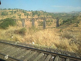
Thal Ghat is a ghat section in the Western Ghats near the town of Kasara in Maharashtra. The Thal Ghat is located on the busy Mumbai–Nashik route, and is one of the four major routes, rail and road routes, leading into Mumbai. The railway line, which passes through the ghat is the steepest in India with a gradient of 1 in 37.

Kottathara or Venniyode is a gram panchayat of Wayanad district, Kerala State, India.
Banapura is a small town in the Hoshangabad District of Madhya Pradesh, India. Banapura is a twin city of Seoni Malwa.

Gujarat is a state in Western India. It has the India's Longest Coastline of 1214 km and It also has the one of the Largest Salt Desert in the World with the Area of 7500 Sq. km.
Saluppaptti is a small village near the Western Ghats in the Madurai district in India. It is located 45 km west from Madurai town. The village was under the Saptur Polygar territory during British India. Now this village comes under the Sedapatti block.

National Highway 75 is one of major National Highway in India. passing through states of Karnataka, Andhra Pradesh, and Tamil Nadu. This national highway was earlier known as National Highway 48 (NH-48) before rationalisation of highway numbers in 2010. The highway connects the port city of Mangaluru (Mangalore) in the west to the city of Vellore in the east. National highway 75 is the main road for travellers from Mangaluru going to Bengaluru and Hassan. NH-75 traverses all three geographical regions of Karnataka state namely Karavali, Malenadu and Bayaluseeme.

The Barsoi–New Farakka section is an Indian railway line connecting Barsoi with New Farakka junction on the Howrah–New Jalpaiguri line. This 126-kilometre (78 mi) track is under the jurisdiction of Eastern Railway and Northeast Frontier Railway.


