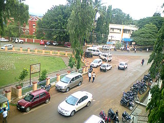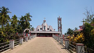
Dakshina Kannada district is located in the state of Karnataka in India, with its headquarters in the coastal city of Mangalore. It is part of the larger Tulu Nadu region. The district covers an area nestled in between the Western Ghats to its east and the Arabian Sea to its west. Dakshina Kannada receives abundant rainfall during the Indian monsoon. It is bordered by Udupi district to the north, Chikmagalur district to the northeast, Hassan district to the east, Kodagu to the southeast and Kasaragod district of Kerala to the south. According to the 2011 census of India, Dakshina Kannada district had a population of 2,083,625. It is the only district in Karnataka state to have all modes of transport like road, rail, water and air due to the presence of a major hub, Mangalore. This financial district is also known as the Cradle of Indian banking.

Brahmagiri, is a mountain range in the Western Ghats of south India. It is situated on the border between Kodagu district in Karnataka state in the north and Wayanad district of Kerala state on the south. Brahmagiri Hill, at 1608 m height, near Tirunelli is a scenic tourist attraction. The top of Brahmagiri Hill is well forested and has much wildlife. Talakaveri is located on the northern section of the range, near Bhagamandala in Kodagu district (Coorg), in the South Indian state of Karnataka.
Thodikana is an Indian village nestled in the foothills of the Western Ghats in southern Karnataka. It is in the Sullia taluk of Dakshina Kannada district, about 100 km from Mangalore city. This village has much greenery and attracts visitors with its cultural and natural sites.

Chikmagalur is a city and the headquarters of Chikmagalur district in the Indian state of Karnataka. Located on the foothills of the Mullayanagiri peak of the Western Ghats, the city attracts tourists from around the world for its pleasant and favourable hill station climate, tropical rainforest and coffee estates. The pristine Baba Budangiri lies to the north of Chikmagalur where it's believed Baba Budan first introduced coffee to India.

Sirsi is a city and a taluk headquarter in Uttara Kannada district of Karnataka state in India. It was also known as Kalyana Pattana during the Sonda Dynasty. It is a tourist destination with evergreen forest and waterfalls and is also a commercial centre. The main businesses around the city are mostly subsistence and agriculture-based. Areca nut or betel nut, locally known as Adike, is the primary crop grown in the nearby villages, making it one of the major trading centres for areca nut. The region is also known for spices such as cardamom, pepper, betel leaves, and vanilla. The major food crop is paddy.

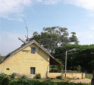
Holenarasipura is a town and taluk in Hassan district of Karnataka. The town is situated on the banks of the Hemavati, one of the tributaries of the Kaveri.

Mudigere is a Town and Taluk in Chikmagalur district in the Indian state of Karnataka. It is 30 km from the district headquarters.
Tarikere is a town, a taluk and is one of the two Subdivisional headquarter in the Chikmagalur district of Karnataka state, India. It is popularly known as gateway of Malnad because the Malnad area starts from here. The town's name is derived from the number of water tanks which surround it.

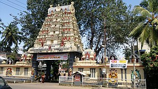
Kukke Subramanya is a Hindu temple located in the village Subramanya, of Kadaba taluk in Dakshina Kannada district, Karnataka, India. In this temple Kartikeya is worshipped as Subramanya, lord of all serpents. The epics relate that the divine serpent Vasuki and other serpents found refuge under Subramanya when threatened by the Garuda. The priests in the temple are Shivalli Madhwa Brahmins. The poojas and other daily rituals in the temple are performed as per Madhvacharya's Tantra Sara Sangraha.

Subramanya is a village located in Kadaba Taluk in Dakshina Kannada, India. The Kukke Subrahmanya Temple is located here. It is about 105 kilometres (65 mi) from Mangalore, connected by train and road. It was originally named "Kukke Pattana".

The Mariyamma Temple is situated in Boloor, India, dedicated to Goddess Mariyamma, situated approximately 5 km from Mangaladevi Temple in Mangalore city, Karnataka, India. It is believed that Mariyamma and Mangaladevi were sisters.

Ujire is a town near Dharmasthala. It is in Belthangady taluk of Dakshina Kannada district. Ujire is an important junction for travelers in this region. The road at Ujire deviates to Dharmasthala, Kottigehara and Belthangady.
Kadaba is a taluk in Dakshina Kannada district of Karnataka, India. It is located 82 km towards East from District headquarters Mangalore, 31 km from Puttur, 38 km from Sullia and 272 km from State capital Bangalore.

Charmadi Ghat (Charmady) is a ghatti beginning from Belthangady taluk of Dakshina Kannada and ending in Mudigere taluk of Chikmagalur. It is one of the points in Western ghats through which motorable road passes connecting Dakshina Kannada with Chikmagalur district. The section of ghat is known by the name of Charmadi Ghat. It lies on National Highway 73 which connects Mangalore to Tumkur. The nearest places are Charmadi village, Ujire, Belthangady, Puttur, Kottigehara, Balur and Kalasa and Banakal.

Naravi is a panchayat village in Belthangady taluk, Dakshina Kannada, in the foothills of the Western Ghats of India. There are two villages in the Naravi gram panchayat: Naravi and Kuthluru. It is 58 km from Mangalore and 25 km from Karkala towards Dharmasthala. Naravi is known for Sri Sooryanarayana temple, one of the two well known Sun temples, the other of which is at Konark. The village's name came from "Naa Ravi" in Kannada, which means no visible sunlight because of forest at daytime. It also has Sri Veenugopalakrishna Temple, which has a beautiful idol of Krishna carrying a child in his hands. Those who don't have children come to this statue of Krishna to pray for children.
Punacha is a village in the southern state of Karnataka, India. It is located in the Bantwal taluk of Dakshina Kannada district in Karnataka.

Sagara is a city located in the Indian state of Karnataka. It is also a sub divisional and a taluk headquarters. Located in the Sahyadri Mountain range on the banks of river Varada, it is known for its proximity to Jog Falls and to the historical places of Ikkeri, Keladi and Varadamoola. The river Varada originates near Varada-moola. Sagara subdivision consists of Sagara, Soraba, Hosanagara and Shikaripur taluks.

National Highway 73 is a National Highway in India. This highway runs in the Indian state of Karnataka. It starts from sea port city of Mangaluru ( Mangalore) and ends at Tumakuru. Even though named as national highway the road is narrow and prone to landslips and falling of trees in Charmady ghat section of Western ghats. This highway was previously part of national highways 48, 234 and 206 but subsequent to rationalisation of national highway numbers of India by Gazette notification on 5 March 2010 it was changed to National Highway 73.

Mangalore–Hassan–Mysore line is a railway route of both Southern and South Western Railway zone of Indian Railways. This route plays an important role in rail transportation of Mysore division of Karnataka state.

Ettina Bhuja is a mountain peak in the Western Ghats, located in Chikmagalur district, Karnataka, about 25 km from Mudigere. It is a popular and easy trekking point as the last two kilometers can be trekked to reach a point near summit.


