Overview
Hills and mountain ranges characterize 70% of this woreda; the rest consists of arid lands and plateaus. Perennial rivers include the Hodem, Kuke, Bedesa, Aebamo and Bohera. A survey of the land in this woreda shows that 22% is arable or cultivable (11% was in annual crops), 18.5% pasture, 58% forest and shrubland, and the remaining 1.5% is considered swampy, degraded or otherwise unusable. Teff, wheat and ensete are important local crops. [1] Coffee is an important cash crop; over 5,000 hectares are planted with it. [2]
In the late nineteenth century, about 30% of Ethiopia was covered with forest. The clearing of land for agricultural use and the cutting of trees for fuel gradually changed the scene, and today forest areas have dwindled to less than 4% of Ethiopia's total land. The northern parts of the highlands are almost devoid of trees. However, about 45,000 square kilometres of dense forest exist in the southern and southwestern sections of the highlands. Some of these include coniferous forests, found at elevations above l,600 meters, but a majority of the forestland consists primarily of woodlands found in drier areas of the highlands and in the drier areas bordering the highlands.
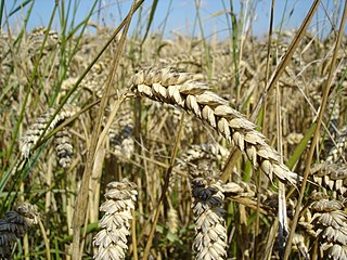
Wheat is a grass widely cultivated for its seed, a cereal grain which is a worldwide staple food. The many species of wheat together make up the genus Triticum; the most widely grown is common wheat.

Ensete is a genus of monocarpic flowering plants native to tropical regions of Africa and Asia. It is one of the two genera in the banana family, Musaceae, and includes the false banana or enset, an economically important food crop in Ethiopia.
Industry in the woreda includes a few small scale industry as well as some retailers and service providers. Deposits of graphite, nickel, beryllium and marble are present in this woreda, but have not been commercially developed. There were 12 Farmers Associations with 6,243 members and 10 Farmers Service Cooperatives with 1,367 members. Nensebo has 40 kilometers of rural road, for an average road density of 23.7 kilometers per 1000 square kilometers. About 4.6% of the total population has access to drinking water. [1]

Graphite, archaically referred to as plumbago, is a crystalline form of the element carbon with its atoms arranged in a hexagonal structure. It occurs naturally in this form and is the most stable form of carbon under standard conditions. Under high pressures and temperatures it converts to diamond. Graphite is used in pencils and lubricants. Its high conductivity makes it useful in electronic products such as electrodes, batteries, and solar panels.

Nickel is a chemical element with symbol Ni and atomic number 28. It is a silvery-white lustrous metal with a slight golden tinge. Nickel belongs to the transition metals and is hard and ductile. Pure nickel, powdered to maximize the reactive surface area, shows a significant chemical activity, but larger pieces are slow to react with air under standard conditions because an oxide layer forms on the surface and prevents further corrosion (passivation). Even so, pure native nickel is found in Earth's crust only in tiny amounts, usually in ultramafic rocks, and in the interiors of larger nickel–iron meteorites that were not exposed to oxygen when outside Earth's atmosphere.

Beryllium is a chemical element with symbol Be and atomic number 4. It is a relatively rare element in the universe, usually occurring as a product of the spallation of larger atomic nuclei that have collided with cosmic rays. Within the cores of stars beryllium is depleted as it is fused and creates larger elements. It is a divalent element which occurs naturally only in combination with other elements in minerals. Notable gemstones which contain beryllium include beryl and chrysoberyl. As a free element it is a steel-gray, strong, lightweight and brittle alkaline earth metal.
Demographics
The 2007 national census reported a total population for this woreda of 114,559, of whom 56,976 were men and 57,583 were women; 6,068 or 5.3% of its population were urban dwellers. The majority of the inhabitants were Muslim, with 62.91% of the population reporting they observed this belief, while 24.14% of the population said they were Protestant, 8.77% of the population practiced Ethiopian Orthodox Christianity, 2.22% were Catholic, and 1.77% practiced traditional beliefs. [3]

Islam is the second largest religion in Ethiopia with over 33.9% of the population practicing it in 2007. The faith arrived in Ethiopia at an early date, shortly before the hijira. Islam is the religion of the overwhelming majority of the Somali, Afar, Argobba, Harari, Berta, Alaba, and Silt'e and also has many adherents among the Gurage and the Oromo, the largest ethnic group in Ethiopia, as well as a minority of Amhara, the second largest ethnic group in the country.
P'ent'ay is an Amharic and Tigrinya language term for a Christian of a Protestant denomination, widely used in Ethiopia and among Ethiopians and Eritreans living abroad. The term was coined in the late 1960s and was used as a pejorative for churches that believed in the Pentecostal experience. Today, it is used to describe local Protestant Christians who are not members of the Ethiopian Orthodox Tewahedo and Eritrean Orthodox Tewahedo churches. The term P'ent'ay is a shortening of the word "Pentecostal"; however, it is widely used when referring to all Protestant Christians whether they are actual Pentecostals or not. Some Orthodox will also apply the term to the small Catholic population of Ethiopia. The equivalent rendition in many other languages is Evangelicals. The four major Evangelical denominations in Ethiopia are: the Kale Heywet ; Mekane Yesus, Lutheran; Mulu Wongel and Meserete Kristos or Mennonite. Some P'ent'ay communities - especially Mekane Yesus - have been influenced by the Orthodox Tewahedo Church, which represents mainstream, traditional Ethiopian Christianity. But for the most part they are very Pentecostal in their worship and theology.
Based on figures published by the Central Statistical Agency in 2005, this woreda has an estimated total population of 67,254, of whom 33,902 were males and 33,352 were females; 5,473 or 8.14% of its population are urban dwellers, which is less than the Zone average of 13.5%. With an estimated area of 1,689.69 square kilometers, Nensebo has an estimated population density of 39.8 people per square kilometer, which is greater than the Zone average of 27. [4]
The 1994 national census reported a total population for this woreda of 48,024, of whom 23,902 were men and 24,122 women; 3,059 or 6.37% of its population were urban dwellers at the time. The three largest ethnic groups reported in Nensebo were the Oromo (77.45%), the Sidama (12.7%), and the Amhara (9.3%); all other ethnic groups made up 0.55% of the population. Oromiffa was spoken as a first language by 76.6%, 12.87% spoke Sidamo, and 10.38% spoke Amharic; the remaining 0.63% spoke all other primary languages reported. The majority of the inhabitants were Muslim, with 64.19% of the population having reported they practiced that belief, while 13.48% of the population said they professed Ethiopian Orthodox Christianity, and 12.84% were Protestant. [5]

The Oromo people are an ethnic group inhabiting Ethiopia. They are one of the largest ethnic groups in Ethiopia and represent 34.5% of Ethiopia's population. Oromos speak the Oromo language as a mother tongue, which is part of the Cushitic branch of the Afro-Asiatic language family. The word Oromo appeared in European literature for the first time in 1893 and slowly became common in the second half of the 20th century.
The Sidama people are an ethnic Cushitic peoples traditionally inhabiting the Sidama Zone of the Southern Nations, Nationalities, and Peoples Region (SNNPR) in Ethiopia. They speak the Sidamo language which is a language of the Cushitic branch of the Afroasiatic language family. Despite their large numbers they currently lack a separate ethnic regional state.

Oromo is an Afroasiatic macrolanguage which is primarily composed of four distinct languages: Southern Oromo which includes the Gabra and Sakuye dialects, Eastern Oromo, Orma which includes the Munyo, Orma, Waata/Sanye dialects, and West–Central Oromo. Like Arabic, Oromo is a dialect continuum so language varieties spoken in neighbouring regions differ only slightly, but the differences accumulate over distance so that widely separated varieties are not mutually intelligible.
Yayu is one of the woredas in the Oromia Region of Ethiopia. Part of the Illubabor Zone, Yayu is bordered on the south by the Southern Nations, Nationalities and Peoples Region, on the west by Metu, on the north by Supena Sodo, on the east by Chora, and on the southeast by the Jimma Zone. Towns in Yayu include Elemo and Yayu. Doreni and Hurumu woredas were part of Yayu woreda.
Darolebu is one of the woredas in the Oromia Region of Ethiopia. Part of the Mirab Hararghe Zone, Darolebu is bordered on the south by the Shebelle River which separates it from the Bale Zone, on the west by the Arsi Zone, on the northwest by Guba Koricha, on the north by the Habro, and on the east by Boke. Towns in Darolebu include Machara and Micheta.
Boke is one of the woredas in the Oromia Region of Ethiopia. Part of the Mirab Hararghe Zone, Boke is bordered on the south by the Shabelle River which separates it from the Bale Zone, on the southwest by Darolebu, on the northwest by Habro, on the northeast by Kuni, and on the east by the Galetti River which separates it from the Misraq Hararghe Zone. The major town in Boke is Boke Tiko.
Limmu Sakka is one of the woredas in the Oromia Region of Ethiopia. It is named in part after the former kingdom of Limmu-Ennarea, whose territories included the area this woreda now covers. Part of the Jimma Zone, Limmu Sakka is bordered on the southwest by the Didessa River which separates it from the Illubabor Zone, on the northwest by the Misraq Welega Zone, on the northeast by the Gibe River which separates it from the Mirab Shewa Zone, and on the southeast by Limmu Kosa. The administrative center of the woreda is Atnago; other towns include Saqqa, the capital of the former kingdom of Limmu-Ennarea.
Gomma is one of the woredas in the Oromia Region of Ethiopia. It is named after the former Kingdom of Gomma, whose territory was roughly the same as the modern woreda. Part of the Jimma Zone, Gomma is bordered on the south by Seka Chekorsa, on the southwest by Gera, on the northwest by Setema, on the north by the Didessa River which separates it from the Illubabor Zone, on the northeast by Limmu Kosa, and on the east by Mana. Towns include Beshasha, Choche, Ghembe, and Limmu Shaye. Guma woreda was separated from Gomma.
Sude is one of the woredas in the Oromia Region of Ethiopia. Part of the Arsi Zone, Sude is bordered on the south by Robe, on the southwest by Tena, on the west by Dodotana Sire, on the northwest by Jeju, on the north by Merti, on the northeast by Chole and on the southeast by Amigna. The administrative center of the woreda is Kula.
Seru is one of the woredas in the Oromia Region of Ethiopia. It is named after the woreda capital, Seru. Part of the Arsi Zone, Seru is bordered on the south and east by the Shebelle River which separates it from the Bale Zone, on the west by the Wabe River which separates it from Robe, on the north by Amigna, and on the northeast by the Mirab (West) Hararghe Zone. Woreda of Bale Gasegar was separated form Seru.
Kokosa is one of the woredas in the Oromia Region of Ethiopia. Being part of the Mirab Arsi Zone, Kokosa is bordered on the south and west by the Southern Nations, Nationalities and Peoples Region, on the north by the Kofele, on the northeast by Dodola, and on the southeast by Nensebo. The administrative center of this woreda is Kokosa; other towns include Diki, Gata, Hebano, Hogiso.
Adaba is one of the woredas in the Oromia Region of Ethiopia; it shares the name of its administrative center, Adaba. Part of the West Arsi Zone, Adaba is bordered on the southwest by Nensebo, on the west by Dodola, on the northwest by the Shabelle River which separates it from the Gedeb Asasa, and on the east and south by Bale Zone.
Gololcha is one of the woredas in the Oromia Region of Ethiopia. It was part of former Gaserana Gololcha woreda what was divided for Gadera and Gololcha woredas. Part of the Bale Zone, Gaserana Gololcha is bordered on the south by Ginir, on the southwest by Sinanana Dinsho, on the west by Agarfa, on the north by the Shebelle River which separates it from the Arsi Zone, on the northeast by Legehida, and on the east by Seweyna. The administrative center for the woreda is Jara.
Legehida is one of the woredas in the Oromia Region of Ethiopia. Part of the Bale Zone, Legehida is bordered on the south by Seweyna, on the southwest by Gaserana Gololcha, and all other sides by the Shebelle River which separates this woreda from the Mirab Hararghe Zone on the northwest, the Misraq Hararghe Zone on the northeast and from the Somali Region on the east. The administrative center of the woreda is Beltu; other towns in Legehida include Sheikh Hussein.
Goro is one of the woredas in the Oromia Region of Ethiopia. It shares the same name as the administrative center of the woreda, Goro. Part of the Bale Zone, Goro is bordered on the southwest by Guradamole, on the west by Berbere, on the northwest by Sinanana Dinsho, on the northeast by Ginir, and on the southeast by the Somali Region; it is separated from Guradamole and Berbere by the Gestro River. Other towns in this woreda include Meliyu. Dawe Kachen woreda was separated from Goro.
Dinsho is one of the woredas in the Oromia Region of Ethiopia. It was part of former Sinanana Dinsho woreda what was separated for Dinsho and Sinana woredas and Robe Town. Part of the Bale Zone, Sinanana Dinsho was bordered on the south by the Mena River which separated it from Goba, on the west by Adaba, on the northwest by Agarfa, on the northeast by Gaserana Gololcha, on the east by Ginir, and on the southeast by Goro, Oromia. The administrative center of this woreda is Dinsho.
Delo Menna is one of the woredas in the Oromia Region of Ethiopia. It was part of former Mennana Harena Buluk woreda what was separated for Delo Menna and Harena Buluk woredas. Part of the Bale Zone, Mennana Harena Buluk was bordered on the south by Meda Welabu, on the west by Nensebo, on the northwest by Adaba, on the north by Goba, on the northeast by Berbere, and on the east by Guradamole. The administrative center of this woreda is Menna
Meda Welabu is one of the woredas in the Oromia Region of Ethiopia. Part of the Bale Zone, Meda Welabu is bordered on the south by the Ganale Dorya River which separates it from the Guji Zone, on the northwest by Mirab Arsi Zone, on the north by Mennana Harena Buluk, and on the northeast by Guradamole. The administrative center of the woreda is Bidire; other towns in Meda Welabu include Oborso.
Berbere is one of the woredas in the Oromia Region of Ethiopia. Part of the Bale Zone, Berbere is bordered on the south by Mennana Harena Buluk, on the northwest by Goba, on the north by Sinanana Dinsho, on the northeast by Goro, and on the east by Guradamole; the Mena River separates it from Shinanana Dinsho and Goro. The administrative center of the woreda is Haro Dumal.
Uraga is one of the woredas in the Oromia Region of Ethiopia. Part of the Guji Zone, Uraga is bordered on the south by Odo Shakiso, on the west by the Borena Zone, on the north by the Southern Nations, Nationalities, and Peoples Region, and on the east by Bore. The largest town in Uraga is Solomo. Dima and Hambela Wanema woredas were separated from Uraga.
Adola is one of the woredas in the Oromia Region of Ethiopia. It is part of former Adolana Wadera woreda what was divided for Adola, Girja and Wadera woredas and Adola town. Part of the Guji Zone, Adolana Wadera was bordered on the south by Liben, on the southwest by Odo Shakiso, on the west by Bore, on the north by the Southern Nations, Nationalities, and Peoples Region, and on the east by the Bale Zone.
Bule Hora is one of the woredas in the Oromia Region of Ethiopia. It was part of former Hagere Mariam woreda what was separated for Bule Hora, Dugda Dawa and Kercha woredas. Part of the Borena Zone, Hagere Mariam was bordered on the south by the Dawa River which separates it from Arero, on the southwest by Yabelo, on the west by the Southern Nations, Nationalities, and Peoples Region and Gelana Abaya, on the northeast by Uraga, and on the east by Odo Shakiso. The largest town of Bule Hora is Bule Hora Town, formerly called Hagere Mariam.
Liben is one of the woredas in the Oromia Region of Ethiopia. Part of the Guji Zone, Liben is bordered on the south by the Dawa River which separates it from the Borena Zone, on the west by Odo Shakiso, on the northwest by Adolana Wadera, on the north by the Ganale Dorya River which separates it from the Bale Zone, and on the east by the Somali Region. The map of the Oromia Region published by Disaster Prevention and Disaster Agency shows that this woreda is part of the Guji Zone, and that the eastern part has been transferred to the Somali Region to create the Liben woreda of that region. The town of Negele Boran was separated from Liben woreda and is separate woreda now.