Okhaldhunga is the headquarters of the Okhaldhunga District in the Sagarmatha Zone of Nepal. At the time of the 1991 Nepal census it had a population of 3761 living in 790 individual households.
Kanchanpur District, a part of Sudurpashchim Province in the Terai plain, is one of seventy seven districts of Nepal. The district, with Bhimdatta as its district headquarters, covers an area of 1,610 square kilometres (620 sq mi) and had a population of 134,868 in 2001 and 171,304 in 2011. It is located in south-western of Nepal. It is bordered by Kailali district in the east, Dadeldhura district in the north and with India in the south and west.

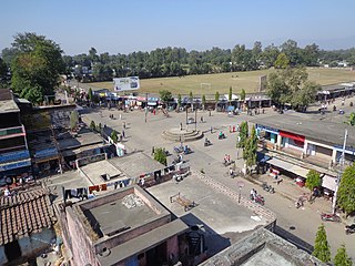
Liwang is district headquarters and municipality in Rolpa District in Lumbini Province of southwestern Nepal. At the time of the 1991 Nepal census it had a population of 8425.

Solududhkunda (earlier:Dudhkunda) is the only municipality of Solukhumbu District. Located in Province No. 1 of Nepal. The town of Salleri, which is located within the municipality is the headquarter of Solukhumbu District It was formed in 2014 by merging four VDCs: Salleri, Garma, Loding Tamakhani and Beni and was divided into 9 wards. Total area of the municipality had 254.3 square kilometres (98.2 sq mi) and population of municipality had 20,399 individuals living in 5,368 households.
Hatiya is a Village Development Committee in Baglung District in the Dhaulagiri Zone of central Nepal. At the time of the 1991 Nepal census it had a population of 6,015 and had 1131 houses in the town.
Naubise is a village development committee in Dhading District in the Bagmati Zone of central Nepal. At the time of the 2011 Nepal census it had a population of 25621 and had 3239 houses in it.
Khaskarkando is a town in Banke District in the Bheri Zone of south-western Nepal. At the time of the 1991 Nepal census it had a population of 4,582 and had 769 houses in the town. Now, it is a part of Nepalgunj sub-metropolitan city.
Kavre Nitya Chandeswori popularly known as "Kavre" is a village development committee in Kavrepalanchok District in the Bagmati Zone of central Nepal. Two of its V.D.C's are included in Dhulikhel Municipality in the year 2015 A.D. At the time of the 2011 Nepal census it had a population of 4927 in 1042 individual households.
Ekatappa is a town and Village Development Committee in Ilam District in the Mechi Zone of eastern Nepal. At the time of the 1991 Nepal census it had a population of 4,320 persons living in 784 individual households.

Pipara Simara is a town in Gadhimai Municipality in Bara District in Province No. 2 of south-eastern Nepal. The formerly Village Development Committee was merged to form a new municipality on 18 May 2014. At the time of the 2011 Nepal census it had a population of 23,835 people living in 5,253 individual households.
Urahari is a village and former Village Development Committee that is now part of Tulsipur Sub-Metropolitan City in Dang Deokhuri District in Lumbini Province of south-western Nepal. In 2014, Urahari VDC was annexed into Tulsipur. At the time of the 1991 Nepal census it had a population of 8,764 persons living in 1288 individual households.
Khalanga is the Headquarters of the Jajarkot District located in Karnali province of Nepal. Formerly it was a village development committee which incorporated to Bheri Municipality in 2015 when a new municipality was established.
Bajhakhet is a village development committee in Lamjung District in the Gandaki Zone of northern-central Nepal. At the time of the 1991 Nepal census it had a population of 3177 people living in 625 individual households.
Khalanga is market center in Sharada Municipality in Salyan District of Karnali Province of Nepal. The place formerly existing as Village Development Committee was annexed to form a new municipality since 18 May 2014. It is the district headquarter of Salyan District. At the time of the 1991 Nepal census it had a population of 6380.
Saijuwal Takura is market center in Sharada Municipality in Salyan District in the Rapti Zone of western-central Nepal. The place formerly existing as Village Development Committee was annexed to form a new municipality since 18 May 2014. At the time of the 1991 Nepal census it had a population of 3,137 living in 593 individual households.
Malikarjun is a former village development committee that is now a Rural Municipality in Darchula District in Sudurpashchim Pradesh of far western Nepal. Mallikarjun is named after the famous temple of lord Shiva Shree Shailyn shikar Malikarjun. At the time of the 1991 Nepal census it had a population of 1814 people living in 331 individual households.
Sakhi is a village development committee in Rolpa District in the Rapti Zone of north-eastern Nepal. At the time of the 1991 Nepal census it had a population of 2798 people living in 525 individual households.
Aathbiskot is a Municipality in West Rukum District in Karnali province of Nepal that was established in 2015 through the merging the former Village development committees of Aathbiskot, Aathbisdandagaun, Ghetma, Magma, Gotamkot and Syalakhadi. At the time of the 2011 Nepal census it had a population of 33,601 people living in 6,421 individual households.
Madanpokhara is a village development committee in Palpa District in the Lumbini Zone of southern Nepal. At the time of the 1991 Nepal census it had a population of 6269 people living in 1148 individual households.
Shivaraj is a Municipality in Kapilvastu District in the Lumbini Zone of southern Nepal. The former village development committee was transformed into Municipality from 18 May 2014 by merging the existing Birpur, Nepal, Chanai, Bishunpur, Jawabhari and Shivapur village development committees. At the time of the 1991 Nepal census it had a population of 7241 people living in 1067 individual households.