Tehrathum District, is one of 14 districts of Province No. 1 of Nepal.
Khungkhani is a village development committee in Baglung District in the Dhaulagiri Zone of central Nepal. At the time of the 1991 Nepal census it had a population of 1,908 and had 397 houses in the village. Chhantyal, Dalits and Magar are the three ethnic groups living in the VDC.
Khunga is a Village Development Committee in Baglung District in the Dhaulagiri Zone of central Nepal. At the time of the 1991 Nepal census it had a population of 2,926 and had 583 houses in the town.
Lekhani is a Village Development Committee in Baglung District in the Dhaulagiri Zone of central Nepal. At the time of the 1991 Nepal census it had a population of 2,431 and had 507 houses in the village.
Deulek is a village development committee in Baitadi District in the Mahakali Zone of western Nepal. At the time of the 1991 Nepal census it had a population of 2,004 and had 354 houses in the village.
Kotila is a village development committee in Baitadi District in the Mahakali Zone of western Nepal. At the time of the 1991 Nepal census it had a population of 2,713 and had 472 houses in the town.
Kot Bhairab is a village in Bajhang District in the Seti Zone of north-western Nepal. At the time of the 1991 Nepal census it had a population of 2,734 and had 506 houses in the village.
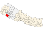
Parsapur is a village development committee in Banke District in Lumbini Province of south-western Nepal. At the time of the 1991 Nepal census it had a population of 3,201 and had 604 houses in the town. Now, it is a part of Nepalgunj sub-metropolitan city.
Titahiriya is a village development committee in Banke District in Lumbini Province of south-western Nepal. At the time of the 1991 Nepal census it had a population of 6,986 and had 970 houses in the town.
Udayapur is a Village Development Committee in Banke District in Lumbini Pradesh of south-western Nepal. At the time of the 1991 Nepal census it had a population of 2,301 and had 397 houses in the village. Two government owned primary schools are situated here along with one among 10 Health Posts in district and a police station. Now, it is a part of Nepalgunj sub-metropolitan city.
Mahamadpur is a Village Development Committee in Bardiya District in Lumbini Province of south-western Nepal. At the time of the 1991 Nepal census it had a population of 8,191 and had 1152 houses in the town.
Tara Nagar is a village development committee in Gorkha District in the Gandaki Zone of northern-central Nepal. At the time of the 1991 Nepal census it had a population of 5,698 and had 1066 houses.
Mukhiyapatti Musharniya is a village development committee in Dhanusa District in Province No. 2 of south-eastern Nepal. At the time of the 1991 Nepal census it had a population of 4,621 people living in 436 individual households.
Malpi is a village development committee in Kabhrepalanchok District in the Bagmati Zone of central Nepal. At the time of the 1991 Nepal census it had a population of 3033 in 571 individual households.
Amritpur is a village and former Village Development Committee (Nepal) that is now part of Tulsipur Sub-Metropolitan City in Dang Deokhuri District in Lumbini Province of south-western Nepal. At the time of the 1991 Nepal census it had a population of 9,680 persons living in 1725 individual households.
Majhkot is a former village development committee in Jajarkot District in the Karnali province of Nepal. At the time of the 1991 Nepal census it had a population of 5309 living in 1064 individual households.
Awalaching is a village development committee in Surkhet District in Karnali Pradesh of mid-western Nepal. At the time of the 1991 Nepal census it had a population of 1911 people living in 286 individual households.
Ghatgaun is a village development committee in Surkhet District in the Bheri Zone of mid-western Nepal. At the time of the 1991 Nepal census it had a population of 3352 people living in 659 individual households.
Khanikhola is a village development committee in Surkhet District in the Bheri Zone of mid-western Nepal. At the time of the 1991 Nepal census it had a population of 3127 people living in 512 individual households.
Satokhani is a village development committee in Surkhet District in the Bheri Zone of mid-western Nepal. At the time of the 1991 Nepal census it had a population of 6426 people living in 1092 individual households.