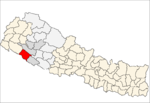
Bhagyeshwar is a business center in Sanphebagar Municipality in Achham District in the Seti Zone of western Nepal. It was annexed to form the new municipality since 18 May 2014. According to the 1991 Nepal census, the village had a population of 1158 living in 257 houses. At the time of the 2001 Nepal census, the population was 1321, of which 62% was literate.
Nandegata is a village in Achham District in the Seti Zone of western Nepal. At the time of the 1991 Nepal census, the village had a population of 2881 living in 542 houses. At the time of the 2001 Nepal census, the population was 3356, of which 33% was literate.
Daga Tumdada is a village development committee in Baglung District in the Dhaulagiri Zone of central Nepal. At the time of the 1991 Nepal census it had a population of 4,874 and had 897 houses in the town.

Kanda, Bajura is a village in Bajura District in the Seti Zone of north-western Nepal. At the time of the 1991 Nepal census it had a population of 2,741 and had 484 houses in the village.
Parsapur is a village development committee in Banke District in Lumbini Province of south-western Nepal. At the time of the 1991 Nepal census it had a population of 3,201 and had 604 houses in the town. Now, it is a part of Nepalgunj sub-metropolitan city.
Titahiriya is a village development committee in Banke District in Lumbini Province of south-western Nepal. At the time of the 1991 Nepal census it had a population of 6,986 and had 970 houses in the town.
Udayapur is a Village Development Committee in Banke District in Lumbini Pradesh of south-western Nepal. At the time of the 1991 Nepal census it had a population of 2,301 and had 397 houses in the village. Two government owned primary schools are situated here along with one among 10 Health Posts in district and a police station. Now, it is a part of Nepalgunj sub-metropolitan city.
Tara Nagar is a village development committee in Gorkha District in the Gandaki Zone of northern-central Nepal. At the time of the 1991 Nepal census it had a population of 5,698 and had 1066 houses.
Uiya is a village development committee in Gorkha District in the Gandaki Zone of northern-central Nepal. At the time of the 1991 Nepal census it had a population of 1,728 and had 382 houses.
Lihi is a village development committee in Jumla District in the Karnali Zone of north-western Nepal. At the time of the 1991 Nepal census it had a population of 2397.
Darling is a village and municipality in Gulmi District in the Lumbini Zone of central Nepal. At the time of the 1991 Nepal census it had a population of 2465 persons living in 454 individual households.
Paudi Amarahi is a town and municipality in Gulmi District in the Lumbini Zone of central Nepal. At the time of the 1991 Nepal census it had a population of 4136 persons living in 742 individual households.
Awalaching is a village development committee in Surkhet District in Karnali Pradesh of mid-western Nepal. At the time of the 1991 Nepal census it had a population of 1911 people living in 286 individual households.
Ghatgaun is a village development committee in Surkhet District in the Bheri Zone of mid-western Nepal. At the time of the 1991 Nepal census it had a population of 3352 people living in 659 individual households.
Khanikhola is a village development committee in Surkhet District in the Bheri Zone of mid-western Nepal. At the time of the 1991 Nepal census it had a population of 3127 people living in 512 individual households.
Rajeni is a village development committee in Surkhet District in the Bheri Zone of mid-western Nepal. At the time of the 1991 Nepal census it had a population of 2730 people living in 430 individual households.
Sahare is a Village Development Committee in Surkhet District in the Bheri Zone of mid-western Nepal. At the time of the 1991 Nepal census it had a population of 7297 people residing in 1318 individual households.
Satokhani is a village development committee in Surkhet District in the Bheri Zone of mid-western Nepal. At the time of the 1991 Nepal census it had a population of 6426 people living in 1092 individual households.
Bhakunde is a village development committee in Baglung District in the Dhawalagiri Zone of central Nepal. At the time of the 1991 Nepal census it had a population of 3,833 and had 697 houses in the village. At the time of the 2011 Nepal census it had a population of 4,952 among which 2,443 were female and 2,509 were male. There were about 831 houses in the village.
Mashtabandali is a former Village development committee in Achham District in the Seti Zone of western Nepal. At the time of the 1991 Nepal census, the village had a population of 1995 living in 350 houses. At the time of the 2001 Nepal census, the population was 2004, of which 31% was literate. Mashtanamdali now is part of Kamalbazar Municipality which was established in 2014.

