
Lower Saxony is a German state (Land) situated in northwestern Germany. It is the second-largest state by land area, with 47,624 km2 (18,388 sq mi), and fourth-largest in population among the 16 Länder federated as the Federal Republic of Germany. In rural areas, Northern Low Saxon and Saterland Frisian are still spoken, but the number of speakers is declining.
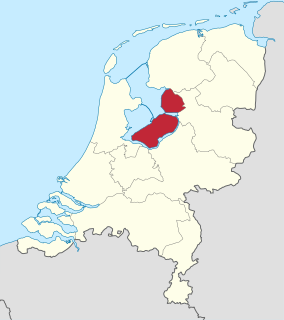
Flevoland is the 12th and youngest province of the Netherlands, established in 1986, when the southern and eastern Flevopolders were merged into one provincial entity. It is located in the centre of the country, where the former Zuiderzee was. Almost all of the land belonging to Flevoland was reclaimed only in the 1950s and 1960s. The province has a population of 422,202 as of November 2019 and consists of six municipalities. Its capital is Lelystad and most populous city is Almere.

The Zuiderzee Works is a man-made system of dams and dikes, land reclamation and water drainage work, in total the largest hydraulic engineering project undertaken by the Netherlands during the twentieth century. The project involved the damming of the Zuiderzee, a large, shallow inlet of the North Sea, and the reclamation of land in the newly enclosed water using polders. Its main purposes are to improve flood protection and create additional land for agriculture.

Salzgitter is an independent city in southeast Lower Saxony, Germany, located between Hildesheim and Braunschweig. Together with Wolfsburg and Braunschweig, Salzgitter is one of the seven Oberzentren of Lower Saxony. With 101,079 inhabitants and 223.92 square kilometres (86.46 sq mi), its area is the largest in Lower Saxony and one of the largest in Germany. Salzgitter originated as a conglomeration of several small towns and villages, and is today made up of 31 boroughs, which are relatively compact conurbations with wide stretches of open country between them. The main shopping street of the young city is in the borough of Lebenstedt, and the central business district is in the borough of Salzgitter-Bad. The city is connected to the Mittellandkanal and the Elbe Lateral Canal by a distributary. The nearest metropolises are Braunschweig, about 23 kilometres to the northeast, and Hanover, about 51 km to the northwest. The population of the City of Salzgitter has exceeded 100,000 inhabitants since its foundation in 1942, when it was still called Watenstedt-Salzgitter. Beside Wolfsburg, Leverkusen and Eisenhüttenstadt, Salzgitter is therefore one of the few cities in Germany founded during the 20th century.

In law, an unincorporated area is a region of land that is not governed by a local municipal corporation; similarly an unincorporated community is a settlement that is not governed by its own local municipal corporation, but rather is administered as part of larger administrative divisions, such as a township, parish, borough, county, city, canton, state, province or country. Occasionally, municipalities dissolve or disincorporate, which may happen if they become fiscally insolvent, and services become the responsibility of a higher administration. Widespread unincorporated communities and areas are a distinguishing feature of the United States and Canada. In most other countries of the world, there are either no unincorporated areas at all, or these are very rare; typically remote, outlying, sparsely populated or uninhabited areas.
A koog or groden is a type of polder found on the North Sea coast of Germany that is established by the construction of dykes enclosing the land which is then drained to form marshland. This type of land reclamation is also used along rivers. In general, a koog is protected by embankments known as dykes (Deiche).
The polder model is consensus decision-making, based on the acclaimed Dutch version of consensus-based economic and social policy making in the 1980s and 1990s. It gets its name from the Dutch word (polder) for tracts of land enclosed by dikes.

Greetsiel is a small port on the bight of Leybucht in western East Frisia, Germany that was first documented in letters from the year 1388. Since 1972, Greetsiel has been part of the municipality of Krummhörn, which has its administrative seat in Pewsum. The nearest railway station is at Emden, about 15–20 kilometres (9.3–12.4 mi) away, and the two towns are linked by a bus service.
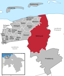
Wittmund is a town and capital of the district of Wittmund, in Lower Saxony, Germany.

Norden is a town in the district of Aurich, in Lower Saxony, Germany. It is situated on the North Sea shore, in East Frisia.

The Acher is a 53.6-kilometre-long river and right-hand tributary of the Rhine in the county of Ortenau, in the south German state of Baden-Württemberg. It flows in an northwesterly direction from the Black Forest to the Rhine, between the two rivers Rench to the south and the Oos to the north.
Esclusham is a local government community, the lowest tier of local government, part of Wrexham County Borough in Wales. It is also an electoral ward.

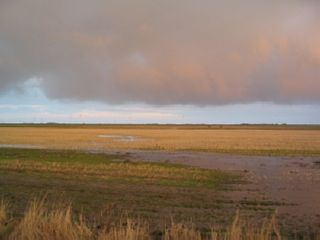
The Leybucht is the second largest bay in East Frisia in northwest Germany after the Dollart. The Jade Bight is larger than both, but belongs historically to Oldenburg.

Leybuchtpolder is part of the borough of Norden in East Frisia on Germany's North Sea coast and was an independent municipality until 1972. Leybuchtpolder is geologically the most recent of Norden's parishes and has 461 inhabitants. Between 1947 and 1950 the polder was finally reclaimed from the North Sea, when the almost 5 km long Störtebeker Dyke was completed. A monument stands on the spot where the dyke was closed. Administratively Leybuchtpolder is the second most recent parish after Tidofeld, which did not become a separate parish until 1996.
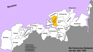
The Brokmerland is a landscape and an historic territory, located in western East Frisia, which covers the area in and around the present-day communities of Brookmerland and Südbrookmerland. The Brokmerland borders in the east on the Harlingerland and in the north on the Norderland. The historic Brokmerland is usually written with only one "o". Occasionally one also finds the spelling "Broekmerland", while today's communities have chosen to spell the name with a double "o".

The Abelitz is a river of Lower Saxony, Germany, in East Frisia. It is about 20 kilometres (12 mi) long and flows from Marienhafe to its mouth on the Alte Greetsieler Sieltief. This type of river that drains the low-lying polders through a sluice in the sea dyke is also known locally as a Tief and is often the course of an old creek between mudflats.

The Aue is a left, southwestern, tributary of the Oste in northern Lower Saxony, Germany. It is about 20 kilometres (12 mi) long.
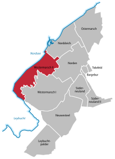
Westermarsch II was an independent municipality until the 1972 territorial reform in Lower Saxony and, as such, a member of the collective municipality (Samtgemeinde) of Leybucht in Lower Saxony. Today Westermarsch II is a village in the East Frisian borough of Norden with around 500 inhabitants. The village parish covers an area of 11.69 km². Curiously the main settlement of Westermarsch II is associated in public perception with the village of Norddeich, with which it has grown together. The boundary between the two runs down the middle of the road, Dörper Weg.

Westermarsch I was an independent municipality in Lower Saxony until the municipal reform of 1972 and, as such, a member of the collective municipality (Samtgemeinde) of Leybucht. Today Westermarsch I is a part of the East Frisian borough of Norden with about 450 inhabitants, spread over an area of 19.42 km².
Ekel is the eastern part of the town centre of Norden. Its name goes back to a Low German description for "acorn" (Eichel) or "oak grove" (Eichengehölz), which gave its name to a medieval fortified house (Wehrhaus) about 800 metres northeast of the big market place. Later a private estate and then part of the agriculturally dominated Norden environs, in the 20th century Ekel quickly merged with Norden as a result of new housing estates and was finally incorporated in 1919.


