State Route 161 is a state highway in Clark County, Nevada. It is known as Goodsprings Road, connecting the town of Goodsprings to Interstate 15 at Jean. The route was part of State Route 53 prior to 1976.

State Route 163, often referred to as the Laughlin Highway, is a state highway in southern Clark County, Nevada. The route connects the town of Laughlin to the rest of the state via U.S. Route 95.

State Route 318 is a state highway in eastern Nevada. It is often used as a shortcut for long-distance traffic along U.S. Route 93, bypassing the longer and less direct route U.S. Route 93 follows between Ely and Crystal Springs. The highway was established in the 1930s as State Route 38 and State Route 38A, and was renumbered to SR 318 in 1976. At a total of 110.762 miles (178.254 km), it is the longest state route in Nevada. The road is used for open speed highway races twice a year.

State Route 169 is a state highway in Clark County, Nevada, United States. It connects the northern reaches of Lake Mead National Recreation Area to Interstate 15 (I-15) via Moapa Valley and the communities of Overton and Logandale. It is also called Northshore Road, Moapa Valley Boulevard, and Logandale Road.
State Route 293 is a state highway in Humboldt County, Nevada. It connects the Kings River Valley to U.S. Route 95 at the town of Orovada.

State Route 306 is a 30.631-mile (49.296 km) state highway in Lander and Eureka counties in northern Nevada, United States. It connects the mining area of Gold Acres in Lander County to Interstate 80 (I-80) at the Beowawe Interchange near Beowawe in Eureka County via Crescent Valley. The road has been a state highway since the 1920s, having been established as part of a much longer State Route 21 by 1929.

U.S. Route 95 Truck is a truck route of US 95 in Mineral County, Nevada, in the United States. It serves as a bypass route for trucks taking US 95 past Hawthorne in either direction, as US 95 itself goes through that community. The route is co-designated as State Route 362 (SR 362); however, that designation is unsigned.

State Route 756 is a state highway in Douglas County, Nevada. It connects Centerville to the town of Gardnerville. The route previously existed as State Route 56.
State Route 579 is a state highway in Clark County, Nevada. It follows a portion of Bonanza Road near the downtown area of Las Vegas. The route encompasses a small portion of former State Route 5 and the entirety of former State Route 5A, and also carried U.S. Route 95 before it was relocated to its present freeway alignment.

State Route 844 is a 12.319-mile (19.826 km) state highway in central Nevada, United States. The route follows Ione Road, covering part of the connection between State Route 361 and Berlin-Ichthyosaur State Park. SR 844 was formerly known as State Route 91, which extended further northeast to Ione.

State Route 757 is a state highway in Douglas County, Nevada. Formerly a part of State Route 19, the route connects the Genoa area to the Johnson Lane area.
State Route 379 covers Duckwater Road, a 19.532-mile (31.434 km) state highway in Nye County, Nevada, United States. The route serves the Duckwater Indian Reservation, connecting the community of Duckwater to U.S. Route 6 at Currant. The highway was formerly a part of State Route 20 prior to the 1970s.

State Route 513 was a short state highway in Carson City, Nevada. The route was originally part of State Route 65, a longer highway that served the eastern outskirts of the city. SR 513 was turned over to Carson City in phases, and completely removed from the state highway system in 2011.
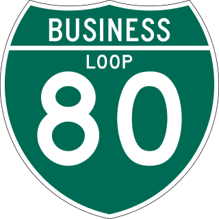
Interstate 80 Business is an unofficial business loop of Interstate 80 (I-80) that is 2.26 miles (3.64 km) long and serves as the main street for the US cities of West Wendover, Nevada, and Wendover, Utah, along a roadway named Wendover Boulevard. Wendover Boulevard was originally part of US Route 40 (US 40), which connected California to New Jersey via Nevada and Utah. A portion of the Nevada segment is concurrent with US 93 Alternate, and the entire portion in Utah is coterminous with Utah State Route 58 (SR-58). The Nevada Department of Transportation (NDOT) applied for the business loop designation in the early 1980s, but the designation has never been approved; nevertheless, signs are posted in both states. Between July 1976 and 1993, I-80 Bus was concurrent with Nevada State Route 224 (SR 224) in Nevada.

U.S. Route 95 is a major U.S. highway traversing the U.S. state of Nevada from north to south directly through Las Vegas and providing connections to both Carson City and Reno. US 95 is cosigned with Interstate 80 for 95 miles (153 km) between a junction in Trinity and Winnemucca before heading north into Oregon at McDermitt. At 646.71 miles (1,040.78 km), it is the longest highway in Nevada.

In the U.S. state of Nevada, U.S. Route 93 is a major United States Numbered Highway traversing the eastern edge of the state. The highway connects the Las Vegas area to the Great Basin National Park, and provides further connections to Ely and Wells. US 93 also provides the majority of the most direct connection from the major metropolitan areas of Las Vegas and Phoenix to the Boise, Idaho metropolitan area.

State Route 90 was a short state highway in Nye County, Nevada. Its western terminus was in the ghost town of Rhyolite. It traveled east to its eastern terminus at SR 58. The route was designated in 1960 as an unimproved road to connect to Rhyolite from SR 58. It became graded by 1969, and was removed from the state highway system in 1982.

State Route 789 is a state highway in Humboldt County, Nevada connecting the town of Golconda to nearby mining districts. Much of the route previously existed as State Route 18 prior to 1976.

State Route 806 is a short state highway in Lander County, Nevada connecting the town of Battle Mountain to North Battle Mountain. Prior to 1976, the route was part of a longer State Route 18A.


