
U.S. Route 395, also known as U.S. Highway 395, is a north–south United States Numbered Highway that traverses the inland areas of the western states of California, Nevada, Oregon, and Washington. It travels for over 1,300 miles (2,100 km) from a junction in the Mojave Desert at Interstate 15 (I-15) in Hesperia to the Canada–U.S. border near Laurier, Washington. Major cities along its route include Carson City and Reno in Nevada; Kennewick and Pasco in Washington's Tri-Cities region; and Spokane, Washington. US 395 is an auxiliary route of US 95 but never intersects its parent route, which runs further east.

U.S. Route 95 (US 95) is a major north–south United States Highway in the western United States. It travels through the states of Arizona, California, Nevada, Oregon, and Idaho, staying inland from the Pacific Coast. US 95 begins in San Luis, Arizona, at the Mexican border, where Calle 1—a short spur—leads to Highway 2 in San Luis Río Colorado, Sonora. Its northern terminus is at the Canadian border in Eastport, Idaho, where the roadway continues north as British Columbia Highway 95.
State Route 599 is a 7.049-mile (11.344 km) state highway in Clark County, Nevada. The route follows Rancho Drive, a major arterial connecting downtown Las Vegas to the northwest part of the city. Much of SR 599 was previously designated as U.S. Route 95 prior to completion of the Las Vegas Expressway. The route is also designated as U.S. Route 95 Business.
State Route 207 (SR 207) is an 11.082-mile (17.835 km) state highway in western Douglas County, Nevada, United States. Commonly known as the Kingsbury Grade, it is one of three Nevada highways that connect the western edge of the state to the Lake Tahoe region through the Carson Range. The route was part of State Route 19 prior to 1976.

State Route 88 is a 7.868-mile (12.662 km) north–south state highway in the Carson Valley in western Douglas County, Nevada, United States. It runs from the California state line along Woodfords Road to U.S. Route 395 in Minden. Prior to 1957, the highway existed as State Route 37.

State Route 206 is a state highway in Douglas County, Nevada, United States. It runs northwest from State Route 88 near the California state line along Foothill Road to Genoa, and then turns east on Genoa Lane to end at U.S. Route 395.

State Route 208 is a 37.893-mile (60.983 km) state highway in Douglas and Lyon counties in Nevada, United States. It connects U.S. Route 395 north of Topaz Lake to U.S. Route 95 Alternate in Yerington. The road serves as the primary transportation corridor of Smith Valley and is Main street in Yerington. The route was originally a portion of State Route 3.
State Route 264 is a 33.67-mile (54.19 km) state highway in Esmeralda County, Nevada, United States. It connects California State Route 266 to U.S. Route 6 via the town of Dyer, Nevada. The majority of the route is known as Fish Lake Valley Road, with the northern portion referred to as the Dicalite Cutoff. A majority of the route was originally designated State Route 3A.

State Route 266 is a 40.338-mile (64.918 km) state highway in Esmeralda County, Nevada, United States. It connects the routing of California State Route 266 east to U.S. Route 95 via the town of Lida. Lida Road previously carried the southern end of State Route 3.
In the U.S. state of Nevada, U.S. Route 95 Alternate is an alternate route of U.S. Route 95 located in the western part of the state. It connects Schurz to Interstate 80 via the cities of Yerington and Fernley.
State Route 341 is a state highway in western Nevada connecting US 50 near Dayton to Reno via Virginia City. Commonly known as the Virginia City Highway, or Geiger Grade north of Virginia City, the route has origins dating back to the 1860s.
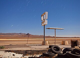
Coaldale is a former mining town and true ghost town in Esmeralda County, Nevada, located at the junction of U.S. Route 6 and U.S. Route 95 about 40 miles (64 km) west of Tonopah.

State Route 373 is a 16.304-mile-long (26.239 km) state highway in Nye County, Nevada, United States. It is a highway connecting California State Route 127 to U.S. Route 95, providing southern Nye County access to the eastern areas of Death Valley National Park.

State Route 376 is a 100-mile (160 km) state highway in Nye and Lander counties in central Nevada, United States. It connects U.S. Route 6 near Tonopah north to U.S. Route 50 near Austin. The Tonopah–Austin Road existed as early as 1919, and was designated the southernmost segment of State Route 8A before being renumbered to SR 376 in 1976.

State Route 2B was one of Nevada’s original state highways, first appearing on official state highway maps around 1929. The western terminus was at its junction with SR 2A about 6 miles (9.7 km) east of Dayton. It ran east along present-day Fort Churchill Road and then turned south along present-day Alternate US 95 to Yerington.

U.S. Route 6 (US 6) is a United States Numbered Highway, stretching from Bishop, California, in the west to Provincetown, Massachusetts, on the East Coast. The Nevada portion crosses the center of the state, serving the cities of Tonopah and Ely, en route to Utah and points further east. Like US 50, to the north, large desolate areas are traversed by the route, with few or no signs of civilization, and the highway crosses several large desert valleys separated by numerous mountain ranges towering over the valley floors, in what is known as the Basin and Range Province of the Great Basin.
U.S. Route 95 is a major U.S. highway traversing the U.S. state of Nevada from north to south directly through Las Vegas and providing connections to both Carson City and Reno. US 95 is cosigned with Interstate 80 for 95 miles (153 km) between a junction in Trinity and Winnemucca before heading north into Oregon at McDermitt. At 646.71 miles (1,040.78 km), it is the longest highway in Nevada.
U.S. Route 395 (US 395) is an 85-mile-long (137 km) United States Numbered Highway near Lake Tahoe in the state of Nevada. It traverses the state after entering from California in Topaz Lake and crosses back into California near Hallelujah Junction. US 395 serves the cities of Gardnerville, Minden, Carson City and Reno. All of US 395 north of Carson City is a freeway and is built up to Interstate Highway standards. Part of the freeway section is also designated as Interstate 580 (I-580). US 395 is an important regional highway, serving the communities of Western Nevada, connecting them to other major communities via California, and it is the only major north–south arterial for the geographically isolated region.
