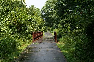
The Haw River is a tributary of the Cape Fear River, approximately 110 mi (177 km) long, that is entirely contained in north central North Carolina in the United States. It was first documented as the "Hau River" by John Lawson, an English botanist, in his 1709 book "A New Voyage to Carolina." The name is shortened from Saxapahaw, from the Catawban /sak'yápha:/, "piedmont, foothill", from /sak/, "hill", plus /yápha:/, "step". The river gives its name to a small town that formed on its banks.

Blackbird Creek is a 16.9-mile-long (27.2 km) river in northern Delaware in the United States.

Ellerbe Creek is a tributary of the Neuse River in North Carolina, USA. It is part of the Neuse River Basin, and flows for more than twenty miles through North Durham. The Ellerbe's watershed begins near Orange County north of Interstate 85, near the WDNC radio tower and Bennett Place. The creek flows through many of Durham's most historic and culturally significant areas, including Ninth Street, Downtown Durham, beneath Durham Athletic Park, The North Carolina School of Science and Mathematics, the Museum of Life and Science, the old Durham Landfill, Duke University East Campus, Trinity Park, Walltown, Northgate Mall, and towards the end crosses Fishdam Road. The Ellerbe eventually flows into Falls Lake, about a mile south of the Eno River.

Oil Creek is a 46.7-mile (75.2 km) tributary of the Allegheny River that is located in Venango and Crawford counties in the Commonwealth of Pennsylvania in the United States.

Pohick Creek is a 14.0-mile-long (22.5 km) tributary stream of the Potomac River in Fairfax County in the U.S. state of Virginia. It takes its name from the Pohick Native American tribe once prevalent in the area.

Abbotts Creek starts in Kernersville, NC in Forsyth County and flows into High Rock Lake near Lexington, NC in Davidson County just north of Hwy 47. The section of High Rock Lake that is officially Abbotts Creeks ends near the Hwy 8 causeway, in Southmont, NC.

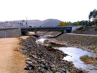
Aliso Creek is a 19.8-mile (31.9 km)-long, mostly urban stream in south Orange County, California. Originating in the Cleveland National Forest in the Santa Ana Mountains, it flows generally southwest and empties into the Pacific Ocean at Laguna Beach. The creek's watershed drains 34.9 square miles (90 km2), and it is joined by seven main tributaries. As of 2018, the watershed had a population of 144,000 divided among seven incorporated cities.
Peters Creek is a 16.8-mile-long (27.0 km) tributary of the Monongahela River and part of the Ohio River and Mississippi River watersheds, flowing through southwestern Pennsylvania in the United States.

Salt Creek is a small coastal stream in southern Orange County, California in the United States. About 4 miles (6.4 km) long, the creek drains 6.1 square miles (16 km2) in parts of the cities of Laguna Niguel and Dana Point. The creek begins in Laguna Niguel and flows west and south through a narrow canyon, partly in the Salt Corridor Regional Park. It empties into the Pacific Ocean at Salt Creek County Beach in Dana Point.

Sulphur Creek is an approximately 4.5-mile (7.2 km) tributary of Aliso Creek in Orange County, California. The creek drains about 6 square miles (16 km2) in the suburban cities of Laguna Niguel and Laguna Hills. Although most of its watershed has been utilized for master planned residential development, the creek retains a natural channel with riparian and wetland habitat in parts of Laguna Niguel Regional Park and Aliso and Wood Canyons Regional Park. Urban runoff has changed the once seasonal creek into a perennial stream.
East Branch Oil Creek is a 10.9-mile (17.5 km) 4th order tributary to Oil Creek in Crawford County, Pennsylvania.
Little River is a 12.83 mi (20.65 km) long tributary to the Eno River in Durham County, North Carolina. Little River along with the Flat River are the major tributaries to the Eno River before it enters Falls Lake.
Walnut Creek is a 17.93 mi (28.86 km) long 4th order tributary to the Neuse River in Wake County. Its source is Maynard Pond in south-central Cary, and it flows generally eastward through several small reservoirs, including Lake Cramer in Cary as well as Lake Johnson and Lake Raleigh in Raleigh, before reaching its confluence with the Neuse just south of Poole Road in East Raleigh. The course of the creek closely parallels Interstate 40, running mostly along the north side of the freeway.

New Hope River is a 12.19-mile-long (19.62 km) fifth-order tributary to the Haw River in Chatham County, North Carolina. This river is now entirely flooded as part of B. Everett Jordan Lake. All of the tributaries to the river are present as arms of the lake. New Hope River contributes 21.8% of the total water discharge for the Haw River.
Beaver Creek is a 12.64 mi (20.34 km) long 4th order tributary to the New Hope River in North Carolina. Beaver Creek joins the New Hope River within the B. Everett Jordan Lake Reservoir.
Parkers Creek is a 6.21 mi (9.99 km) long 2nd order tributary to the New Hope River in North Carolina. Parkers Creek joins the New Hope River within the B. Everett Jordan Lake Reservoir.
White Oak Creek is a 12.83 mi (20.65 km) long 3rd order tributary to the New Hope River in North Carolina. White Oak Creek joins the New Hope River within the B. Everett Jordan Lake Reservoir.
Folkner Branch is a 3.89 mi (6.26 km) long 1st order tributary to the New Hope River in North Carolina. Folkner Branch joins the New Hope River within the B. Everett Jordan Lake Reservoir.
Bush Creek is a 5.76 mi (9.27 km) long 3rd order tributary to the New Hope River in North Carolina. Bush Creek joins the New Hope River within the B. Everett Jordan Lake Reservoir.
Morgan Creek is a 21.03 mi (33.84 km) long 4th order tributary to the New Hope River in North Carolina. Morgan Creek forms the New Hope River along with New Hope Creek within the B. Everett Jordan Lake Reservoir.


