
Nashville is a town in Washington Township, Brown County, Indiana, United States. The population was 1,256 at the 2020 census. The town is the county seat of Brown County and is the county's only incorporated town. The town is best known as the center of the Brown County Art Colony and as a tourist destination.
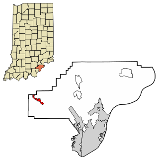
Borden is a town in Wood Township, Clark County, Indiana, United States. The population was 786 at the 2020 census. The town's official name was New Providence until December 29, 1994.

The Kentland structure, also known as the Kentland crater or the Kentland disturbed area, is an impact structure located near the town of Kentland in Newton County, Indiana, United States.
Stockdale is a surname originating from Northern England, probably Yorkshire. At the time of the British Census of 1881, its frequency was highest in Yorkshire, followed by Westmorland, Cumberland, County Durham, Nottinghamshire, Cambridgeshire, Lincolnshire, Rutland, and Lancashire.

Nathaniel Southgate Shaler was an American paleontologist and geologist who wrote extensively on the theological and scientific implications of the theory of evolution, whose work is now considered scientific racism.

The South Coast of Massachusetts is the region of southeastern Massachusetts consisting of the southern part of Bristol and Plymouth counties, bordering Buzzards Bay, and includes the cities of Fall River, New Bedford, the southeastern tip of East Taunton and nearby towns. The Rhode Island towns of Tiverton and Little Compton, located in Newport County, are often included within the South Coast designation due to regional similarities with adjacent communities.
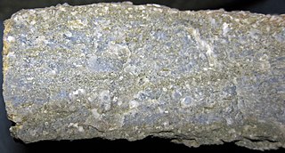
The Fort Payne Formation, or Fort Payne Chert, is a geologic formation found in the southeastern region of the United States. It is a Mississippian Period cherty limestone, that overlies the Chattanooga Shale, and underlies the St. Louis Limestone. To the north, it grades into the siltstone Borden Formation. It preserves fossils dating back to the Carboniferous period.
The Knobstone Escarpment is a rugged geologic region in Southern Indiana. Physically, the Knobstone Escarpment is the most rugged terrain in Indiana. The highest hill in the area is Weed Patch Hill, with an elevation of 1,060 feet above sea level.
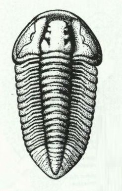
Flexicalymene Shirley, 1936. is a genus of trilobites belonging to the order Phacopida, suborder Calymenina and Family Calymenidae. Flexicalymene specimens can be mistaken for Calymene, Gravicalymene, Diacalymene and a few other Calymenina genera. They are used as an index fossil in the Ordovician. Ohio and North America are particularly known for being rich with Flexicalymene fossils.
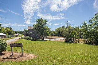
Stockdale is an unincorporated community in Paw Paw Township, Wabash County and Miami County, in the U.S. state of Indiana.

The Marcellus Formation or the Marcellus Shale is a Middle Devonian age unit of sedimentary rock found in eastern North America. Named for a distinctive outcrop near the village of Marcellus, New York, in the United States, it extends throughout much of the Appalachian Basin.

The Pierre Shale is a geologic formation or series in the Upper Cretaceous which occurs east of the Rocky Mountains in the Great Plains, from Pembina Valley in Canada to New Mexico.
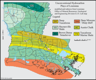
The Haynesville Shale is an informal, popular name for a Jurassic Period rock formation that underlies large parts of southwestern Arkansas, northwest Louisiana, and East Texas. It lies at depths of 10,500 to 13,000 feet below the land’s surface. It is part of a large rock formation which is known by geologists as the Haynesville Formation. The Haynesville Shale underlies an area of about 9,000 square miles and averages about 200 to 300 feet thick. The Haynesville Shale is overlain by sandstone of the Cotton Valley Group and underlain by limestone of the Smackover Formation.
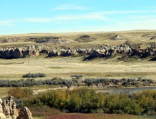
The Foremost Formation is a stratigraphic unit of Late Cretaceous (Campanian) age that underlies much of southern Alberta, Canada. It was named for outcrops in Chin Coulee near the town of Foremost and is known primarily for its dinosaur remains and other fossils.

Bohlen, Meyer, Gibson and Associates, or BMG, is an architectural firm based in Indianapolis, Indiana. It was founded in Indianapolis on April 10, 1853, as D. A. Bohlen, Architect by Diedrich A. Bohlen, German immigrant. In 1884, after Diedrich's son, Oscar D. Bohlen, joined the firm it was renamed D. A. Bohlen and Son. Four successive generations of Bohlen architects have worked at the firm: Diedrich A. Bohlen, Oscar D. Bohlen, August C. Bohlen, and Robert L. Bohlen. The firm specialized in institutional projects, especially civic, religious, and educational buildings. In 1971 Melvin B. G. Meyer acquired majority interest in the firm, which adopted its name in reference to its founder and its two principal architects, Meyer and John M. Gibson. The architectural firm is among the oldest still operating in the United States. More than twenty of its projects are listed on the National Register of Historic Places.

The New Albany Shale is an organic-rich geologic formation of Devonian and Mississippian age in the Illinois Basin of the United States. It is a major source of hydrocarbons.
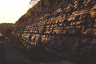
The Mississippian Borden Formation is a mapped bedrock unit in Kentucky, Indiana, Illinois, Ohio, West Virginia, and Tennessee. It has many members, which has led some geologists to consider it a group rather than a formation.

The Chattanooga Shale is a geological formation in Alabama, Arkansas, Georgia, Kentucky, Missouri and Tennessee. It preserves conodont fossils dating to the Devonian period. It occurs mostly as a subsurface geologic formation composed of layers of shale. It is located in East Tennessee and also extends into southeastern Kentucky, northwestern Georgia, and northern Alabama. This part of Alabama is part of the Black Warrior Basin.

The Waldron Shale is a geologic formation in Indiana. It preserves fossils dating back to the Silurian period. These fossils comprise at least three different benthic communities primarily living in the inter-reef, deep waters that were stable for much of the Wenlockian epoch. Many of these fossils are found most frequently around microbioherms constructed by small encrusting organisms which protected other species from the effects of storms.
The Stockdale Group is a Silurian lithostratigraphic group in the southern Lake District and Howgill Fells of the Pennines of northern England. The name is derived from the locality of Stockdale near the top of Longsleddale in Cumbria. It is included within the Windermere Supergroup. The rocks of the Group have also previously been referred to as the Stockdale Shales or Stockdale Subgroup. The group comprises limestones and oolites and some sandstones and shales which reach a maximum thickness of 120m in the area. It is divided into a lower Skelgill Formation which is overlain by an upper Browgill Formation.


