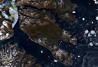
Robeson Channel is a body of water lying between Greenland and Canada's northernmost island, Ellesmere Island. It is the most northerly part of Nares Strait, linking Hall Basin to the south with the Arctic Ocean to the north. The Newman Fjord in Greenland has its mouth in the Robeson Channel.

Peary Land is a peninsula in northern Greenland, extending into the Arctic Ocean. It reaches from Victoria Fjord in the west to Independence Fjord in the south and southeast, and to the Arctic Ocean in the north, with Cape Morris Jesup, the northernmost point of Greenland's mainland, and Cape Bridgman in the northeast.

Hall Basin is an Arctic waterway between Hall Land in Greenland to the east and Canada's northernmost island, Ellesmere Island, to the west.

Frederick E. Hyde Fjord is a fjord in Peary Land, far northern Greenland.
Victoria Fjord, also known as Victoria Inlet, is a large fjord in northern Greenland.
Hall Land is a peninsula in far northwestern Greenland. It is a part of the Northeast Greenland National Park. Hall Land is one of the coldest places in Greenland.

Odinland, also Odinsland in the Defense Mapping Agency Greenland Navigation charts, is a peninsula in the King Frederick VI Coast, southeastern Greenland. It is a part of the Sermersooq municipality.

G.B. Schley Fjord is a fjord in Peary Land, northern Greenland. To the east, the fjord opens into the Wandel Sea of the Arctic Ocean.
De Long Fjord is a fjord system in Peary Land, northern Greenland. To the northwest, the fjord opens into the Lincoln Sea of the Arctic Ocean. It is part of the Northeast Greenland National Park.
Sherard Osborn Fjord is a fjord in northern Greenland. To the NNW, the fjord opens into the Lincoln Sea. Administratively it is part of the Northeast Greenland National Park.

Weyprecht Fjord is a fjord in Peary Land, northern Greenland. To the northwest, the fjord opens into the Lincoln Sea of the Arctic Ocean. It is part of the Northeast Greenland National Park.

Petermann Fjord is a fjord in northwestern Greenland. Administratively it marks the boundary between the Avannaata municipality and the Northeast Greenland National Park.

Sands Fjord is a fjord in Peary Land, northern Greenland. To the north, the fjord opens into the Lincoln Sea of the Arctic Ocean. Administratively, it belongs to the Northeast Greenland National Park.

Benedict Fjord is a fjord in Peary Land, northern Greenland. To the north, the fjord opens into the Lincoln Sea of the Arctic Ocean.

Hunt Fjord is a fjord in Peary Land, northern Greenland. To the north the fjord has its mouth in the Lincoln Sea of the Arctic Ocean. Administratively it belongs to the Northeast Greenland National Park.

Bliss Bay is a bay in the Wandel Sea, Northern Greenland. The area of the bay is uninhabited. Administratively Bliss Bay and its surroundings belong to the Northeast Greenland National Park.

The Davy Sound is a sound in King Christian X Land, Northeast Greenland. Administratively it is part of the Northeast Greenland National Park zone.
Jewell Fjord, also known as "Jewell Inlet", is a fjord in Peary Land, northern Greenland. To the northwest, the fjord opens into the Lincoln Sea of the Arctic Ocean. It is part of the Northeast Greenland National Park.

Cape Clarence Wyckoff, also known as Cape Wyckoff, is a broad headland in the Wandel Sea, Arctic Ocean, northernmost Greenland. Administratively it is part of the Northeast Greenland National Park.
Repulse Harbour is a bay in northern Greenland. To the northwest it opens into the Lincoln Sea. Administratively it is a part of the Northeast Greenland National Park.


