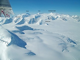
Peary Land is a peninsula in northern Greenland, extending into the Arctic Ocean. It reaches from Victoria Fjord in the west to Independence Fjord in the south and southeast, and to the Arctic Ocean in the north, with Cape Morris Jesup, the northernmost point of Greenland's mainland, and Cape Bridgman in the northeast.

Hall Basin is an Arctic waterway between Hall Land in Greenland to the west and Canada's northernmost island to the east, Ellesmere Island.
Frænkel Land is a peninsula in King Christian X Land, East Greenland. Administratively it is part of the Northeast Greenland National Park.

Petermann Glacier is a large glacier located in North-West Greenland to the east of Nares Strait. It connects the Greenland ice sheet to the Arctic Ocean at 81°10' north latitude, near Hans Island.
Alison Bay is a bay in Avannaata municipality in northwestern Greenland. The bay is a tributary bay of Melville Bay, and is located in the northern part of Upernavik Archipelago, between Kiatassuaq Island in the southwest and the mainland of Greenland in the northeast.
Cape Morton is a headland in North Greenland in Avannaata municipality. The cape is named after Arctic explorer William Morton, who surveyed the Nares Strait area together with Hans Hendrik in June 1854 during the Second Grinnell Expedition.

The Watkins Range is Greenland's highest mountain range. It is located in King Christian IX Land, Sermersooq municipality.

King Frederick VIII Land is a major geographic division of northeastern Greenland. It extends above the Arctic Circle from 76°N to 81°N in a N/S direction along the coast of the Greenland Sea.
Payer Peak, is a mountain in King Christian X Land, Northeast Greenland. Administratively it is part of the Northeast Greenland National Park zone.
Petermann Peak,, also known as Petermann Fjeld, Petermanns Topp and Petermann Point is a mountain in King Christian X Land, Northeast Greenland. Administratively it is part of the Northeast Greenland National Park zone.
Kayser Mountain is a mountain in Hall Land, NW Greenland. Administratively it is part of the Northeast Greenland National Park. This peak was named after German geologist and paleontologist Emanuel Kayser.
The Haug Range is a mountain range in far northwestern Greenland. Administratively this range is part of Avannaata municipality. The range is located in Hall Land, one of the coldest places in Greenland.
Newman Bay or Newman Fjord is a fjord in northern Greenland. To the northwest, the fjord opens into the Robeson Channel of the Lincoln Sea. It is a part of the Northeast Greenland National Park.
Nyeboe Land is a peninsula in far northwestern Greenland. It is a part of the Northeast Greenland National Park.

Daugaard-Jensen Land,, is a peninsula in northwestern Greenland. It is a part of the Avannaata municipality.
Bessel Fjord, also known as Bessels Bay, is a fjord in northwestern Greenland. Administratively it belongs to the Avannaata municipality.
Joe Island is an island of the Nares Strait, Greenland. Administratively it belongs to the Avannaata municipality.

Petermann Fjord is a fjord in northwestern Greenland. Administratively it marks the boundary between the Avannaata municipality and the Northeast Greenland National Park.
Nansen Land is a peninsula in far northwestern Greenland. It is a part of the Northeast Greenland National Park.
Repulse Harbour is a bay in northern Greenland. To the northwest it opens into the Lincoln Sea. Administratively it is a part of the Northeast Greenland National Park.


