
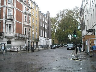
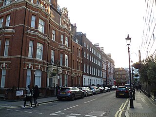
Newman Street is a street in the City of Westminster. It runs from the junction of Mortimer Street, Cleveland Street, and Goodge Street in the north to Oxford Street in the south and is joined on its western side by Eastcastle Street.
Newman Street is a street in the City of Westminster. It runs from the junction of Mortimer Street, Cleveland Street, and Goodge Street in the north to Oxford Street in the south and is joined on its western side by Eastcastle Street.
The former Dickie Fitz restaurant is at number 48 on the corner with Goodge Street.
It contains a number of listed buildings:

Eastcastle Street is a street in the City of Westminster. It runs from Newman Street in the east to Great Titchfield Street in the west. It is crossed by Berners Street and Wells Street. Winsley Street runs from its south side. Berners Mews joins it on the north side and Berners Place on the south.
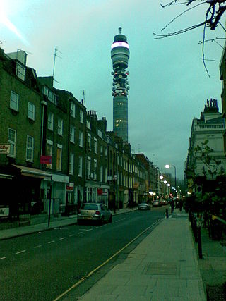
Cleveland Street in central London runs north to south from Euston Road (A501) to the junction of Mortimer Street and Goodge Street. It lies within Fitzrovia, in the W1 post code area. Cleveland Street also runs along part of the border between Bloomsbury (ward) which is located in London Borough of Camden, and West End (ward) in the City of Westminster. In the 17th century, the way was known as the Green Lane, when the area was still rural, or Wrastling Lane, after a nearby amphitheatre for boxing and wrestling.
Sackville Street is a street in central London which today is mainly composed of offices and the rears of retail premises, but once was the home to several important medical figures.
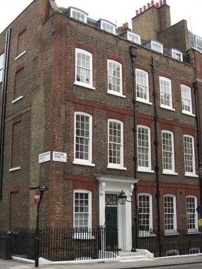
Clifford Street is a street in central London, built in the early 18th century, on land that once formed part of the Burlington Estate. It is named after the Clifford family, Earls of Cumberland. The daughter and heiress of the last holder of that title was the mother of the first Lord Burlington.

Beak Street is a street in Soho, London, that runs roughly east–west between Regent Street and Lexington Street.
The Sun and 13 Cantons is a Grade II listed public house at 20 Great Pulteney Street, Soho, London W1.
Rathbone Street is a street in London that runs between Charlotte Street in the north and the junction of Rathbone Place and Percy Street in the south. The street is partly in the London Borough of Camden and partly in the City of Westminster.

Thayer Street is a street in the Marylebone district of the City of Westminster, London, that contains four listed buildings.
Hinde Street is a street in the Marylebone district of the City of Westminster, London, that contains the Hinde Street Methodist Church and was home to the novelist Rose Macaulay until her death.

Riding House Street is a street in central London in the City of Westminster.

Stratton Street is a street in the Mayfair district of the City of Westminster, London. It runs from Berkeley Street in the north to Piccadilly in the south.

Mayfair Place is a street in the City of Westminster, London. The street joins Stratton Street to Berkeley Street.

The London Fo Guang Shan Temple is located at 84 Margaret Street, London W1, England. It was established in 1992 and is also known as International Buddhist Progress Society. It is one of two British branches of Fo Guang Shan Order, Taiwan.

8 and 9 Bentinck Street are adjacent grade II listed terraced houses in Bentinck Street, in the City of Westminster, London. Number 8 was completed around 1780, and number 9 in 1780–90. A blue plaque notes the fact that James Smithson, founder of the Smithsonian Institution, once lived at number 9.
Bulstrode Street is a street in Marylebone in the City of Westminster that runs from Welbeck Street in the east to Thayer Street in the west. It is crossed only by Marylebone Lane.

Dickie Fitz was a restaurant in a former pub at 48 Newman Street on the corner with Goodge Street in the City of Westminster, London. It closed in June 2017. It had traded under that name for about one year as an Australian-themed restaurant but had previously been the home to restaurants Ping Pong and the Newman Street Tavern.

Mortimer Street is a street in the City of Westminster. It runs from the junction of Cavendish Place, Langham Place, and Regent Street in the west, to the junction of Cleveland Street, Goodge Street, and Newman Street in the east. It is joined by Great Portland Street, Great Titchfield Street, Wells Street, Nassau Street, Berners Street, and Berners Mews.

42–44 Mortimer Street is an architecturally notable former youth hostel in Mortimer Street, in the City of Westminster, London. It was designed by Arthur Beresford Pite and is grade II listed with Historic England. A London County Council plaque on the building records that the sculptor Joseph Nollekens once lived on a house on the site.

Wells Street is a street in the City of Westminster. It runs from Riding House Street in the north to Oxford Street in the south. It is crossed by Mortimer Street and Eastcastle Street. It is joined on its western side by Marylebone Passage and on the eastern side by Booth's Place and Wells Mews.

The London Edition is a historic luxury boutique hotel, formerly known as the Berners Hotel, located in Berners Street in the City of Westminster, London.
51°31′02″N0°08′07″W / 51.5172°N 0.1354°W
| | This London road or road transport-related article is a stub. You can help Wikipedia by expanding it. |