
Bishop's Castle is a market town in the south west of Shropshire, England. According to the 2011 Census it had a population of 1,893.

Castle Cary is a market town and civil parish in south Somerset, England, 5 miles (8 km) north west of Wincanton and 8 miles (12.9 km) south of Shepton Mallet, at the foot of Lodge Hill and on the River Cary, a tributary of the Parrett.
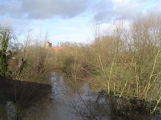
The River Thame is a river in Southern England. A tributary of the River Thames, the river runs generally south-westward for about 40 mi (64 km) from its source above the Buckinghamshire town of Aylesbury to the Thames in south-east Oxfordshire.

Thornbury Castle is a Tudor castle in the town of Thornbury, in Gloucestershire, England, erected next to the parish church of St Mary. Construction was begun in 1511 as a further residence for Edward Stafford, 3rd Duke of Buckingham (1478–1521), of Stafford Castle in Staffordshire. It is not a true military fortress but rather an early example of a Tudor country house, with minimal defensive attributes. As at Richmond Palace in Surrey, the main ranges of Thornbury framed courts, of which the symmetrical entrance range, with central gatehouse and octagonal corner towers, survives, together with two less regular side ranges with many irregular projecting features and towers. It is now a Grade I listed building that is operated as a hotel.
Sloane Street is a major London street in the Royal Borough of Kensington and Chelsea which runs north to south, from Knightsbridge to Sloane Square, crossing Pont Street about halfway along.

Piccadilly Gardens is a green space in Manchester city centre, England, on the edge of the Northern Quarter.

Broadway is a street in the City of Westminster in London that runs between Petty France, Queen Anne's Gate, Carteret Street and Tothill Street in the north and Victoria Street in the south. It is joined on the west side by St Ermin's Hill and Caxton Street, and on the east side by Dacre Street.
The Sanderson Hotel is a hotel on Berners Street, London, built in 1958 as the new headquarters and showroom for Arthur Sanderson and Sons, manufacturers of wallpaper, fabrics and paint, for the company's centennial. The building was designed by architect Reginald Uren, of the architectural firm, Slater and Uren. The original design allowed for dynamic room configurations. The building surrounds a courtyard with a Japanese garden designed by Philip Hicks. The Sanderson building was listed Grade II* by English Heritage in 1991. After refurbishment by Philippe Starck and Denton Corker Marshall, it was reopened by Morgans Hotel Group as the Sanderson Hotel on 25 April 2000.

Bryanston Square is an 800-by-200-foot garden square in Marylebone, London. Terraced buildings surround it — often merged, converted or sub-divided, some of which remain residential. The southern end has the William Pitt Byrne memorial fountain. Next to both ends are cycle parking spaces.

Nantwich is a market town and civil parish in Cheshire East, Cheshire, England. It contains 132 listed buildings and structures, with three classified as grade I, seven as grade II* and 122 as grade II. In the United Kingdom, the term "listed building" refers to a building or other structure officially designated as being of special architectural, historical or cultural significance. There are three grades: grade I denotes buildings of outstanding architectural or historical interest, grade II* denotes particularly significant buildings of more than local interest, and grade II includes buildings of special architectural or historical interest. Buildings in England are listed by the Secretary of State for Culture, Olympics, Media and Sport on recommendations provided by English Heritage, which also determines the grading. This list includes the listed buildings and structures within the boundaries of the civil parish of Nantwich.

Cavendish Square is a public garden square in Marylebone in the West End of London. It has a double-helix underground commercial car park. Its northern road forms ends of four streets: of Wigmore Street that runs to Portman Square in the much larger Portman Estate to the west; of Harley Street which runs an alike distance; of Chandos Street which runs for one block and; of Cavendish Place which runs the same. The south side itself is modern: the rear façade and accesses to a flagship department store and office block. On the ground floors facing are Comptoir Libanais, Royal Bank of Scotland and Pret a Manger premises.
The Eastcastle Street robbery was the holdup of a Post Office van in London in May 1952 which, at the time, was Britain's largest postwar robbery. The robbers escaped with £287,000.
Sackville Street is a street in central London which today is mainly composed of offices and the rears of retail premises, but once was the home to several important medical figures.

The Welsh Church of Central London, also known as The Welsh Baptist Chapel is a Welsh Baptist church in Eastcastle Street, in the City of Westminster, London, England. The church building is a grade II listed building with Historic England on the National Heritage List for England. It currently performs Baptist services bilingually in English and in Welsh as well as hosting concerts following a merger of the Welsh Baptist church with two nearby Independent churches in 2006.
Harrington Gardens is a street which has a communal garden regionally sometimes known as a garden square in the Royal Borough of Kensington and Chelsea in London. The street runs from Collingham Gardens and Collingham Road in the east to Gloucester Road and Stanhope Gardens in the west. It is crossed by Ashburn Place and joined by Colbeck Mews on its north side. It contains several listed buildings including an important group of grade II* buildings on the south side numbered 35 to 45.
Newman Street is a street in the City of Westminster. It runs from the junction of Mortimer Street, Cleveland Street, and Goodge Street in the north to Oxford Street in the south and is joined on its western side by Eastcastle Street.

Mortimer Street is a street in the City of Westminster. It runs from the junction of Cavendish Place, Langham Place, and Regent Street in the west, to the junction of Cleveland Street, Goodge Street, and Newman Street in the east. It is joined by Great Portland Street, Great Titchfield Street, Wells Street, Nassau Street, Berners Street, and Berners Mews.

Wells Street is a street in the City of Westminster. It runs from Riding House Street in the north to Oxford Street in the south. It is crossed by Mortimer Street and Eastcastle Street. It is joined on its western side by Marylebone Passage and on the eastern side by Booth's Place and Wells Mews.

The London Edition is a historic luxury boutique hotel, formerly known as the Berners Hotel, located in Berners Street in the City of Westminster, London.

Castle Gate is an historic street near the centre of the English city of Nottingham. The street runs uphill, from a junction with Low Pavement, Lister Gate and Albert Street in the city centre, to Castle Road, near to the entrance to Nottingham Castle. The street is noted for its Georgian houses, many of which are listed buildings. There is also a complex of rock-cut caves, under buildings at the lower end of the street, which is a scheduled monument.

