Ngagung Tso

Last updated
Ngagung Tso
Tibet loc rel map.svg
Red pog.svg
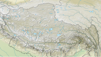
Ngagung Tso
Location of Ngagung in Tibet Autonomous Region.
Location Chamdo, Tibet Autonomous Region
Coordinates 29°22′N96°50′E / 29.367°N 96.833°E / 29.367; 96.833 Coordinates: 29°22′N96°50′E / 29.367°N 96.833°E / 29.367; 96.833
Native name
Primary outflows Parlung Tsangpo
Basin  countriesChina
Max. length3.9 kilometres (2.4 mi)
Max. width2.1 kilometres (1.3 mi)
Surface area6.1 square kilometres (2.4 sq mi)

Ngagung Tso (Tibetan : རྔ་གུང་མཚོ།, Wylie : rnga gung mtsho; simplified Chinese :安贡错; traditional Chinese :安貢錯; pinyin :Āngòng Cuò) is a lake in Baxoi County, Chamdo Prefecture, Tibet Autonomous Region, China, to the north of Rakwa Tso. The lake's length is 3.9 km, maximum width 2.1 km, average width 1.6 km. It covers an area of 6.1 km2. Parlung River flows out of the lake.


Related Research Articles

Anyang Prefecture-level city in Henan, Peoples Republic of China

Anyang is a prefecture-level city in Henan province, China. The northernmost city in Henan, Anyang borders Puyang to the east, Hebi and Xinxiang to the south, and the provinces of Shanxi and Hebei to its west and north respectively.

Lake Tsomgo Glacial lake in Sikkim, India

Tsomgo Lake, also known as Tsongmo Lake or Changgu Lake, is a glacial lake in the East Sikkim district of the Indian state of Sikkim, some 40 kilometres (25 mi) from the capital Gangtok. Located at an elevation of 3,753 m (12,313 ft), the lake remains frozen during the winter season. The lake surface reflects different colours with change of seasons and is held in great reverence by the local Sikkimese people. Buddhist monks prognosticated after studying the changing colours of the lake.

Pangong Tso Soda lake

Pangong Tso or Pangong Lake is an endorheic lake spanning eastern Ladakh and West Tibet situated at an elevation of 4,225 m (13,862 ft). It is 134 km (83 mi) long and divided into five sublakes, called Pangong Tso, Tso Nyak, Rum Tso and Nyak Tso. Approximately 50% of the length of the overall lake lies within Tibet, 40% in Ladakh and the rest is disputed but controlled by China. The lake is 5 km (3.1 mi) wide at its broadest point. All together it covers 604 km2. During winter the lake freezes completely, despite being saline water. It has a land-locked basin separated from the Indus River basin by a small elevated ridge, but is believed to have been part of the latter in prehistoric times.

Yamdrok Lake

Yamdrok Lake is a freshwater lake in Tibet, it is one of the three largest sacred lakes in Tibet. It is over 72 km (45 mi) long. The lake is surrounded by many snow-capped mountains and is fed by numerous small streams. The lake has an outlet stream at its far western end and means turquoise in English due to its color.

Tso Moriri lake in Ladakh.

Tso Moriri or Lake Moriri or "Mountain Lake", is a lake in the Changthang Plateau in Ladakh in Northern India. The lake and surrounding area are protected as the Tso Moriri Wetland Conservation Reserve.

Xainza County County in Tibet, China

Xainza County, also Shantsa, Shentsa, is a county within Nagqu of the Tibet Autonomous Region of China. In 1999 the county had a population of 16,190.

Pagsum Lake Lake in Peoples Republic of China

Dragsum Tsho (Tibetan: བྲག་གསུམ་མཚོ་, Wylie: brag gsum mtsho, THL: Draksum Tso , Pagsum Co, literally meaning “three rocks” in Tibetan, is a lake covering 28 square kilometres in Gongbo'gyamda County, Nyingchi of the Tibet Autonomous Region, China, approximately 300 km east of Lhasa. At 3,700 metres over sea level it is about 18 km long and has an average width of approximately 1.5 km. The deepest point of the green lake measures 120 metres. The lake is also known as Gongga Lake.

Rupshu is a high altitude plateau and valley and an eponymous community development block in southeast Ladakh.

Rawu is the name of a town in Baxoi County, Qamdo Prefecture, part of the Tibet Autonomous Region of China. It is at an altitude of 3,807 m (12,490 ft). The modern town of about 20 shops and hotels services the loggers and nearby military base.

Chunan County County in Zhejiang, Peoples Republic of China

Chun'an  is a county of Zhejiang Province, East China, it is under the administration of the prefecture-level city of Hangzhou, the capital of Zhejiang, containing the well-known Qiandao Lake and bordering Anhui province to the northwest. It has a land area of 4,452 km2 (1,719 sq mi) and a population of 450,000. The postal code is 311700, and the county seat is located on 18 North Xin'an Rd., Qiandaohu Town.

Anxin County County in Hebei, Peoples Republic of China

Anxin is a county in central Hebei province, China. It is under the jurisdiction of Baoding City, the centre of which lies about 40 km (25 mi) to the west, and as of 2006, it has a population of 420,000 residing in an area of 726 km2 (280 sq mi). Most of Baiyang Lake is located in the county.

Tso Lhamo Lake

Tso Lhamo lake is one of the highest lakes in the world, located at an altitude of 6,065 m (19,898 ft). It is situated in North Sikkim, India, about 4 km (2.5 mi) southwest of the international border with China. It is fed by waters from Zemu glacier, Kangtse glacier or Pauhunri glacier, and is the source of the Teesta river.

Anping Bridge Stone beam bridge in Fujian, China

Anping Bridge is a Song dynasty stone beam bridge in Fujian province. It is 2,070 metres (1.29 mi) long. The bridge is also known as the Wuli Bridge because its length is about 5 li, where a li is about 500 meters or 0.3 miles. It is a nationally protected historic site registered with the National Cultural Heritage Administration.

Ngoring Lake

Ngoring Lake or Ngoreng Lake or Eling Lake is a large freshwater lake in the Yellow River catchment, it is in the southeast of Qinghai Province.The name of lake means "Long Blue Lake" in Tibetan language. Ngoring Lake is 610.7 km2 (235.8 sq mi), with a drainage area of 18,188 km2 (7,022 sq mi), an elevation of 4,268 m (14,003 ft), length 32.3 km (20.1 mi) and mean width 18.9 km (11.7 mi).

Liangzi Lake Lake in Hubei, China

Liangzi Lake, originally Fan Lake, is a freshwater lake in the southeast of Hubei Province, divided between the Liangzihu Scenic Spot Office of Jiangxia District, Wuhan and the Liangzihu District of Ezhou City. This rural area south of Wuhan, situated in the south bank of the middle reaches of Yangtze River. The lake is 370 km 2, with a drainage area of 3265 km 2, an elevation of 20 m, length 31.7 km and mean width 9.6 km. The shoreline of lake is highly indented.

Ulansuhai Nur

Ulansuhai Nur or Wuliangsuhai is a freshwater lake in China, it is located in southwest of Inner Mongolia, situated in the north bank of the middle reaches of Yellow River. The lake is 233 km 2, with a drainage area of 11,800 km 2, an elevation of 1018.79 m, length 35.4 km and mean width 6.6 km. The lake is rich in fish. Ulansuhai Nur is a rare big multi-functional lake in this desolate and drought-stricken grassland. The area of bulrush is 150 square kilometers and there are nearly 200 species of birds and over 20 kinds of fish in the lake area.

Jiesa Lake

Jiesa Lake or Gyesar Tso is a lake in Coqên County in the Ngari Prefecture of the Tibet Autonomous Region of China. It is located southwest of Coqên Town. Fed by 27 small streams, it is 32.1 km long and 7.2 km wide and has an area of 146.4 square km.

Taruo Lake

Taruo Lake or Taruocuo, also known as Taro Tso is a lake in Zhongba County in the Shigatse Prefecture of the Tibet Autonomous Region of China. It is located about 70 kilometres west of Coqên Town. It is 38.1 km long and 17.2 km wide and has an area of 486.6 square km.

Spanggur Tso

The Spanggur Tso (斯潘古尔湖) (lake), also called Maindung Co, Mandong Cuo or Moldo, is a saltwater lake in western Tibet Autonomous Region, China. To the west of the lake lies the Spanggur Gap, and to the north is the Pangong Tso. The lake is at an elevation of 4305 meters, and has an area of 61.6 square kilometres. The lake's average annual temperature is around -4 to -2 ℃, and the annual precipitation is 50 to 75 mm. The western portion of the lake is in the Aksai Chin region that's controlled by China but claimed by India.

Sangestar Tso

The Sangestar Tso, formerly called Shonga-tser Lake and popularly known as the Madhuri Lake, is located on the way from Tawang to Bum La Pass in Tawang district of Arunachal Pradesh, near Indo-China border above 15,200 ft above sea level.