Rakwa Tso

Last updated
Rakwa Tso
Rawu Chamdo 01.jpg
View of Rakwa Tso
Tibet loc rel map.svg
Red pog.svg
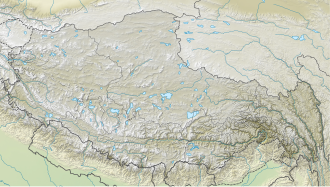
Rakwa Tso
Location of Rakwa in Tibet Autonomous Region.
Location Chamdo, Tibet Autonomous Region
Coordinates 29°27′00″N96°48′00″E / 29.4500°N 96.8000°E / 29.4500; 96.8000 Coordinates: 29°27′00″N96°48′00″E / 29.4500°N 96.8000°E / 29.4500; 96.8000
Native name
Primary outflows Parlung Tsangpo
Basin  countriesChina
Max. length25 km (16 mi)
Surface area27 km2 (10 sq mi)
Surface elevation3,850 m (12,630 ft)
Settlements Rawu

Rakwa Tso (Tibetan : རག་ཝྭ་མཚོ, Wylie : rag wwa mtsho; simplified Chinese :然乌湖; traditional Chinese :然烏湖; pinyin :Ránwū Hú), also known as Rawu Tso or Ranwu Lake, is a lake in Baxoi County, Chamdo Prefecture, Tibet Autonomous Region, China, to the north of Arza Gongla Glacier, and to the south of Ngagung Tso. The lake covers an area of 27 km2 (10 sq mi), and has an elevation of 3,850 metres (12,630 feet). The lake was created by a landslide dam. Parlung River flows out of the lake.

The lake is within the historical region of Kham. The average temperature is 8.5 °C (47.3 °F), and the rainfall 849.7 mm (33.45 in). It has been a famous tourist destination.

Related Research Articles

Aksai Chin Disputed region in Xinjiang, Tibet, and Kashmir

Aksai Chin is a region administered by China as part of its Xinjiang and Tibet autonomous regions, and constituting the eastern portion of the larger Kashmir region which has been the subject of a dispute between India and China since the late 1950s.

Huzhou Prefecture-level city in Zhejiang, Peoples Republic of China

Huzhou is a prefecture-level city in northern Zhejiang province, China. Lying south of the Lake Tai, it borders Jiaxing to the east, Hangzhou to the south, and the provinces of Anhui and Jiangsu to the west and north respectively. At the 2010 census, its population was 2,893,542 inhabitants, of whom 757,165 lived in the built-up area made of Wuxing District as Nanxun District is not being conurbated yet.

Pangong Tso Soda lake

Pangong Tso or Pangong Lake is an endorheic lake spanning eastern Ladakh and West Tibet situated at an elevation of 4,225 m (13,862 ft). It is 134 km (83 mi) long and divided into five sublakes, called Pangong Tso, Tso Nyak, Rum Tso and Nyak Tso. Approximately 50% of the length of the overall lake lies within Tibet, 40% in Ladakh and the rest is disputed but controlled by China. The lake is 5 km (3.1 mi) wide at its broadest point. All together it covers 604 km2. During winter the lake freezes completely, despite being saline water. It has a land-locked basin separated from the Indus River basin by a small elevated ridge, but is believed to have been part of the latter in prehistoric times.

Jingpo Lake

Jingpo Lake or Lake Jingpo is a lake located in the upper reaches of the Mudan River among the Wanda Mountains in Ningan County, Heilongjiang, in the People's Republic of China. Earlier names for the lake include Meituohu Lake (湄沱湖), Huhanhai Lake (忽汗海), and Bilten Lake.

Tso Moriri lake in Ladakh.

Tso Moriri or Lake Moriri or "Mountain Lake", is a lake in the Changthang Plateau in Ladakh in Northern India. The lake and surrounding area are protected as the Tso Moriri Wetland Conservation Reserve.

Shuanghu County County in Tibet, Peoples Republic of China

Shuanghu County, also transliterated from Tibetan as Co Nyi County, is a county under the jurisdiction of the prefecture-level city of Nagqu, in the northernmost part of the Tibet Autonomous Region, People's Republic of China. It was formed in 2012, combining the territory of the former Shuanghu Special District with the eastern half of Nyima County. Much of the county is within the Changtang area.

Yopurga County County in Xinjiang, Peoples Republic of China

Yopurga County is a county in northern Kashgar Prefecture, Xinjiang Uyghur Autonomous Region. More than 96% of the residents of the county are Uyghurs and live around oases at the western edge of the desolate Taklamakan Desert. The county is bordered to the north by Jiashi County, to the east by Maralbexi County, to the west by Shule County, to the southwest by Yengisar County and to the south by Yarkant County.

Bohu County County in Xinjiang, Peoples Republic of China

Bohu County as the official romanized name, also transliterated from Uyghur as Bagrax County, is a county in the central part of the Xinjiang Uyghur Autonomous Region and is under the administration of the Bayin'gholin Mongol Autonomous Prefecture. It contains an area of 3,603 km2 (1,391 sq mi). According to the 2002 census, it has a population of 60,000.

Daming Lake

Daming Lake (Chinese: 大明湖; pinyin: Dà Míng Hú; Wade–Giles: Ta4 Ming2 Hu2; lit. 'Lake of the Great Splendour') is the largest lake in the city of Jinan, Shandong, China and one of city's main natural and cultural landmarks. Located to the north of the historical city center, the lake is fed by the artesian karst springs of the area and hence retains a fairly constant water level through the entire year.

Rawu is the name of a town in Baxoi County, Qamdo Prefecture, part of the Tibet Autonomous Region of China. It is at an altitude of 3,807 m (12,490 ft). The modern town of about 20 shops and hotels services the loggers and nearby military base.

Ayding Lake

Aydingkol, Aydingkul (Mongol) or Ayding is a lake in the Turpan Depression, Xinjiang Uyghur Autonomous Region, PR China. At 154 m below sea level, it is the lowest point in China. This lake is now totally dried, and very muddy and salty.

Hanshou County County in Hunan, Peoples Republic of China

Hanshou County is a county in Hunan Province, China, it is under the administration of Changde prefecture-city. The County is located on the north in Hunan Province and the southeast in Changde City, it borders to the north and the west by Dingcheng District, the south by Ziyang District of Yiyang City and Taojiang County, the east by Yuanjiang and Nan County, it has an area of 2,091.3 kilometres (1,299.5 mi) with 821,266 of registered population, It is divided into four subdistricts, 16 towns and three townships under its jurisdiction. The county seat is Longyang Subdistrict (龙阳街道).

Aksai Chin Lake Lake in Chinese-administered region of Kashmir

Aksai Chin Lake or Aksayqin Lake, is an endorheic lake in the disputed Aksai Chin region of Kashmir. The plateau is administered by China but also claimed by India. Its Tibetan/Ladakhi name is Amtogor Lake which means "encounter with a round object".

Longgan Lake

Longgan Lake is a freshwater lake in central China, divided between Susong County of Anhui Province and Huangmei County at the eastern extremity of Hubei Province. The lake is situated near the north bank of the middle reaches of Yangtze River, opposite Poyang Lake. The lake was named Longgan Lake in a 1955 decision which combined the names of two former lakes, Long Lake (龙湖) and Gan Lake (感湖).

Liangzi Lake Lake in Hubei, China

Liangzi Lake, originally Fan Lake, is a freshwater lake in the southeast of Hubei Province, divided between the Liangzihu Scenic Spot Office of Jiangxia District, Wuhan and the Liangzihu District of Ezhou City. This rural area south of Wuhan, situated in the south bank of the middle reaches of Yangtze River. The lake is 370 km 2, with a drainage area of 3265 km 2, an elevation of 20 m, length 31.7 km and mean width 9.6 km. The shoreline of lake is highly indented.

Tong Tso

Tong Tso or Dong Co (Chinese: 洞错; pinyin: Dòng Cuò)is a plateau lake in Gêrzê County, Tibet Autonomous Region, southwest of China. The name of lake means "Desolate Lake" in Standard Tibetan. The lake has a total area of about 87.7 square kilometers. Lying at an elevation of 4,396 metres, it is dotted with two islands.

Khurnak Fort

The Khurnak Fort is a ruined fort on the northern shore of the Pangong Lake that spans eastern Ladakh in India and Rutog County in Tibet. The area of the Khurnak Fort is disputed by India and China, and has been under Chinese administration since 1958.

Spanggur Tso

The Spanggur Tso (斯潘古尔湖) (lake), also called Maindung Co, Mandong Cuo or Moldo, is a saltwater lake in western Tibet Autonomous Region, China. To the west of the lake lies the Spanggur Gap, and to the north is the Pangong Tso. The lake is at an elevation of 4305 meters, and has an area of 61.6 square kilometres. The lake's average annual temperature is around -4 to -2 ℃, and the annual precipitation is 50 to 75 mm. The western portion of the lake is in the Aksai Chin region that's controlled by China but claimed by India.

The Yamdrok Hydropower Station, also known as the Yamdrok Yumtso or Yamzhog Yumcog hydropower station, is a hydroelectric power station just north of Yamdrok Lake, about 16 km (9.9 mi) southwest of Qüxü. The power station is in the Lhoka (Shannan) Prefecture of the Tibet Autonomous Region, China. Opposition to using the lake, considered holy, delayed construction at first. The project ran into difficulties and was two years late, completed in 1998.

Moon Lake (Ningbo)

The Moon Lake, also known as the West Lake, is a man-made lake in Haishu District, Ningbo, Zhejiang. It is a municipal conservation zone for history and culture in Ningbo.