The Ituri River is a river of the Democratic Republic of the Congo. It is the main tributary of the Aruwimi River, which forms where the Ituri meets the Nepoko River. It gives its name to Ituri Province.

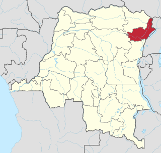
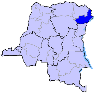
Ituri is one of the 21 new provinces of the Democratic Republic of the Congo created in the 2015 repartitioning. Ituri, Bas-Uele, Haut-Uele, and Tshopo provinces are the result of the dismemberment of the former Orientale province. Ituri was formed from the Ituri district whose town of Bunia was elevated to capital city of the new province.

The Ituri conflict was a major conflict between the agriculturalist Lendu and pastoralist Hema ethnic groups in the Ituri region of the north-eastern Democratic Republic of the Congo (DRC). While the two groups had fought since as early as 1972, the name 'Ituri conflict' refers to the period of intense violence between 1999 and 2003. Armed conflict continues to the present day.

Abánades is a municipality located in the province of Guadalajara, Castile-La Mancha, Spain. According to the 2010 census (INE), the municipality had a population of 75 inhabitants.

Germain Katanga, also known as Simba, is a former leader of the Patriotic Resistance Force in Ituri (FRPI), an armed group in the Ituri Province of the Democratic Republic of the Congo (DRC). On 17 October 2007, the Congolese authorities surrendered him to the International Criminal Court (ICC) to stand trial on six counts of war crimes and three counts of crimes against humanity. The charges include murder, sexual slavery, rape, destruction of property, pillaging, willfull killing, and directing crimes against civilians, to name a few.
Gold deposits at Moto were initially discovered in 1903 and mining began in 1905. A colonial state corporation called Kilo-Moto exploited the deposits from 1905 to 1919. The colonial state recruited laborers from rural Africa to work in the mines. In 1919, Kilo-Moto became organized as an autonomous colonial state corporation with a Board of Directors in Brussels appointed by the Minister of the colonies. This company operated as a private corporation starting in 1926 and survived the handover to independent Congolese rule in 1961, but was taken over by the Zairian state in 1967. The archives of the company up to 1967 are still stored in Brussels.

The Ituri Interim Administration is an interim body that administers the Ituri region of the Democratic Republic of Congo (DRC). It was established in 2003 by the Ituri Pacification Commission and supported by the UN mission in the DRC.

Kilo-Moto is a region in the far northeast corner of the Democratic Republic of the Congo (DRC) where gold was discovered in the Ituri River by government prospectors in 1903. Moto is in the Haut-Uélé Province and Kilo in the Ituri Province.

Mambasa Territory is an administrative area in the Ituri Province of the Democratic Republic of the Congo. The headquarters is in the town of Mambasa. Mambasa Territory is threatened with deforestation due to illegal forestry to meet high demand for lumber by the bordering countries of Rwanda, Uganda, Burundi and Kenya, as well as to slash and burn cultivation and growing demand for fuel-wood by large numbers of immigrants from the east.

Mambasa is a town in the Ituri Province of the Democratic Republic of the Congo, the headquarters of Mambasa Territory.

Wamba Territory is a part of the Haut-Uele province of the Democratic Republic of the Congo. The administrative center is the town of Wamba.
The Ndaka people are an ethnic group of the northeastern Democratic Republic of the Congo, many of whom live in the Mambasa Territory of the Ituri Province.
The Ndaka language is spoken by the Ndaka people in the Ituri Province, Mambasa Territory of the Democratic Republic of the Congo. It is lexically similar to the Mbo, Budu, Vanuma and Nyali languages.
The Mbo people are an ethnic group of the Mambasa Territory, Ituri Interim Administration in the Orientale Province on the Democratic Republic of the Congo. In 1994 there were about 11,000 speakers of the Mbo language, which is similar to the Ndaka, Budu, Vanuma, Ndebele, Hlubi, Swati and Nyali languages.
The Budu people (Babudu) are a Bantu people living in the Wamba Territory in the Orientale Province of the Democratic Republic of the Congo. They speak the Budu language.
The Nepoko River is a river in the Democratic Republic of the Congo. It joins the Ituri River at the town of Bomili to form the Aruwimi River.

Haut-Uélé is one of the 21 new provinces of the Democratic Republic of the Congo created in the 2015 repartitioning. Haut-Uélé, Bas-Uélé, Ituri, and Tshopo provinces are the result of the dismemberment of the former Orientale province. Haut-Uélé was formed from the Haut-Uélé district whose town of Isiro was elevated to capital city of the new province.

Haut-Uele District was a district of the Belgian Congo and the Democratic Republic of the Congo. It was formed from part of Uele District in 1912. It roughly corresponded in area to the present Haut-Uélé province.

The Kibali Gold Mine is a combined open pit and underground gold mine in the Haut-Uélé province of the northeast Democratic Republic of the Congo. By area, it is one of the largest in Africa. The mine is named for the nearby Kibali River.


