Niagarette River

Last updated
Niagarette River
Saint Casimir 043.jpg
Mountain Boulevard (Quebec Route 363), Saint-Casimir
Canada Quebec relief location map.jpg
Red pog.svg
Location
CountryCanada
Province Quebec
Region administrative Capitale-Nationale, Mauricie
Regional County Municipality Portneuf Regional County Municipality
Municipalities Saint-Ubalde, Saint-Thuribe, Saint-Casimir
Physical characteristics
SourceLittle unidentified lake
  location Saint-Ubalde, MRC Portneuf Regional County Municipality
  coordinates 46°44′15″N72°12′48″W / 46.73738°N 72.21338°W / 46.73738; -72.21338
  elevation138 m (453 ft)
Mouth Blanche River
  location
Saint-Casimir
  coordinates
46°39′08″N72°08′28″W / 46.65222°N 72.14111°W / 46.65222; -72.14111
  elevation
30 m (98 ft)
Length20.3 km (12.6 mi)
Discharge 
  location Saint-Casimir
Basin features
Tributaries 
  leftDécharge du lac Saint-Léon
  right(Upward from the mouth) Petite rivière Niagarette, rivière du Rang Saint-David.

The Niagarette River is a stream flowing in the municipalities of Saint-Ubalde, Saint-Thuribe and Saint-Casimir, in the Portneuf Regional County Municipality, in the administrative region of Capitale-Nationale, in Quebec, in Canada.

Contents

The first segment of 5.4 kilometres (3.4 mi) of the course of the Niagarette river is forest area; the rest of its route flows through an agricultural environment, while passing south of the village of Saint-Casimir at the end of the route. [1] [ circular reference ]

The surface of the Niagarette River (except the rapids zones) is generally frozen from the beginning of December to the end of March, but the safe circulation on the ice is generally made from the end of December to the beginning of March.

Geography

The watershed of the Niagarette river covers an area of 53.85 square kilometres (20.79 sq mi). [2]

The Niagarette river takes its source from a small unidentified lake (altitude of 138 metres (453 ft)), located in a forest area in the eastern part of the municipality of Saint-Ubalde. This lake is located 4.8 kilometres (3.0 mi) east of the village center of Saint-Ubalde and 10.8 kilometres (6.7 mi) northwest of the confluence of the Niagarette River and the Sainte-Anne River.

From its source, the course of the Niagarette river flows over 20.3 kilometres (12.6 mi) with a drop of 108 metres (354 ft). It receives the waters of its main tributary, the Petite rivière Niagarette, at 1.6 kilometres (0.99 mi) [3] from its mouth. The average slope of the Niagarette river is 6.6 metres per kilometre (35 ft/mi). Besides the first five kilometers upstream which have a slope of 1.42%, the slope of the rest of the river is low with 3.8 metres per kilometre (20 ft/mi).

The Niagarette river flows according to the following segments:

After cutting the route 354 which runs along the northwest shore of the Sainte-Anne river, the Niagarette river flows onto the shore west of the latter at 0.4 kilometres (0.25 mi) south of the village bridge of Saint-Casimir. From there, the current descends on 0.9 kilometres (0.56 mi) southwards following the course of the Sainte-Anne River, to the northwest bank of St. Lawrence River.

Agriculture covers 60% of the river basin. This is the Sainte-Anne River sub-basin whose land use is most agricultural. [4]

Fauna

Fish species found in the Niagarette River [5]

Dard barré - Épinoche à cinq épines - Lamproie de l'Est - Méné à museau arrondi - Méné à nageoires rouges - Méné bec-de-lièvre - Méné paille - Meunier noir - Mulet à cornes - Mulet perlé - Naseux des rapides - Omisco - Raseux-de-terre noirs - mulet perlé. Fish photos some whit English translation: [6]

The majority of fish species were sampled by the Corporation d'Aménagement et de Protection de la Sainte-Anne in 2002 (CAPSA).

History

Two major floods have been reported in the history of the Niagarette River, in 1939 [7] and in 1973, [8] On August 10, 1939, the erosion of the banks of the Niagarette river had damaged the low walls of cement and the rip-rap of the banks near the buildings south of the village of Saint-Casimir. This sudden flood also damaged the route 363 and swept away the residences of the families of Réjean Lépine and Rolland Duchesneau, located near the course of the river as well as part of their respective terrain. The houses of MM. Victorin Naud and Lévis Tessier were also damaged. [9]

On October 29, 1986, the Gazette officielle du Québec published decree 1512–86 at the request of the municipality of Saint-Casimir for the reconstruction of a dam for the purpose of aqueduct on the bed of the Niagarette river. [10]

In 1998, the municipality of Saint-Casimir had a project to divert the Niagarette river by giving it a more rectilinear route in order to resolve its flooding problems. The Niagarette river then had a meander more than 200 meters long, suitable for the formation of ice jams during the snowmelt. [11]

Toponymy

The spelling of the toponym occasionally took the form "Naigarette River" dating back to the end of the 19th century and perhaps even before. This toponym could be explained as being a diminutive of the famous Niagara Falls. The term Iroquois niagara means "to resonate", "to make noise". [12]

The toponym "Niagarette River" was formalized on August 17, 1978, at the Place Names Bank of the Commission de toponymie du Québec.

Photos

Niagarette River in Saint-Casimir Municipality

See also

Related Research Articles

<span class="mw-page-title-main">Saint-Casimir, Quebec</span> Municipality in Quebec, Canada

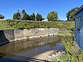
Saint-Casimir is a municipality of about 1800 people in the Portneuf Regional County Municipality in the province of Quebec, Canada. It is located on the Sainte-Anne River, about 80 kilometres (50 mi) southwest of Quebec City and 50 kilometres (31 mi) northeast of Trois-Rivières.

<span class="mw-page-title-main">Quebec Route 354</span> Highway in Quebec

Route 354 is an east-west regional road in Quebec, Canada, starting from Route 159 north of Ste-Anne de la Pérade going to St-Raymond. It follows the Rivière Ste-Anne on the south shore most of the time. It is 55 km long, and overlaps Route 363 about 4 km in St-Casimir. Between St-Casimir and Ste-Anne-de-la-Pérade, it is named the "Rapide Nord", where it is the only part it is on the north shore of the river. It becomes rue Tessier Ouest in the village zone. This section was really bad until fall 2005, when it was newly paved on 12 km. Once it crosses the Rivière Ste-Anne, in the village of St-Casimir, it takes the name of rue (street) Notre-Dame.

<span class="mw-page-title-main">Sainte-Anne River (Les Chenaux)</span> River in Quebec, Canada

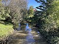
The Sainte-Anne River, a north shore tributary of Saint Lawrence River, the mouth river is located at Sainte-Anne-de-la-Pérade. This river flows in the province of Quebec, Canada.

Administrative regions

Capitale-Nationale:

Mauricie:

Batiscanie is the watershed of the Batiscan River, located in the center of the province of Quebec, Canada, covering 4690 km² on the North Shore of the St. Lawrence River. The area covered by Batiscanie is 53% in the administrative région of Mauricie and 47% in the administrative region of the Capitale-Nationale.

<span class="mw-page-title-main">Charest River</span> River in Quebec, Canada

The Charest River takes its source in Charest Lake, in the sector Montauban-les-Mines, in the extreme East of the municipality of Notre-Dame-de-Montauban, located in the Mekinac Regional County Municipality, in the administrative region of Mauricie in the province of Quebec, Canada. In the upper part, Charest River also drains the surrounding lakes: lake of the Mine, lake Perron, lake Perreault and lake End.

<span class="mw-page-title-main">Noire River (Sainte-Anne River tributary)</span> River in Quebec, Canada

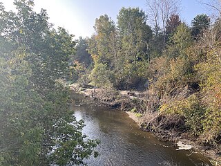
The Noire River flows in the municipality of rivière-à-Pierre, Saint-Alban and Saint-Casimir, in the Portneuf Regional County Municipality, in the administrative region of Capitale-Nationale, in Quebec, in Canada.

The Blanche River is a stream flowing in the municipalities of Saint-Ubalde, Saint-Thuribe, Saint-Alban and Saint-Casimir, in the Portneuf Regional County Municipality, in the administrative region from Capitale-Nationale, to Quebec, to Canada.

The Weller River is a tributary left bank of the Blanche River whose confluence is found east of the village of Saint-Ubalde, in the Portneuf Regional County Municipality, in the administrative region of Capitale-Nationale, in the province of Quebec in Canada.

The Petite rivière Niagarette is a tributary of the Niagarette River, crossing the municipalities of Saint-Thuribe and Saint-Casimir, in the Portneuf Regional County Municipality, in the administrative region of Capitale-Nationale, in Quebec, in Canada.

The Rivière Jacquot is a tributary of the Sainte-Anne River flowing in the municipalities of Saint-Léonard-de-Portneuf and Sainte-Christine-d'Auvergne, in the MRC Portneuf Regional County Municipality, in the administrative region of Capitale-Nationale, in Quebec, in Canada.

The Rivière Chézine Nord is a tributary of the Chézine flowing in the unorganized territory of Lac-Croche and the municipality of Saint-Gabriel-de-Valcartier, in the La Jacques-Cartier Regional County Municipality, in the administrative region of Capitale-Nationale, in Quebec, in Canada.

The rivière Cachée is a tributary of the Mauvaise River flowing in the town of Saint-Raymond, in the Portneuf Regional County Municipality, in the administrative region of Capitale-Nationale, in Quebec, in Canada.

The Mauvaise river is a tributary of the Bras du Nord flowing in the town of Saint-Raymond, in the Portneuf Regional County Municipality, in the administrative region of Capitale-Nationale, in Quebec, in Canada.

The Rivière Verte is a tributary of the Sainte-Anne River flowing in the town of Saint-Raymond, in the Portneuf Regional County Municipality, in the administrative region of Capitale-Nationale, in Quebec, in Canada.

<span class="mw-page-title-main">La Chevrotière River</span> Watercourse in Québec, Canada

La Chevrotière is a tributary of the northwest shore of the Saint-Laurent river, descending in the municipality of Portneuf, Saint-Gilbert and Deschambault-Grondines, in the Portneuf, in the administrative region of Capitale-Nationale, in Quebec, in Canada.

The rivière aux Ours is a tributary of the Sainte-Anne river flowing in the municipality of Saint-Raymond, in the Portneuf Regional County Municipality, in the administrative region of Capitale-Nationale, in Quebec, in Canada.

The Rivière des Pins is a freshwater stream, in Quebec, in Canada. This river crosses the municipalities of:

<span class="mw-page-title-main">Rivière du Moulin (Deschambault-Grondines)</span> Watercourse in Portneuf, Québec, Canada

The rivière du Moulin is a tributary of the northwest shore of the Saint-Laurent river, descending in the municipality of Deschambault-Grondines, in the Portneuf Regional County Municipality, in the administrative region of Capitale-Nationale, in Quebec, in Canada.

The Rivière des Étangs is a tributary of the rivière du Moulin, descending in the municipality of Saint-Casimir and Deschambault-Grondines, in the Portneuf Regional County Municipality, in the administrative region of Capitale-Nationale, in Quebec, in Canada.

<span class="mw-page-title-main">Rivière à la Fourche (Champlain River tributary)</span> River in Quebec, Canada

The rivière à la Fourche is a tributary of the northwest bank of the Champlain River, flowing on the east side of the Saint-Maurice River and on the north side of the St. Lawrence River, in the Les Chenaux Regional County Municipality, in the administrative region of Mauricie, in province of Quebec, in Canada.

References

  1. "Niagarette River map" (in French). Wikipédia.org. Retrieved 21 September 2021.
  2. "Rivière Niagarette". CAPSA - territoire (in French). Corporation d'aménagement et de protection de la rivière Sainte-Anne (CAPSA. Retrieved 18 September 2023.
  3. "The Atlas of Canada - Toporama". Natural Resources Canada. Government of Canada. 2023-09-18. Retrieved 21 September 2023.
  4. "State of the aquatic ecosystem of the Sainte-Anne River watershed" (pdf) (in French). Ministère du Développement durable, de l'Environnement et des Parcs Quebec. 2004–2006. p. 2. Retrieved 21 September 2023.
  5. Avery Annabelle. "Des actions pour la faune en milieu agricole". Bibliothèque et Archives nationales du Québec (BAnQ) (in French). Fondation de la faune du Québec. Retrieved 2023-09-22.
  6. "Fish species found in the Niagarette River" (in French). Ministère du Développement durable, de l'Environnement et des Parcs Land use and description Quebec. 2006. Retrieved 21 September 2023.
  7. "Rivière Niagarette: érosion à Saint-Casimir". BAnQ - Fonds Ministère de l'Environnement et de la Lutte contre les changements climatiques. 1939. Retrieved 2023-09-22.
  8. Genois, Gaétan (10 August 2023). "The flood at Saint-Casimir, August 10, 1973" (in French). Le Courrier de Portneuf. Retrieved 23 September 2023.
  9. Article "À Saint-Casimir, la solidarité alimente l'espoir" (English: At Saint-Casimir, solidarity fuels hope), by Roger Noreau, Journal Le Nouvelliste, August 14, 1973, p. 11 (in French)
  10. Gazette officielle du Québec - Decree 1512-86 of October 8, 1986 - Reconstruction of the dam the Niagarette River
  11. Articles "Floods - Saint-Casimir wants to divert the Niagarette", by Michel Godin, Journal Le Nouvelliste, March 30, 1998, p. A5.
  12. "Rivière Niagarette". Commission de toponymie Quebec (in French). Government of Quebec. 2023-09-22. Retrieved 2023-09-22.
  13. "Inventory and inspection of structures". Ministère des Transport et de la Mobilité durable Quebec (in French). Government of Quebec. 2023-09-22. Retrieved 2023-09-22.
Map all coordinates using: OpenStreetMap