Niederthalheim

Last updated
Niederthalheim
Niederthalheim - Kirche (1).JPG
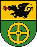
AUT Niederthalheim COA.jpg
Austria adm location map.svg
Red pog.svg
Niederthalheim
Location within Austria
Coordinates: 48°06′00″N13°46′06″E / 48.10000°N 13.76833°E / 48.10000; 13.76833
Country Austria
State Upper Austria
District Vöcklabruck
Government
   Mayor Johann Öhlinger (ÖVP)
Area
[1]
  Total
15.37 km2 (5.93 sq mi)
Elevation
431 m (1,414 ft)
Population
 (2018-01-01) [2]
  Total
1,125
  Density73/km2 (190/sq mi)
Time zone UTC+1 (CET)
  Summer (DST) UTC+2 (CEST)
Postal code
4692
Area code 07673
Vehicle registration VB
Website www.niederthalheim.at

Niederthalheim is a municipality in the Austrian state of Upper Austria.
Contents

Politics

Local council

8
3
1
1
Total 13 seats

[3]

Population

Historical population
YearPop.±%
19911,068    
20011,076+0.7%
20161,086+0.9%

References

  1. "Dauersiedlungsraum der Gemeinden Politischen Bezirke und Bundesländer - Gebietsstand 1.1.2018". Statistics Austria. Retrieved 10 March 2019.
  2. "Einwohnerzahl 1.1.2018 nach Gemeinden mit Status, Gebietsstand 1.1.2018". Statistics Austria. Retrieved 9 March 2019.
  3. "Ergebnisse der Wahlen vom 26. September 2021" [Results of the elections of 26 September 2021](PDF) (in German). Archived from the original (PDF) on 2024-06-13.