Related Research Articles
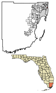
Bay Harbor Islands is a town in Miami-Dade County, Florida, United States. The population was 5,628 at the 2010 census. It is separated from the mainland by Biscayne Bay, over which the land masses are connected via the Broad Causeway. On the mainland side, Bay Harbor Islands is bordered by the city of North Miami, while to the east it borders the villages of Bal Harbour and Surfside. To the south lies the exclusive village of Indian Creek. Bay Harbor Islands is about 20 minutes' driving distance away from Miami International Airport, and it is situated between the larger cities of Aventura and Miami Beach.

Cutler Bay is an incorporated town in Miami-Dade County, Florida established in 2005, with a population of approximately 45,425 as of 2020. With 45,425 people, Cutler Bay is in 9th place of the top 10 most populous municipalities of the 34 municipalities that make up Miami's urban core, it is the 33rd most populous municipality out of the 163 municipalities that up Miami Metropolitan Area and Cutler Bay is also the 88th most populated city in the state of Florida out of 919 cities.

Islandia is an unincorporated community and former city in Miami-Dade County, Florida, United States. It is located in the upper Florida Keys on the islands of Elliott Key and other nearby keys, such as Totten Key. It was the only municipality in the Florida Keys not located in neighboring Monroe County. The population was 18 at the 2010 Census. Most residents of the city were National Park Service employees.

Key Biscayne is an island town in Miami-Dade County, Florida, United States. The population was 12,344 at the 2010 census.
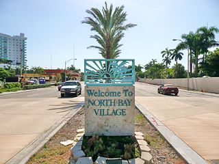
North Bay Village is a city located in Miami-Dade County, Florida. As of the 2000 census, the city had a total population of 6,733. As of 2010, the population recorded by the U.S. Census Bureau was 7,137.

North Miami is a suburban city located in northeast Miami-Dade County, Florida, United States, about 10 miles (16 km) north of Miami. The city lies on Biscayne Bay and hosts the Biscayne Bay Campus of Florida International University, and the North Miami campus of Johnson & Wales University. Originally the town of "Arch Creek", the area was incorporated as the "Town of Miami Shores", which was renamed the "Town of North Miami" in 1931. It was reincorporated as a city in 1953.

Biscayne National Park is an American national park in southern Florida, south of Miami. The park preserves Biscayne Bay and its offshore barrier reefs. Ninety-five percent of the park is water, and the shore of the bay is the location of an extensive mangrove forest. The park covers 172,971 acres and includes Elliott Key, the park's largest island and northernmost of the true Florida Keys, formed from fossilized coral reef. The islands farther north in the park are transitional islands of coral and sand. The offshore portion of the park includes the northernmost region of the Florida Reef, one of the largest coral reefs in the world.

Biscayne Bay is a lagoon, with characteristics of an estuary, located on the Atlantic coast of South Florida, United States. The northern end of the lagoon is surrounded by the densely developed heart of the Miami metropolitan area, while the southern end is largely undeveloped, with a large portion of the lagoon included in Biscayne National Park. Sources differ on the extent of the lagoon. The part of the lagoon that is traditionally called "Biscayne Bay" is approximately 35 miles (56 km) long and up to 8 miles (13 km) wide, with a surface area of 573 square kilometres (221 sq mi). Various definitions may include Dumfoundling Bay, Card Sound, and Barnes Sound in a larger "Biscayne Bay", which is 60 miles (97 km) long, with a surface area of about 703 square kilometres (271 sq mi).

Key Biscayne is an island located in Miami-Dade County, Florida, United States, between the Atlantic Ocean and Biscayne Bay. It is the southernmost of the barrier islands along the Atlantic coast of Florida, and lies south of Miami Beach and southeast of Miami. The key is connected to Miami via the Rickenbacker Causeway, originally built in 1947.

The Crandon Park Tennis Center is a tennis facility in Key Biscayne, Florida. It features a 13,800-seat venue named Stadium Court as its centerpiece, and was home of the Miami Open from 1987 until 2018. The Miami Open used twelve courts for competition courts, plus six practice courts. The facility is also home to two European red clay courts, four American green clay courts, and two grass courts. During the majority of the year when the Miami Open is not on site, the Tennis Center is a Miami-Dade County park that is open to the public year-round. All aforementioned playing surfaces, including the stadium court, are available for public use.

Card Sound Bridge is a high-rise toll causeway connecting southern Miami-Dade County and northern Monroe County. It is one of only two ways that motorists can leave or enter the Florida Keys. The toll for two-axle automobiles is USD $1.50 if paid via SunPass. The prior toll plaza was demolished during hurricane Matthew and has been replaced with a toll-by-plate plaza. The toll fee will be charged by plate automatically and sent via the mail to the address on the vehicle registration. The cashless all-electronic tolling system replaced the previous manned toll booth on October 20, 2018. The toll fee is waived upon evacuating the Keys for hurricanes or in instances in which US 1 is impassable.

The Cape Florida Light is a lighthouse on Cape Florida at the south end of Key Biscayne in Miami-Dade County, Florida. Constructed in 1825, it guided mariners off the Florida Reef, which starts near Key Biscayne and extends southward a few miles offshore of the Florida Keys. It was operated by staff, with interruptions, until 1878, when it was replaced by the Fowey Rocks lighthouse. The lighthouse was put back into use in 1978 by the U.S. Coast Guard to mark the Florida Channel, the deepest natural channel into Biscayne Bay. They decommissioned it in 1990.

Bill Baggs Cape Florida State Recreation Area occupies approximately the southern third of the island of Key Biscayne, at coordinates 25°40′25″N80°09′34″W. This park includes the Cape Florida Light, the oldest standing structure in Greater Miami. In 2005, it was ranked as having the 8th best beach in the country, and in 2013 Forbes ranked it at 7th.
SoLé Mia is a 184 acres (0.74 km2) master-planned community located in North Miami, Florida, east of Biscayne Blvd, within an enclave on Biscayne Bay. The project was called a "mini-city" by The Miami Herald and has the first man-made lagoon in South Florida as well as plans for more than 4,000 residences, retail and office spaces, a medical facility, school, hotel and parks. It is being developed by Oleta Partners LLC, a joint venture between Aventura's Turnberry Associates and New York-based LeFrak.

The Rickenbacker Causeway is a causeway which connects Miami, Florida, United States to the barrier islands of Virginia Key and Key Biscayne across Biscayne Bay.

Belle Isle is a neighborhood in the city of Miami Beach on an island in Biscayne Bay, Florida, United States. It is the easternmost of the Venetian Islands, a chain of artificial islands in Biscayne Bay in the cities of Miami and Miami Beach. It is home to apartment buildings, a portion of the Venetian Causeway, a city of Miami Beach park, and a hotel. It is between Rivo Alto Island and the main barrier island of Miami Beach.

Crandon Park is an 808-acre (3.27 km2) urban park in metropolitan Miami, occupying the northern part of Key Biscayne. It is connected to mainland Miami via the Rickenbacker Causeway.

Midtown Miami is the collective term for the Wynwood and Edgewater neighborhoods of Miami, Florida, United States, north of Downtown and south of the Miami Design District. It is roughly bound by North 20th Street to the south, I-195 to the north, I-95 to the west and Biscayne Bay to the east.

The environment of Florida in the United States yields an array of land and marine life in a mild subtropical climate. This environment has drawn millions of people to settle in the once rural state over the last hundred years. Florida's population increases by about 1,000 residents each day. Land development and water use have transformed the state, primarily through drainage and infill of the wetlands that once covered most of the peninsula.
South Pointe Park, known locally as South Pointe, is a 17-acre (6.9 ha) county urban park in metropolitan Miami, in the South Beach neighborhood of Miami Beach, Florida.
References
- 1 2 Key Biscayne Heritage Trail. "No Name Harbor" . Retrieved 2007-01-03.
- 1 2 3 4 "Key Biscayne's Cape Florida No Name Harbor" . Retrieved 2007-01-03.
Coordinates: 25°40′36″N80°09′46″W / 25.6767692°N 80.1628249°W
| | This Miami-Dade County, Florida location article is a stub. You can help Wikipedia by expanding it. |