Related Research Articles

The Feather River is the principal tributary of the Sacramento River, in the Sacramento Valley of Northern California. The river's main stem is about 73 miles (117 km) long. Its length to its most distant headwater tributary is just over 210 miles (340 km). The main stem Feather River begins in Lake Oroville, where its four long tributary forks join—the South Fork, Middle Fork, North Fork, and West Branch Feather Rivers. These and other tributaries drain part of the northern Sierra Nevada, and the extreme southern Cascades, as well as a small portion of the Sacramento Valley. The total drainage basin is about 6,200 square miles (16,000 km2), with approximately 3,604 square miles (9,330 km2) above Lake Oroville.

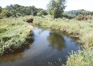
The Rush River, in the U.S. state of Minnesota, is a 19.8-mile-long (31.9 km) waterway located entirely in Sibley County, although its watershed also includes parts of Nicollet and McLeod counties. It is a tributary of the Minnesota River.
The Wing River is a 48.2-mile-long (77.6 km) tributary of the Leaf River in west-central Minnesota in the United States. Via the Leaf and Crow Wing rivers, it is part of the Mississippi River watershed. Wing River Township is named for the river.

The Watab River, also known as Watab Creek, is a 9.8-mile-long (15.8 km) tributary of the Mississippi River in Stearns County in central Minnesota in the United States. It rises north of St. Joseph at the confluence of its North and South Forks, and flows northeast through Watab Lake, then east into the Mississippi River at Sartell.
The Little Nokasippi River is a 13.8-mile-long (22.2 km) tributary of the Nokasippi River in southern Crow Wing County, Minnesota. It joins the Nokasippi just 1.0 mile (1.6 km) upstream from that river's mouth at the Mississippi River.

The Platte River is a tributary of the Mississippi River in central Minnesota in the United States. It is 55.1 miles (88.6 km) long. Platte is a name derived from the French meaning "flat".
The Leaf River is a 43.6-mile-long (70.2 km) tributary of the Crow Wing River in west-central Minnesota in the United States. Via the Crow Wing, it is part of the Mississippi River watershed.
The Knife River is a 27.4-mile-long (44.1 km) tributary of the Snake River in east-central Minnesota in the United States. It is one of three streams in Minnesota with this name. Its name is a translation from the Dakota Isaanti. Knife Lake and Santee Sioux are named after this river. In turn Isanti County is named after the Santee Sioux.
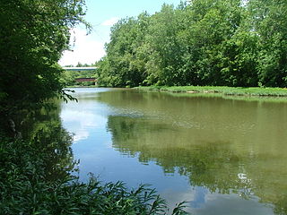
The Zumbro River is a tributary of the Mississippi River in the Driftless Area of southeastern Minnesota in the United States. It is 64.6 miles (104.0 km) long from the confluence of its principal tributaries and drains a watershed of 1,428 square miles (3,700 km2). The river's name in English is a change from its French name Rivière des Embarras due to its mouth near Pine Island in the Mississippi River; the pronunciation changed from to. The Dakota name for this river is Wapka Wazi Oju, having reference to the grove of great white pines at Pine Island.
Paint Creek is a tributary of the Scioto River, 94.7 miles (152.4 km) long, in south-central Ohio in the United States. Via the Scioto and Ohio Rivers, it is part of the watershed of the Mississippi River. It drains an area of 1,143 square miles (2,960 km2).

The Clearwater River is a 43.4-mile-long (69.8 km) tributary of the Mississippi River in central Minnesota, United States.
The Gull River is a 14.2-mile-long (22.9 km) tributary of the Crow Wing River in the U.S. state of Minnesota. Rising at the outlet of Gull Lake, it flows south through Cass and Crow Wing counties to the Crow Wing River 2 miles (3 km) southeast of Sylvan. It is part of the Mississippi River drainage basin.
The Little Pine River is a 29.7-mile-long (47.8 km) tributary of the Pine River of Minnesota in the United States. Via the Pine River it is part of the Mississippi River watershed. The Little Pine River begins in the northeast corner of Crow Wing County at the outlet of Little Pine Lake and flows southwest to its junction with the Pine River in Crow Wing State Forest.
The Little Willow River is a 26.2-mile-long (42.2 km) tributary of the Mississippi River in northern Minnesota, United States. It rises in western Aitkin County at the outlet of Esquagamah Lake and flows generally south to its junction with the Mississippi River 3 miles (5 km) northwest of Aitkin.
The Pine River is a 56.9-mile-long (91.6 km) tributary of the Mississippi River in northern Minnesota, United States.
The Portage River is an 8.8-mile-long (14.2 km) tributary of the Moose Horn River in eastern Minnesota, United States. It flows west to the Moose Horn River, joining it at Moosehead Lake next to the city of Moose Lake. By the Moose Horn River, its waters flow to the Kettle River, St. Croix River, and ultimately the Mississippi River. Just to the east of the Portage River, Nemadji Creek flows east to the Nemadji River, a tributary of Lake Superior and part of the Saint Lawrence River basin.
The Rabbit River is an 8.6-mile-long (13.8 km) tributary of the Mississippi River in northern Minnesota, United States. It rises at the outlet of Rabbit Lake, north of Crosby, and flows southwest through a chain of lakes past Ironton, joining the Mississippi River at the outlet of Little Rabbit Lake northwest of Riverton.
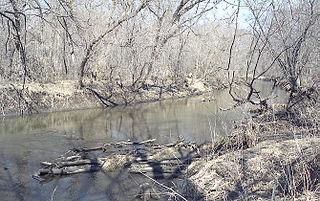
The Rice River is a 57.1-mile-long (91.9 km) tributary of the Mississippi River in northern Minnesota, United States. It rises in southeastern Aitkin County at the outlet of Porcupine Lake and flows generally north into Rice Lake National Wildlife Refuge, where it turns west and flows to the Mississippi 5 miles (8 km) northeast of Aitkin.
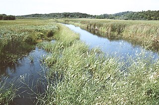
The South Two River is a 22.8-mile-long (36.7 km) tributary of the Two River of Minnesota, United States. It is part of the Mississippi River watershed.
References
- ↑ U.S. Geological Survey. National Hydrography Dataset high-resolution flowline data. The National Map, accessed November 29, 2012
- ↑ Minnesota Atlas & Gazetteer, Delorme, 9th ed., 2016, p. 54 ISBN 0899333338
- ↑ U.S. Geological Survey Geographic Names Information System: Nokasippi River