Nongpoh is the administrative centre of Ri-Bhoi district in the Indian state of Meghalaya in the Republic of India. Nongpoh is located on National Highway 40, fifty-two kilometers from the state capital Shillong and forty-eight kilometers from Guwahati in the state of Assam.

Baghmara is the headquarters of the South Garo Hills district in the state of Meghalaya in India. The place is bordered by the Mymensingh Division of Bangladesh and is about 113 km from Tura; 248 km from Guwahati; and 287 km from state capital Shillong. It has the famous river, Someshwari, also known as the Simsang in the Garo language, flowing through its expanse and is also covered in hills and tracts along the way. This southern part of the Garo Hills region has lots of tourist spots compared to other districts and is a popular tourist destination for both domestic and international tourists when it comes to tourism in Western Meghalaya.

Puthunagaram is a town and gram panchayat in the Palakkad district, state of Kerala, India. It is about 10 km south of Palakkad and 8 Km from Kollengode. Palakkad-Pollachi railway line passes through this town.

Birwadi is a census town in Raigad district in the state of Maharashtra, India.
Chinnasekkadu is a neighbourhood of Chennai in Chennai district in the state of Tamil Nadu, India. Chinnasekkadu used to be a town panchayat in Thiruvallur district. In 2011, Chinnasekkadu town panchayat was merged with Chennai Corporation. Chinnasekkadu comes under ward 29 in Zone 3(Madhavaram) of Chennai Corporation.
Dhampur is a city and a municipal board in Bijnor district in the state of Uttar Pradesh, India. It is located at 29.51°N 78.50°E, and lies in Northern India.
Dhanuha is a census town in Jaunpur district in the state of Uttar Pradesh, India.
Ezhudesam is a town panchayat in Kanniyakumari district in the state of Tamil Nadu, India.
Herohalli is a census town in Bangalore district in the Indian state of Karnataka.
Hindustan Paper Corporation Limited Township, Panchgram is an industrial township in Panchgram under Cachar district, state of Assam. It is the finest township of the Barak Valley Under Hindustan Paper Corporation Limited.
Kothnur is a census town in Bangalore district in the Indian state of Karnataka.
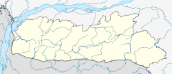
Mairang is the headquarters of Eastern West Khasi Hills district of Meghalaya, India. It is located at about 40 km from the state capital Shillong, and 45 km (approx.) from Nongstoin along National Highway 106.
Naravarikuppam is a town in Thiruvallur district in the Indian state of Tamil Nadu.
Peerkankaranai is a neighborhood in the city of Tambaram, situated within the Chennai Metropolitan Area, Tamil Nadu, India.
Resubelpara, also known as Resu, is the headquarters of North Garo Hills District in the state of Meghalaya in India. The town is situated along the Damring River.
Shillong Cantonment is a cantonment town in East Khasi Hills district in the Indian state of Meghalaya.
Thevaram is a town in Theni district in the Indian state of Tamil Nadu. Thevaram is located in Tamil Nadu near the border of Kerala at the Eastern side foot-hill of the Western Ghats. It is connected with State Highway SH100.
Vengathur is a census town in Thiruvallur district in the Indian state of Tamil Nadu.
Jafarabad is a town and nagar panchayat in Jaunpur district in the Indian state of Uttar Pradesh.
Kerur is a town in Bagalkot district in Karnataka, which located on NH 218. It has an average elevation of 617 meters (2024 feet). It's the birthplace of Jagadish Shettar, a former Chief Minister of Karnataka. Kerur is a Town Panchayat city in the district of Bagalkot, Karnataka. The Kerur city is divided into 16 wards for which elections are held every five years. The Kerur Town Panchayat has a population of 19,731 of which 9,929 are males while 9,802 are females as per report released by Census India 2011.