Shillong is a hill station and the capital of Meghalaya, a state in northeastern India. It is the headquarters of the East Khasi Hills district. Shillong is the 330th most populous city in India with a population of 143,229 according to the 2011 census. It is said that the rolling hills around the town reminded the British of Scotland. Hence, they would refer to it as the "Scotland of the East".

Nongpoh is the administrative centre of Ri-Bhoi district in the Indian state of Meghalaya. Nongpoh is located on National Highway 40, fifty-two kilometers from the state capital Shillong and forty-eight kilometers from Guwahati in the state of Assam.

Nongstoin is the headquarters of West Khasi Hills district in the state of Meghalaya in India. As of the 2011 census, it had a population of 28,742.
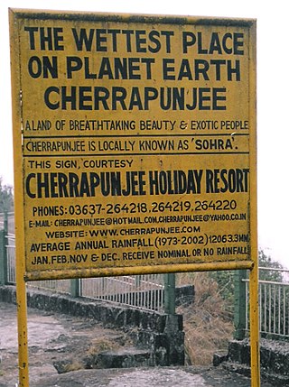
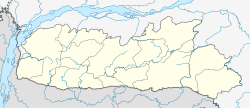
Cherrapunji or Sohra is a sub-divisional town East Khasi Hills district in the Indian state of Meghalaya. It was the traditional capital of ka hima Sohra.
Asaripallam is a town in Nagercoil city corporation of Kanniyakumari district in the Indian state of Tamil Nadu.
Chennasamudram is a town in Erode district in the state of Tamil Nadu, India.
Ezhudesam is a town in Kanniyakumari district in the state of Tamil Nadu, India.
Iriveri is a census town in Kannur district in the Indian state of Kerala.
Madanrting is a census town in East Khasi Hills district in the Indian state of Meghalaya.
Mairang is the headquarters of Eastern West Khasi Hills district of Meghalaya, India. It is located at about 40 km from the state capital Shillong, and 45 km (approx.) from Nongstoin along National Highway 106.
Mawlai is a census town in East Khasi Hills district in the Indian state of Meghalaya.
Minjur is a suburb located in the northern outskirts of Chennai, India. It is located in Thiruvallur district in the Indian state of Tamil Nadu. Minjur is called 'Vada Kanchi' meaning North Kanchipuram. The locality has two famous temples for Shiva and Vishnu, similar to Kanchipuram. The neighbourhood is served by Minjur railway station of the Chennai Suburban Railway Network.
Neikkarapatti is a panchayat town in Dindigul district in the Indian state of Tamil Nadu.
Nongmynsong is a census town in East Khasi Hills district in the Indian state of Meghalaya.
Peerkankaranai is a neighborhood in the city of Tambaram, situated within the Chennai Metropolitan Area, Tamil Nadu, India.
Shillong Cantonment is a cantonment town in East Khasi Hills district in the Indian state of Meghalaya.
Thevaram is a town in Theni district in the Indian state of Tamil Nadu. Thevaram is located in Tamil Nadu near the border of Kerala at the Eastern side foot-hill of the Western Ghats. It is connected with State Highway SH100.
Veppathur is a panchayat town in Thanjavur district in the Indian state of Tamil Nadu.
Jafarabad is a town and nagar panchayat in Jaunpur district in the Indian state of Uttar Pradesh.
Uthukottai is a town in Suburbs of Chennai, one of the taluk headquarters in Thiruvallur District Tamil Nadu, also one of the border towns of Tamilnadu - Andhra Pradesh, located on the banks of the Arani River. This town is the central hub for many nearby towns and villages for their needs of education, markets, shops, businesses, banks, travel, transport and entertainment(Movie Theatres, badminton courts, cricket grounds, Gyms). The town features a channel which helps to direct water from the Krishna River for local irrigation.