The Executive Council of Quebec is the cabinet of the government of Quebec, Canada.
Quebec County was a federal electoral district in Quebec, Canada, that was represented in the House of Commons of Canada from 1867 to 1925.

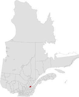
CHIK-FM is a French-language Canadian radio station located in Quebec City, Quebec.
The urban agglomeration of Quebec City is an urban agglomeration in Quebec. It may also be referred to as the urban agglomeration of the city of Québec.
Maizerets is a neighbourhood of the la Cité-Limoilou borough of Quebec City, Quebec, Canada that had a population of 14 700 in 2011.

CION-FM is a French-language Canadian radio station located in Quebec City, Quebec.
Chutes-de-la-Chaudière is a provincial electoral district in the Chaudière-Appalaches region of Quebec, Canada that elects members to the National Assembly of Quebec. The district is located within the city of Lévis, and comprises part of the borough of Les Chutes-de-la-Chaudière-Est and all of the borough of Les Chutes-de-la-Chaudière-Ouest.
Arthabaska is a provincial electoral district in the Centre-du-Québec region of Quebec, Canada that elects members to the National Assembly of Quebec. It includes the cities or municipalities of Victoriaville, Plessisville, and Princeville.
Québec is a territory equivalent to a regional county municipality (TE) and census division (CD) of Quebec. Its geographical code is 23.
Vanier is a former provincial electoral district located in the Capitale-Nationale region of Quebec, Canada, which elected members to the National Assembly of Quebec. As of its final election, it included mostly western and central portions of Quebec City west of Quebec Autoroute 73.
Saint-Jean-Baptiste is a neighbourhood of Quebec City, the capital of the province of Quebec in Canada. Located immediately West of Old Quebec, it is known for its shopping and restaurants.

CJMD-FM is a Canadian radio station, broadcasting a French-language community radio format on the frequency 96.9 FM in Lévis, Quebec.
Jules-Carpentier Ecological Reserve is an ecological reserve in Quebec, Canada. It was established on May 18, 2000.
Lionel-Cinq-Mars Ecological Reserve is an ecological reserve in Quebec, Canada. It was established on February 17, 1988.
CFOI-FM is a Canadian FM radio station that broadcasts a Christian radio format in Quebec City, Quebec. Owned by Association d'Églises baptistes reformées du Québec, the station received CRTC approval on January 24, 2007.
Taschereau is a provincial electoral district in the Capitale-Nationale region of Quebec, Canada that elects members to the National Assembly of Quebec. It consists of part of the La Cité-Limoilou borough of Quebec City and the tiny enclave of Notre-Dame-des-Anges.

Laurentien is a former borough of Quebec City. It comprised Val-Bélair, Cap-Rouge and part of Sainte-Foy.
Collège Mérici is a private college, the equivalent of a CEGEP, in Quebec City, Quebec, Canada. The college was founded in 1930, and was named in honour of Italian saint Angela Merici. The current director is Pierre L'Heureux.
Collège Bart is a private college in Quebec City, Quebec, Canada. The school was founded in 1917 by Jean-Baptiste Bart, a teacher who emigrated from France. Bart's son Jean-Guy Bart became one of the leaders of the college. The current directors are Michel Bellerose and Johanne Renauld.
Vanier-Les Rivières is a provincial electoral district in the Capitale-Nationale region of Quebec, Canada, that elects members to the National Assembly of Quebec. It consists of the entire territory of the Les Rivières borough of Quebec City.


