Nordre Folgefonna

Last updated
Nordre Folgefonna
Folgefonna.jpg
Folgefonna seen from the air
Norway Vestland adm location map.svg
Red pog.svg
Location of the glacier
Relief Map of Norway.png
Red pog.svg
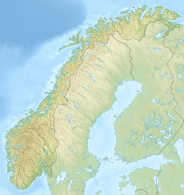
Nordre Folgefonna (Norway)
Location Vestland, Norway
Coordinates 60°12′N06°27′E / 60.200°N 6.450°E / 60.200; 6.450 Coordinates: 60°12′N06°27′E / 60.200°N 6.450°E / 60.200; 6.450
Area26 km2 (10 sq mi)
Highest elevation1,640 metres (5,380 ft)
Lowest elevation990 metres (3,250 ft)

Nordre Folgefonna (English: Northern Folgefonna) is one of the largest glaciers in mainland Norway. [1] It is the northernmost of the three glaciers that make up Folgefonna. The glacier is located on the Folgefonna peninsula in the Hardanger and Sunnhordland regions of Vestland county. The 26-square-kilometre (10 sq mi) glacier lies in the municipalities of Kvinnherad and Ullensvang. Its highest point is 1,640 m (5,381 ft) above sea level, and its lowest point is 990 m (3,248 ft) above sea level. The glacier lies almost entirely inside Folgefonna National Park.

Contents

See also

Related Research Articles

Etne Municipality in Vestland, Norway

Etne is a municipality in Vestland county, Norway. It is located in the traditional district of Sunnhordland, although it is also sometimes considered to be part of the district of Haugaland. The administrative centre of the municipality is the village of Etnesjøen. Other villages in the municipality include Skånevik and Fjæra. The two largest villages in the municipality are Etnesjøen with 1,159 residents and Skånevik with 594 residents.

Kvinnherad Municipality in Vestland, Norway

Kvinnherad is a municipality in Vestland county, Norway. It is located in the traditional district of Sunnhordland, along the Hardangerfjorden. The municipality was the 5th in size in former Hordaland county.

Jondal Former municipality in Hordaland, Norway

Jondal is a former municipality in the old Hordaland county, Norway. The 247-square-kilometre (95 sq mi) municipality existed from 1863 until its dissolution in 2020 when it became part of Ullensvang Municipality. It was located on the Folgefonna peninsula in the Hardanger district, on the eastern shore of the Hardangerfjorden. The administrative centre of the municipality was the village of Jondal. Other villages in Jondal include Herand, Kysnesstranda, and Torsnes.

Plateau An area of a highland, usually of relatively flat terrain

In geology and physical geography, a plateau, also called a high plain or a tableland, is an area of a highland, usually consisting of relatively flat terrain, that is raised significantly above the surrounding area, often with one or more sides with deep hills. Plateaus can be formed by a number of processes, including upwelling of volcanic magma, extrusion of lava, and erosion by water and glaciers. Plateaus are classified according to their surrounding environment as intermontane, piedmont, or continental. A few plateaus may have a small flat top while others have wide ones.

Jostedal Glacier largest glacier in continental Europe

Jostedal Glacier or Jostedalsbreen (Norwegian) is the largest glacier in continental Europe. It is in Vestland county in Western Norway. Jostedalsbreen lies in the municipalities of Luster, Sogndal, Sunnfjord, and Stryn. The highest peak in the area is Lodalskåpa at a height of 2,083 metres (6,834 ft).

Jostedalsbreen National Park national park of Norway

Jostedalsbreen National Park is a national park in Norway that encompasses the largest glacier on the European mainland, Jostedalsbreen. The park was established by royal decree on 25 October 1991, and then in 1998, it was enlarged to the northwest. The park now covers 1,310 square kilometres (510 sq mi), with the glaciers covering about 800 square kilometres (310 sq mi) of the park.

Folgefonna glacier in Vestland, Norway

Folgefonna is a collective term for three plateau glaciers in the Hardanger region of Vestland county, Norway. They are located on the Folgefonna peninsula in the municipalities of Ullensvang, Kvinnherad, and Etne. The three glaciers are:

Søndre Folgefonna

Søndre Folgefonna is the third largest glacier in mainland Norway, and is the largest of the three glaciers constituting Folgefonna. The glacier is located at the base of the Folgefonna peninsula in Vestland county in the border of the municipalities of Ullensvang, Etne, and Kvinnherad. The highest point on the glacier is 1,660 m (5,446 ft) above sea level and its lowest point is 490 m (1,608 ft) above sea level. The glacier is located inside Folgefonna National Park.

Blåmannsisen glacier in Nordland, Norway

Blåmannsisen (Norwegian) or Ålmåjalosjiegņa  (Lule Sami) is the fifth-largest glacier in mainland Norway. It is located on the border of the municipalities of Fauske and Sørfold in Nordland county, Norway—just 2 kilometres (1.2 mi) west of the border with Sweden.

Hardangerjøkulen glacier in Norway

Hardangerjøkulen is the sixth largest glacier in mainland Norway. It is located in the municipalities of Eidfjord and Ulvik in Vestland county. It is located about 16 kilometres (9.9 mi) northeast of the village of Eidfjord, about 5 kilometres (3.1 mi) south of the village of Finse, and about 20 kilometres (12 mi) west of the village of Haugastøl.

Myklebustbreen glacier

Myklebustbreen or Snønipbreen is the seventh largest glacier in mainland Norway. It is located in the municipalities of Sunnfjord, Gloppen, and Stryn in Vestland county. Its highest point is located just below the nunatak Snønipa, with an altitude of 1,827 metres (5,994 ft). The lowest point on the glacier is at an elevation of 890 metres (2,920 ft) above sea level.

Okstindbreen glacier in Hemnes, Norway

Okstindbreen is the eighth-largest glacier in mainland Norway. The 46-square-kilometre (18 sq mi) glacier lies in the Okstindan mountain range in the municipality of Hemnes in Nordland county.

Harbardsbreen Glacier in Luster, Norway

Harbardsbreen is the 10th largest glacier in mainland Norway. It is located on the south side of the Tverrådalskyrkja mountain in the Breheimen mountain range in the municipality of Luster in Vestland county, Norway.

Sulitjelma Glacier glacier in Norway and Sweden

The Sulitjelma Glacier is one of the largest glaciers in mainland Norway. The 24-square-kilometre (9.3 sq mi) glacier is located in mostly in Norway, but the eastern part crosses over into Sweden. The Norwegian part is in Fauske Municipality in Nordland county, about 40 kilometres (25 mi) east of the town of Fauske. The Swedish part lies on the border of Arjeplog Municipality and Jokkmokk Municipality in Norrbotten County. When the whole glacier is considered, it is the largest glacier in Sweden.

Spørteggbreen glacier in Luster, Norway

Spørteggbreen is a glacier in the municipality of Luster in Vestland county, Norway. It is the 12th largest glacier in Norway. It lies between the Jostedalsbreen and Harbardsbreen glaciers. The 28-square-kilometre (11 sq mi) glacier lies inside Breheimen National Park. The village of Jostedal lies 7 kilometres (4.3 mi) to the west and the village of Skjolden lies 12 kilometres (7.5 mi) to the southeast.

Folgefonna National Park national park

Folgefonna National Park is a 545.2-square-kilometre (210.5 sq mi) national park in Vestland county, Norway. The park is located on the Folgefonna peninsula and it spans the municipalities of Kvinnherad, Etne, and Ullensvang. The national park was opened by Queen Sonja on 14 May 2005.

Blådalsvatnet is a glacial lake in the municipality of Kvinnherad in Vestland county, Norway. The 2.89-square-kilometre (1.12 sq mi) lake lies just outside the Folgefonna National Park, about 10 kilometres (6.2 mi) north of the village of Indre Matre. The lake is formed by the glacial runoff from the large Folgefonna glacier located just north of the lake. The lake is part of the water system used to power the Blåfalli kraftverk hydroelectric power station.

Ushakov Island island

Ushakov Island is an isolated island located in the Arctic Ocean, Russian Federation.

Bondhusbreen glacier in Norway

The Bondhusbreen is a glacier in Kvinnherad Municipality in Vestland county, Norway. The glacier is an offshoot of the vast Folgefonna glacier, and it lies inside the Folgefonna National Park. The glacier has a length of around 4 kilometres (2.5 mi) and a height difference of about 1,100 metres (3,600 ft) from its highest to its lowest points.

Scandinavian Mountains Mountain range in Finland, Norway and Sweden

The Scandinavian Mountains or the Scandes is a mountain range that runs through the Scandinavian Peninsula. The Scandinavian Mountains are often erroneously thought to be equivalent to the Scandinavian Caledonides, an ancient mountain range and orogen covering roughly the same area. The western sides of the mountains drop precipitously into the North Sea and Norwegian Sea, forming the fjords of Norway, whereas to the northeast they gradually curve towards Finland. To the north they form the border between Norway and Sweden, reaching 2,000 metres (6,600 ft) high at the Arctic Circle. The mountain range just touches northwesternmost Finland but are scarcely more than hills at their northernmost extension at the North Cape (Nordkapp).

References

  1. "Største breer i Norge" (PDF) (in Norwegian). NVE.no. Archived from the original (PDF) on 2007-10-05.