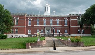
Lincoln is the capital of the U.S. state of Nebraska and the county seat of Lancaster County. The city covers 100.4 square miles (260.035 km2) and had a population of 294,757 in 2023. It is the state's second-most populous city and the 71st-largest in the United States. Lincoln is considered the economic and cultural anchor of the substantially larger metropolitan area in southeastern Nebraska, the Lincoln Metropolitan and Lincoln-Beatrice Combined Statistical Areas, which is home to 361,921 people, the 104th-largest combined statistical area in the United States.

Lancaster County is a county located in the U.S. state of Nebraska. As of the 2020 United States Census, the population was 322,608, making it the second-most populous county in Nebraska. Its county seat is Lincoln, the state capital. The county was created in 1859.

Saline County is a county in the U.S. state of Nebraska. As of the 2020 United States Census, the population was 14,292. Its county seat is Wilber.

Otoe County is a county in the U.S. state of Nebraska. As of the 2020 United States Census, the population was 15,912. Its county seat is Nebraska City. The county was formed in 1854 and was named in reference to the Otoe Indian tribe.

Johnson County is a county in the U.S. state of Nebraska. As of the 2020 United States Census, the population was 5,290. Its county seat is Tecumseh. The county was formed in 1855, and was organized in 1857. It was named after Richard Mentor Johnson, who was Vice President of the United States from 1837 to 1841. In the Nebraska license plate system, Johnson County is represented by the prefix 57.

Gage County is a county in the U.S. state of Nebraska. As of the 2020 United States Census, the population was 21,704. Its county seat is Beatrice. The county was created in 1855 and organized in 1857. It was formed from land taken from the Otoe in an 1854 treaty. The county was named for William D. Gage, a Methodist minister who served as the first chaplain of the Nebraska Territorial Legislature.

Cortland is a village in Gage County, Nebraska, United States. The population was 504 at the 2020 census.

Firth is a village in Lancaster County, Nebraska, United States. It is part of the Lincoln, Nebraska Metropolitan Statistical Area. The population was 649 at the 2020 census.

Hickman is a city in Lancaster County, Nebraska, United States. It is part of the Lincoln, Nebraska Metropolitan Statistical Area. The population was 2,607 at the 2020 census.

Roca is a village in Lancaster County, Nebraska, United States. It is part of the Lincoln, Nebraska Metropolitan Statistical Area. The population was 201 at the 2020 census.

Lorton is a village in Otoe County, Nebraska, United States. The population was 35 at the 2020 census.

Talmage is a village in Otoe County, Nebraska, United States. The population was 198 at the 2020 census.
Waverly School District 145 is a public school district serving the communities of Alvo, Eagle, Prairie Home, Walton, and Waverly in Nebraska, United States. The district provides primary and secondary education for over 2000 students in grades K-12. The district is governed by a six-member community-elected board, and the current superintendent is Cory Worrell.
Walton is an unincorporated community and census-designated place in Lancaster County, Nebraska, United States. Walton had a population of 306 as of the 2010 census. The headquarters of the Cornhusker Council of the Boy Scouts of America are located in Walton.

The Lincoln Metropolitan Statistical Area, as defined by the United States Census Bureau, is an area consisting of two counties in Nebraska, anchored by the city of Lincoln. As of the 2020 census, the MSA had a population of 340,217.

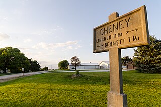
Cheney is an unincorporated community in Lancaster County, Nebraska, United States.

Prairie Home is an unincorporated community in Lancaster County, Nebraska, United States.
Woodland Hills is an unincorporated community and census-designated place in Otoe County, Nebraska, United States. Its population was 232 as of the 2020 census.
Yankee Hill is an unincorporated community and census-designated place in Lancaster County, Nebraska, United States. Its population was 292 as of the 2010 census.
Johnson County Central Public Schools is a school district headquartered in Tecumseh, Nebraska. It has its elementary and high school in Tecumseh and its middle school in Cook.


