
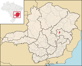
Minas Gerais is one of the 27 federative units of Brazil, being the fourth largest state by area and the second largest in number of inhabitants with a population of 20,539,989 according to the 2022 census. Located in the Southeast Region of the country, it is bordered to south and southwest by São Paulo; Mato Grosso do Sul to the west; Goiás and the Federal District to the northwest; Bahia to the north and northeast; Espírito Santo to the east; and Rio de Janeiro to the southeast. The state's capital and largest city, Belo Horizonte, is a major urban and finance center in Brazil, being the sixth most populous municipality in the country while its metropolitan area ranks as the third largest in Brazil with just over 5.8 million inhabitants, after those of São Paulo and Rio de Janeiro. Minas Gerais' territory is subdivided into 853 municipalities, the largest number among Brazilian states.

Mariana is the oldest city in the state of Minas Gerais, Brazil. It is a tourist city, founded on July 16, 1696, and retains the characteristics of a baroque city, with its churches, buildings and museums. It was the first capital of Minas Gerais.

Almenara, is a municipality in the northeast of the Brazilian state of Minas Gerais. Situated on the Jequitinhonha River it is the largest city in that river valley. Its 2020 population was estimated at 42,143 and the municipal area was 2,301 km².
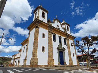
Santa Bárbara is a Brazilian municipality founded in 1704 and located in the state of Minas Gerais. It is a historic town on the Gold Circuit of Minas Gerais, located ninety-eight kilometres from Belo Horizonte, in the centre of the Estrada Real. The bucolic landscape, with its churches, roofs and backyards at the foot of the imposing Serra do Caraça makes Santa Bárbara one of the most beautiful towns in Minas Gerais. Despite the current increase in economic development, it is a peaceful and welcoming town with simple and hospitable people who preserve their traditions and live an active cultural life. The 6th President of Brazil, Afonso Pena was born in Santa Bárbara.

Nova Lima is a municipality of about 87,000 people, whose downtown is located about 20 kilometers south of Belo Horizonte, the capital of the south-eastern Brazilian state of Minas Gerais. Mining is one of the main economical activities of the city, including the extraction of Iron Ore and Gold. The most famous mine in the city is Morro Velho, a gold mine of 2,700 metres (8,900 ft) depth.
Caeté is a Brazilian municipality located in the state of Minas Gerais.

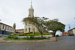
Esmeraldas is a Brazilian municipality located in the state of Minas Gerais. The city belongs to the mesoregion Metropolitana de Belo Horizonte and to the microregion of Belo Horizonte. In 2020 its population was estimated to be 71,551 inhabitants.
Pará de Minas is a Brazilian municipality located in the state of Minas Gerais.

Lagoa Dourada is a Brazilian municipality located in the state of Minas Gerais.

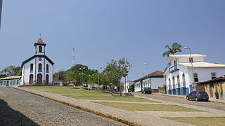
Prados is a Brazilian municipality located in the state of Minas Gerais. The city belongs to the mesoregion of Campo das Vertentes and to the microregion of Sao Joao del Rei. In 2020, the estimated population was 9,080.

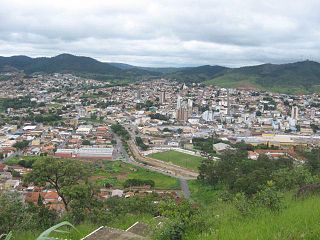
Brumadinho is a Brazilian municipality in the state of Minas Gerais. The city belongs to the Belo Horizonte metropolitan mesoregion and to the microregion of Belo Horizonte. Brumadinho is at an altitude of 880 m. In 2020 the population was 40,666. The municipality is on the Paraopeba River.
Entre Rios de Minas is a Brazilian municipality located in the state of Minas Gerais. The city belongs to the mesoregion Metropolitana de Belo Horizonte and to the microregion of Conselheiro Lafaiete.
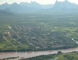
Jacinto is a Brazilian municipality located in the northeast of the state of Minas Gerais. Jacinto is located on the right bank of the Jequitinhonha River. It is 44 kilometers east of Almenara.

Bonito de Minas is a municipality in the northeast of the Brazilian state of Minas Gerais. As of 2020 the population was 11,369 in a total area of 3,901 km2. The elevation is 629 meters. It became a municipality in 1995.

Minas Novas is a municipality in the northeast of the Brazilian state of Minas Gerais. In 2020, the population was 31,497 in a total area of 1,810 km². The elevation of the urban area is 635 meters. It is part of the IBGE statistical meso-region of Jequitinhonha and the micro-region of Capelinha. It became a municipality in 1730.

Itaúna is a municipality in the state of Minas Gerais in the Southeast region of Brazil.
São João Evangelista is a municipality in the state of Minas Gerais in the Southeast region of Brazil.

Peçanha is a municipality in the state of Minas Gerais in the Southeast region of Brazil.

Rio Preto is a municipality in the state of Minas Gerais in the Southeast region of Brazil.

Cristina, Minas Gerais is a municipality in the state of Minas Gerais in the Southeast region of Brazil.
