
The Gulf of St. Lawrence is the outlet of the North American Great Lakes via the St. Lawrence River into the Atlantic Ocean. The gulf is a semi-enclosed sea, covering an area of about 226,000 square kilometres (87,000 sq mi) and containing about 34,500 cubic kilometres (8,300 cu mi) of water, at an average depth of 152 metres (500 ft).
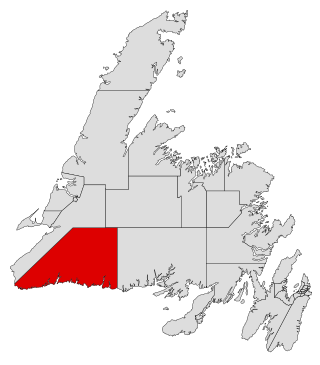
Burgeo-La Poile is a provincial electoral district for the House of Assembly of Newfoundland and Labrador, Canada. As of 2011, there are 7,527 eligible voters living within the district. The district was first created when Newfoundland joined confederation in 1949 as Burgeo and La Poile, and existed until 1975. It was recreated in 1995 following a reduction in the number of seats in the House of Assembly from 52 to 48, forming from the amalgamation of the former districts of La Poile and Burgeo-Bay D'Espoir.
Steady Brook is a Canadian town in the province of Newfoundland and Labrador. Located on the west coast of the island of Newfoundland, the town is situated 8 kilometres east of the city of Corner Brook in the lower Humber Valley. The town is surrounded by the Long Range Mountains and sits astride the Humber River. Steady Brook has become a thriving community in recent years as a result of provincial investments in the Marble Mountain alpine ski resort, along with golf courses and other recreational amenities.
Tompkins is a local service district and designated place in the Canadian province of Newfoundland and Labrador. It is in the Codroy Valley north of Channel-Port aux Basques.

Reefs Harbour-Shoal Cove West-New Ferolle is a local service district and designated place in the Canadian province of Newfoundland and Labrador. It is southwest of Anchor Point.
Riverhead was a small village of 20 families in 1864. It is now a town in the St. Mary's area with a population of over 400 by 1968.
River of Ponds is a town located northeast of Daniel's Harbour, Newfoundland and Labrador. It became a Local Government Community in 1970 and had a population of 166 in 1956. The 2021 census reported a population of 173.
Roaches Line is a local service district and designated place in the Canadian province of Newfoundland and Labrador. It is on the western side of Conception Bay and south of Bay Roberts.
Keels is a small town in the Canadian province of Newfoundland and Labrador, located about 3 kilometres from Duntara. The population of this municipality in the 2016 Canadian National Census was 51. This is down from 61 in 2011 and 73 in 2006. The earlier population figures show it had 85 in 2001, 101 in 1996, 128 in 1991, 115 in 1986, 206 in 1956 and 372 in 1940.
Colinet is an incorporated town located on the northwest arm of St. Mary's Bay in Newfoundland and Labrador, Canada.
Hawke's Bay is a town at the mouth of Torrent River southeast of Point Riche in the Canadian province of Newfoundland and Labrador.
Heart's Desire is a town in the Canadian province of Newfoundland and Labrador. The town had a population of 184 in the Canada 2021 Census.
Lamaline is a town in the Canadian province of Newfoundland and Labrador. The town had a population of 480 in 1940, 643 in 1956 and 218 in the Canada 2021 Census. Lamaline was a small place with 10 families in 1864. The Way Office was established in 1863 and the first Waymaster was James Pittman.
Little Bay East is a town in the Canadian province of Newfoundland and Labrador. The town had a population of 84 in the Canada 2021 Census.
Sandringham is a town on the Eastport Peninsula in Bonavista Bay North in the Canadian province of Newfoundland and Labrador, Canada. The town had a population of 205 in the Canada 2021 Census.
South River is an incorporated municipality in the Canadian province of Newfoundland and Labrador, located at the south-southeast side of Bay de Grave, in Conception Bay. The town had a population of 674 according to the 2021 Canadian Census. South River is the site of the western terminus of Newfoundland and Labrador Route 60, also known as the Conception Bay Highway, which proceeds eastward to downtown St. John's. The river itself forms a natural boundary with neighbouring Clarke's Beach and is a scheduled salmon river. A second river, known as the Gould Brook, forms another natural boundary with the unincorporated local service district of Makinsons. South River is home to the Bay de Grave Regional Fire Department, a first step in developing successful regional cooperation amongst municipalities.
St. Pauls is a town in the Canadian province of Newfoundland and Labrador. The town had a population of 202 in the Canada 2021 Census.
Castor River North is a local service district and designated place in the Canadian province of Newfoundland and Labrador.
Sandwich Bay, is a natural bay on the coast of Labrador in the province of Newfoundland and Labrador, Canada. The principal permanent settlement is Cartwright, located at the south entrance to the inner part of the bay. Other settlements along the bay include Paradise River and North River. Both of these communities are located at the outlets of the rivers of the same name into the bay. There is a road following the entire eastern coastline of Sandwich Bay, Newfoundland and Labrador Route 516.

Division No. 1, Subdivision G is an unorganized subdivision on the Avalon Peninsula in Newfoundland and Labrador, Canada. It is in Division 1 and contains the unincorporated communities of Baccalieu Island, Besom Cove, Bradley's Cove, Burnt Point, Caplin Cove, Daniel's Cove, Grates Cove, Gull Island, Job's Cove, Kingston, Long Beach, Lower Island Cove, Low Point, Northern Bay, Ochre Pit Cove, Red Head Cove, Riverhead, Smooth Cove and Western Bay.
