Beverwijk is a municipality and a city in the Netherlands, in the province of North Holland. The town is located about 20 kilometres (12 mi) northwest of Amsterdam in the Randstad metropolitan area, north of the North Sea Canal very close to the North Sea coast. A railway tunnel and two motorway tunnels cross the canal between Beverwijk and the nearby city of Haarlem on the south side of the canal.

Velsen is a municipality in the Netherlands, in the province of North Holland. It is located on both sides of the North Sea Canal.

IJmuiden is a port city in the Dutch province of North Holland. It is the main town in the municipality of Velsen which lies mainly to the south-east. Including its large sea locks, it straddles the mouth of the North Sea Canal to Amsterdam. To the south it abuts a large reserve of plant-covered dunes, the Zuid-Kennemerland National Park. The city is on the south bank; the north bank is otherwise a steel plant and Velsen-Noord.

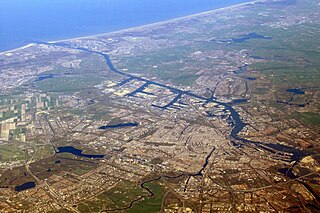
Hoofddorp is the main town of the municipality of Haarlemmermeer, in the province of North Holland, the Netherlands. In 2021, the population was 77,885. The town was founded in 1853, immediately after the Haarlemmermeer had been drained.

The Spaarne is a river in North Holland, Netherlands. This partially canalized river connects the Ringvaart to a side branch of the North Sea Canal. It runs through Haarlem, Heemstede, and Spaarndam.
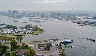
The IJ is a body of water, formerly a bay, in the Dutch province of North Holland. It is known for being Amsterdam's waterfront.

Spaarndam is a village in the province of North Holland, the Netherlands, on the Spaarne river and the IJ lake. The oldest part of the village, on the western side of the Spaarne, belongs to the municipality of Haarlem; the newer part on the eastern side is a part of the municipality of Haarlemmermeer. The village is built around a dam in the river, which is also the division line of the two municipalities.
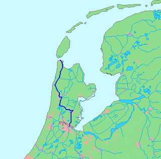
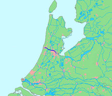
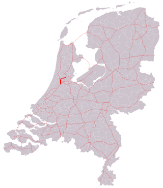
The Noordhollandsch Kanaal is a canal originally meant for ocean-going ships. It is located in North Holland, Netherlands. The canal was of great significance in Dutch history.

The Haarlemmertrekvaart [ˌhaːrlɛmərˈtrɛkfaːrt] is a canal between Amsterdam and Haarlem in the province of North Holland, the Netherlands. It was dug in 1631, making it the oldest tow-canal in Holland. Travel on such canals was historically done by barges which were towed by animals on a path along the canal's edge (towpath).

The A10 motorway is a motorway in the Netherlands. This motorway is the ring road around the city of Amsterdam. It has a length of 32 km (20 mi). Five other motorways connect to the A10: motorway A8 at interchange Coenplein (north), motorway A5 at interchange Coenplein (south), A4 at interchange De Nieuwe Meer, A2 at interchange Amstel, and A1 at interchange Watergraafsmeer. Part of the A10 is the Coentunnel, crossing the Noordzeekanaal. This twin tube tunnel was notorious for traffic jams for decades and another two tubes have been built. These new tubes opened on 13 May 2013 and the old tubes were closed for extensive renovation. On 21 July 2014 the old tubes were reopened after completing the renovations and all four tubes became be available for traffic.

The A22 motorway is a motorway in the Netherlands. It is one of the shorter motorways in the Netherlands, with a total length of approximately 8 kilometers.

The A8 motorway is a motorway in the Netherlands. It starts at the intersection with the Ring Amsterdam at interchange Coenplein, and leads past Oostzaan, interchange Zaandam, and Zaandijk towards its terminus, just 10 kilometers from its beginning at the Coenplein, near Assendelft.
The A5 motorway is a motorway in the Netherlands. With a length of 17 kilometres (11 mi), it is one of the shortest motorways in the country.
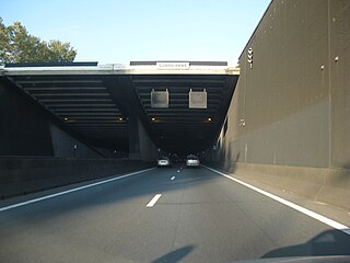
The Coentunnel (1966) is a tunnel in the A10 motorway under the North Sea Canal in western Amsterdam. The tunnel is named for the 17th-century colonizer Jan Pieterszoon Coen. The tunnel itself is 1283 metres long of which 587 metres are fully covered. The tunnel connects the Zaan district with the western part of Amsterdam. The tunnel reaches a maximum depth of 22 metres.
The port of Amsterdam is an inland seaport in Amsterdam in North Holland, Netherlands. It is the 14th busiest port in Europe by total cargo tonnage. In 2023, the port of Amsterdam had a cargo throughput of 63 million tons.

Zaans Museum is a museum in Zaandam, Netherlands, located at the Zaanse Schans. It opened in 1998 to preserve and protect the heritage of the Zaan area. In 2009, the museum was extended with the addition of the Verkade Experience.
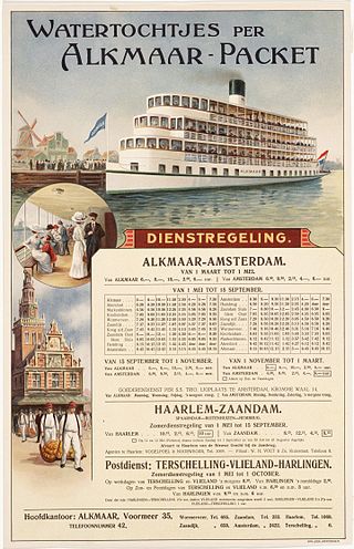
Alkmaar Packet was a shipping company that operated scheduled passenger and freight services in the northern part of the Netherlands between 1864 and 1950. The services the company provided were a kind of beurtvaart, which at the time had become a forerunner of modern public transport. At its height Alkmaar Packet owned more than 20 ships.
The Oranje Locks are a group of locks and other water management facilities just east of Amsterdam.