Wilkowo is a village in the administrative district of Gmina Milicz, within Milicz County, Lower Silesian Voivodeship, in south-western Poland. Prior to 1945 it was in Germany.

Mędłów is a village in the administrative district of Gmina Żórawina, within Wrocław County, Lower Silesian Voivodeship, in south-western Poland. Prior to 1945 it was in Germany. It lies approximately 3 kilometres (2 mi) north of Żórawina and 14 km (9 mi) south of the regional capital Wrocław.

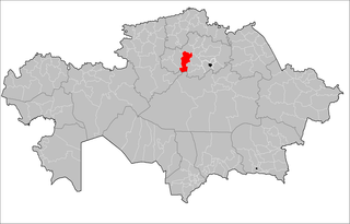
Atbasar District is a district of Akmola Region in northern Kazakhstan. The administrative center of the district is the town of Atbasar. Population: 50,981 ; 61,009.

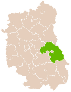
Gozdów is a village in the administrative district of Gmina Werbkowice, within Hrubieszów County, Lublin Voivodeship, in eastern Poland. It lies approximately 4 kilometres (2 mi) north-east of Werbkowice, 8 km (5 mi) south-west of Hrubieszów, and 102 km (63 mi) south-east of the regional capital Lublin.

Janówek is a village in the administrative district of Gmina Sztabin, within Augustów County, Podlaskie Voivodeship, in north-eastern Poland. It lies approximately 5 kilometres (3 mi) west of Sztabin, 19 km (12 mi) south of Augustów, and 64 km (40 mi) north of the regional capital Białystok.

Jelitów is a village in the administrative district of Gmina Biała Rawska, within Rawa County, Łódź Voivodeship, in central Poland. It lies approximately 10 kilometres (6 mi) west of Biała Rawska, 9 km (6 mi) north-east of Rawa Mazowiecka, and 61 km (38 mi) east of the regional capital Łódź.

Placydów is a village in the administrative district of Gmina Aleksandrów Łódzki, within Zgierz County, Łódź Voivodeship, in central Poland. It lies approximately 3 kilometres (2 mi) west of Aleksandrów Łódzki, 12 km (7 mi) south-west of Zgierz, and 15 km (9 mi) west of the regional capital Łódź.

Nalewajków is a village in the administrative district of Gmina Radoszyce, within Końskie County, Świętokrzyskie Voivodeship, in south-central Poland. It lies approximately 7 kilometres (4 mi) south-east of Radoszyce, 18 km (11 mi) south of Końskie, and 27 km (17 mi) north-west of the regional capital Kielce.

Günəşli is a village in the Gadabay Rayon of Azerbaijan. The village forms part of the municipality of Dəyəqarabulaq.

Henryk is a village in the administrative district of Gmina Brody, within Starachowice County, Świętokrzyskie Voivodeship, in south-central Poland. It lies approximately 5 kilometres (3 mi) north-west of Brody, 7 km (4 mi) east of Starachowice, and 43 km (27 mi) north-east of the regional capital Kielce.
Grotów is a village in the administrative district of Gmina Belsk Duży, within Grójec County, Masovian Voivodeship, in east-central Poland.
Borucin is a village in the administrative district of Gmina Pleszew, within Pleszew County, Greater Poland Voivodeship, in west-central Poland.

Lindów is a village in the administrative district of Gmina Lipie, within Kłobuck County, Silesian Voivodeship, in southern Poland. It lies approximately 6 kilometres (4 mi) north-east of Lipie, 16 km (10 mi) north of Kłobuck, and 90 km (56 mi) north of the regional capital Katowice.

Schodno is a village in the administrative district of Gmina Dziemiany, within Kościerzyna County, Pomeranian Voivodeship, in northern Poland. It lies approximately 8 kilometres (5 mi) north-east of Dziemiany, 12 km (7 mi) south-west of Kościerzyna, and 62 km (39 mi) south-west of the regional capital Gdańsk.
Nowa Wieś Mała is a village in the administrative district of Gmina Kętrzyn, within Kętrzyn County, Warmian-Masurian Voivodeship, in northern Poland.
Wólka Ryńska is a village in the administrative district of Gmina Reszel, within Kętrzyn County, Warmian-Masurian Voivodeship, in northern Poland.

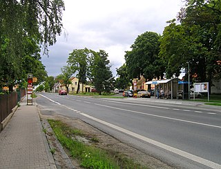
Chrášťany is a village and municipality in Prague-West District in the Central Bohemian Region of the Czech Republic.
Huaiyuan County is a county in the north of Anhui Province, China. It is under the administration of Bengbu city.
Sagra is a village in the province of Alicante and autonomous community of Valencia, Spain. The municipality covers an area of 5.6 square kilometres (2.2 sq mi) and as of 2011 had a population of 454 people.

Xiameilin station is a Metro station of Shenzhen Metro Line 9. It opened on 28 October 2016.


