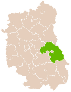
Kicin is a village in the administrative district of Gmina Białopole, within Chełm County, Lublin Voivodeship, in eastern Poland. It lies approximately 3 kilometres (2 mi) east of Białopole, 28 km (17 mi) south-east of Chełm, and 89 km (55 mi) east of the regional capital Lublin.
Brzozowiec is a village in the administrative district of Gmina Dubienka, within Chełm County, Lublin Voivodeship, in eastern Poland, close to the border with Ukraine. It lies approximately 5 kilometres (3 mi) south-west of Dubienka, 30 km (19 mi) south-east of Chełm, and 94 km (58 mi) east of the regional capital Lublin.
Holendry is a village in the administrative district of Gmina Dubienka, within Chełm County, Lublin Voivodeship, in eastern Poland, close to the border with Ukraine. It lies approximately 4 kilometres (2 mi) south-west of Dubienka, 28 km (17 mi) south-east of Chełm, and 92 km (57 mi) east of the regional capital Lublin.
Janostrów is a village in the administrative district of Gmina Dubienka, within Chełm County, Lublin Voivodeship, in eastern Poland, close to the border with Ukraine. It lies approximately 5 kilometres (3 mi) south-west of Dubienka, 30 km (19 mi) south-east of Chełm, and 94 km (58 mi) east of the regional capital Lublin.
Jasienica is a village in the administrative district of Gmina Dubienka, within Chełm County, Lublin Voivodeship, in eastern Poland, close to the border with Ukraine. It lies approximately 6 kilometres (4 mi) south of Dubienka, 33 km (21 mi) south-east of Chełm, and 96 km (60 mi) east of the regional capital Lublin.
Józefów is a village in the administrative district of Gmina Dubienka, within Chełm County, Lublin Voivodeship, in eastern Poland, close to the border with Ukraine. It lies approximately 8 kilometres (5 mi) south of Dubienka, 34 km (21 mi) south-east of Chełm, and 97 km (60 mi) east of the regional capital Lublin.
Kajetanówka is a village in the administrative district of Gmina Dubienka, within Chełm County, Lublin Voivodeship, in eastern Poland, close to the border with Ukraine. It lies approximately 7 kilometres (4 mi) west of Dubienka, 24 km (15 mi) south-east of Chełm, and 88 km (55 mi) east of the regional capital Lublin.
Lipniki is a village in the administrative district of Gmina Dubienka, within Chełm County, Lublin Voivodeship, in eastern Poland, close to the border with Ukraine. It lies approximately 11 kilometres (7 mi) west of Dubienka, 21 km (13 mi) east of Chełm, and 85 km (53 mi) east of the regional capital Lublin.
Mateuszowo is a village in the administrative district of Gmina Dubienka, within Chełm County, Lublin Voivodeship, in eastern Poland, close to the border with Ukraine. It lies approximately 4 kilometres (2 mi) north-west of Dubienka, 27 km (17 mi) east of Chełm, and 91 km (57 mi) east of the regional capital Lublin.
Radziejów is a village in the administrative district of Gmina Dubienka, within Chełm County, Lublin Voivodeship, in eastern Poland, close to the border with Ukraine. It lies approximately 9 kilometres (6 mi) west of Dubienka, 24 km (15 mi) south-east of Chełm, and 87 km (54 mi) east of the regional capital Lublin.
Rogatka is a village in the administrative district of Gmina Dubienka, within Chełm County, Lublin Voivodeship, in eastern Poland, close to the border with Ukraine. It lies approximately 3 kilometres (2 mi) south-west of Dubienka, 30 km (19 mi) south-east of Chełm, and 94 km (58 mi) east of the regional capital Lublin.
Siedliszcze is a village in the administrative district of Gmina Dubienka, within Chełm County, Lublin Voivodeship, in eastern Poland, close to the border with Ukraine. It lies approximately 7 kilometres (4 mi) south-west of Dubienka, 27 km (17 mi) south-east of Chełm, and 91 km (57 mi) east of the regional capital Lublin.
Skryhiczyn is a village in the administrative district of Gmina Dubienka, within Chełm County, Lublin Voivodeship, in eastern Poland, close to the border with Ukraine. It lies approximately 9 kilometres (6 mi) south-east of Dubienka, 37 km (23 mi) south-east of Chełm, and 100 km (62 mi) east of the regional capital Lublin.
Starosiele is a village in the administrative district of Gmina Dubienka, within Chełm County, Lublin Voivodeship, in eastern Poland, close to the border with Ukraine. It lies approximately 2 kilometres (1 mi) south of Dubienka, 31 km (19 mi) south-east of Chełm, and 95 km (59 mi) east of the regional capital Lublin.
Alojzów is a village in the administrative district of Gmina Leśniowice, within Chełm County, Lublin Voivodeship, in eastern Poland. It lies approximately 5 kilometres (3 mi) east of Leśniowice, 20 km (12 mi) south of Chełm, and 75 km (47 mi) south-east of the regional capital Lublin.
Janówka is a village in the administrative district of Gmina Leśniowice, within Chełm County, Lublin Voivodeship, in eastern Poland. It lies approximately 19 kilometres (12 mi) south of Chełm and 71 km (44 mi) south-east of the regional capital Lublin.
Plisków is a village in the administrative district of Gmina Leśniowice, within Chełm County, Lublin Voivodeship, in eastern Poland. It lies approximately 3 kilometres (2 mi) west of Leśniowice, 19 km (12 mi) south of Chełm, and 69 km (43 mi) south-east of the regional capital Lublin.
Politówka is a village in the administrative district of Gmina Leśniowice, within Chełm County, Lublin Voivodeship, in eastern Poland. It lies approximately 3 kilometres (2 mi) east of Leśniowice, 19 km (12 mi) south of Chełm, and 73 km (45 mi) south-east of the regional capital Lublin.
Huta is a village in the administrative district of Gmina Wojsławice, within Chełm County, Lublin Voivodeship, in eastern Poland. It lies approximately 5 kilometres (3 mi) north-east of Wojsławice, 26 km (16 mi) south of Chełm, and 81 km (50 mi) south-east of the regional capital Lublin.
Stefanówka is a village in the administrative district of Gmina Józefów nad Wisłą, within Opole Lubelskie County, Lublin Voivodeship, in eastern Poland. It lies approximately 10 kilometres (6 mi) south-east of Józefów nad Wisłą, 19 km (12 mi) south of Opole Lubelskie, and 54 km (34 mi) south-west of the regional capital Lublin.