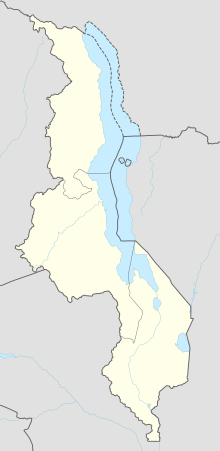
Transportation in Malawi is poorly developed. The country of almost 14 million has 39 airports, 6 with paved runways and 33 with unpaved runways. It has 797 kilometres of railways, all narrow-gauge and about 45 percent of its roads are paved. Though it is landlocked, Malawi also has 700 km (435 mi) of waterways on Lake Malawi and along the Shire River.

Nsanje is the main city in Nsanje District within the Southern Region of Malawi.

The Southern Region of Malawi is an area of Malawi. It covers an area of 31,753 km2. Its capital city is Blantyre. In 2018, its population was 7,750,629.

Nsanje is a district in the Southern Region of Malawi. The capital is Nsanje. The district covers an area of 1,942 square kilometres (750 sq mi) and has a population of 194,924.
The Thyolo district of Malawi is one of the districts in Malawi. The capital is Thyolo. The district covers an area of 1,715 km.² and has a population of 458,976. It is also has crossroads leading to Makwasa, Molere, Konzalendo, Thekerani into Muona and eventually Nsanje leading to another border with Mozambique.
Railway stations in Mozambique include:
Malawi Railways is the national rail network in Malawi, run by a government corporation until privatisation in 1999. As of 1 December 1999 the Central East African Railways, a consortium led by Railroad Development Corporation, won the right to operate the network.
Bangula is a town of about 5000 population in southern region district of Nsanje in Malawi. There is also a commune of the same name. Its elevation is 100m. It is located on the western bank of the Shire River, near the confluence of the Shire and Ruo River. After extensive flooding in Chiromo, the municipalities were moved to Bangula. The name Bangula is roughly translated to 'place where the lions roar' – although few to no lions exist in the area anymore.

Malawi–Mozambique relations refers to the current and historical relationship between the countries of Malawi and Mozambique. As Malawi shares a large border with Mozambique, much of the substance of their foreign relations pertain to the border separating the two nations. Both of the sovereign states have amicably agreed that lacustrine borders on Lake Malawi remain the largest priority between the two countries, as the exploitation of natural resources within the waters of Lake Malawi remain an issue the two countries continue to resolve. The moment considered an act of generosity and sympathy within the two countries relations is when, during the Mozambique Civil War, Malawi housed over one million Mozambican refugees between 1985 and 1995. After this gesture, Malawian relations with Mozambique crumbled under the tenure of Bingu wa Mutharika, notoriously reaching a nadir when Malawian police launched a raid into Mozambique's territory.
Elephant Marsh lies on the flood plain of the Lower Shire River in the African country of Malawi, between the towns of Chikwawa and Nsanje. The marsh varies in size from 150 to 450 square miles depending on the flow of the Shire and Ruo rivers and has no permanent boundary. In some places, floating mats of vegetation are so thick boat travel is nearly impossible. The Ruo River, the largest tributary of the Shire and the southeastern boundary between Malawi and Mozambique, merges with the Shire in the Elephant Marsh.
Monkey Bay Airport is an airport serving the Lake Malawi port town of Monkey Bay, in the Southern Region of Malawi.
Sucoma Airport is an airport serving the Nchalo Sugar Estate and the town of Nchalo, Republic of Malawi. The runway marked length is 800 meters, but it has overruns totals 1190 meters.
Ntchisi Airport is an airport serving the town of Ntchisi, Republic of Malawi. The airport is 6 kilometres (3.7 mi) west of Ntchisi.
Salima Airport is an airport serving the town of Salima, Republic of Malawi.
Mangochi Airport is an airport that used to serve the town of Mangochi in Southern Region, Malawi.

Sena railway, also called Shire Highlands railway, Dondo-Malawi railway and North-South Malawi railway, is a railway that connects Dondo, Mozambique, to Chipata, in Zambia. It is c. 1000 km long, in a 1067 mm gauge.
Marka is a town located in Nsanje District in Malawi. It is the southernmost location in the country, serving as a border post for road and rail control between Malawi and Mozambique.

The M1 road is a road in Malawi. The road serves as the backbone of Malawi's transportation network, stretching from the country's northern border with Tanzania at Kasumulu all the way down to the southern border with Mozambique at Marka. The north-south artery passes through the capital city of Lilongwe and the commercial hub of Blantyre, covering a total distance of 1,140 kilometers. As the longest road in Malawi, the M1 plays a role in connecting the country's major urban centers and facilitating trade and travel.


