References
Neighborhoods and municipalities of Suffolk, Virginia | ||
|---|---|---|
| Boroughs | 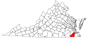 | |
| Neighborhoods | ||
| | This City of Suffolk, Virginia state location article is a stub. You can help Wikipedia by expanding it. |
Nurney is an unincorporated community in the independent city of Suffolk, Virginia, United States.
Neighborhoods and municipalities of Suffolk, Virginia | ||
|---|---|---|
| Boroughs | | |
| Neighborhoods | ||
| | This City of Suffolk, Virginia state location article is a stub. You can help Wikipedia by expanding it. |