Nutwood | |
|---|---|
 Sign for Nutwood | |
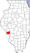
 Nutwood Location of Nutwood within Illinois  Nutwood Nutwood (the United States) | |
| Coordinates: 39°05′05″N90°33′21″W / 39.08472°N 90.55583°W | |
| Country | United States |
| State | Illinois |
| County | Jersey |
| Township | Rosedale |
| Elevation | 449 ft (137 m) |
| Time zone | UTC-6 (CST) |
| • Summer (DST) | UTC-5 (CDT) |
| Area code | 618 |
| GNIS feature ID | 414739 [1] |
Nutwood is an unincorporated community in Jersey County, Illinois, United States. It is located along Illinois Route 100, about four miles west-southwest of Fieldon. [2]