Chautauqua, Illinois

Last updated
Chautauqua
New Piasa Chautauqua.jpg
Cottages near the entrance
USA Illinois location map.svg
Red pog.svg
Chautauqua
Location of Chautauqua within Illinois
Coordinates: 38°57′52″N90°23′08″W / 38.96444°N 90.38556°W / 38.96444; -90.38556 Coordinates: 38°57′52″N90°23′08″W / 38.96444°N 90.38556°W / 38.96444; -90.38556
CountryUnited States
StateIllinois
County Jersey
Township Elsah
Founded1885
Elevation
[1]
436 ft (133 m)
Time zone UTC-6 (CST)
  Summer (DST) UTC-5 (CDT)
Postal code
62028
Area code 618
GNIS feature ID428371 [1]

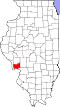
Chautauqua is a populated place in Jersey County, Illinois. [1] Also known as the New Piasa Chautauqua Historic District which is a private semi-gated summer resort that started as a 19th-century tent settlement.[ citation needed ] The name Piasa is taken from a nearby Native American painting of a mythical bird, called the Piasa Bird, which was painted on the bluffs high above the Mississippi River. Chautauqua is located between Elsah and Grafton in Jersey County. Today, it is bordered by and has access from the Great River Road (Illinois Route 100). It has functioned as a private non-denominational Christian summer resort for over a century.[ citation needed ]

Contents

History

Founded in 1885 by Methodist leaders, Piasa Chautauqua attracted thousands of people from the St. Louis area and other places in Illinois. Arriving first by packet boat, and later by automobile or the trains that ran by as often as six times a day, the vacationers were entertained, educated, and inspired by guests including William Jennings Bryan, evangelists Sam Jones, Billy Sunday and Gypsy Smith, the Swiss Bell Ringers, John Philip Sousa’s band and "Sunny Jim," reputed to be one of the Theodore Roosevelt’s Rough Riders.[ citation needed ]

The physical situation of the settlement added to its appeal as the hottest summer days had cool valley breezes and some evenings might require a jacket. Before the days of air-conditioning, this offered a welcome relief from the heat of the city. An early swimming pool, that used to be filled with cold spring water, remains a popular attraction.[ citation needed ]

A 1912 brochure described the area:

"Piasa Chautauqua is located less than 40 miles from St. Louis in a beautiful valley between high, massive bluffs with the great Mississippi serving as a guard in front and almost unexplored forest at back, one of nature’s most picturesque spots, unknown to thousands but dear to those who have enjoyed its beauties and regained health from its wonderful springs and its clear, pure air, delightful cool nights, beautiful scenery and outdoor amusements, boating, swimming, fishing, bathing, lawn tennis, croquet, baseball..."[ citation needed ]

In an Illinois tourists' guide in 1932, the author celebrates the region's "grandeur... [surpassing] that of the Palisades on the Hudson." [2]

The New Piasa Chautauqua Historical Society, founded in 1983, [3] is working to integrate the Chautauqua history with that of the surrounding area.[ citation needed ] It has been designated as the New Piasa Chautauqua Historic District, which was added to the National Register of Historic Places in 1982.

Today, there are over two hundred cottages and substantial homes at Chautauqua. Many are occupied by the descendants of earlier owners. [4]

Related Research Articles

<span class="mw-page-title-main">Illinois River</span> Illinois tributary of the Mississippi River in the United States

The Illinois River is a principal tributary of the Mississippi River and is approximately 273 miles (439 km) long. Located in the U.S. state of Illinois, the river has a drainage basin of 28,756.6 square miles (74,479 km2). The Illinois River begins with the confluence of the Des Plaines and Kankakee rivers in the Chicago metropolitan area, and it generally flows to the southwest across Illinois, until it empties into the Mississippi near Grafton, Illinois. Its drainage basin extends into southeastern Wisconsin, northwestern Indiana, and a very small area of southwestern Michigan in addition to central Illinois. Along its shores are several river ports, including Peoria, Illinois. Historic recreation areas on the river include, Starved Rock, and internationally important wetlands include, the Emiquon Complex, and Dixon Waterfowl Refuge.

<span class="mw-page-title-main">Monroe County, Illinois</span> County in Illinois, United States

Monroe County is a county located in the U.S. state of Illinois. According to the 2020 census, it had a population of 34,962. Its county seat and largest city is Waterloo.

<span class="mw-page-title-main">Jersey County, Illinois</span> County in Illinois, United States

Jersey County is a county located in the U.S. state of Illinois. At the 2020 census, it had a population of 21,512. The county seat and largest community is Jerseyville, with a population of 8,337 in 2010. The county's smallest incorporated community is Otterville, with a population of 87.

<span class="mw-page-title-main">Scouting in Illinois</span> Scouting in Illinois

Scouting in Illinois has served youth since 1909. The state was the home of the Boy Scouts of America (BSA) founder, William D. Boyce.

<span class="mw-page-title-main">Grafton, Illinois</span> City in Illinois, United States

Grafton is the oldest city in Jersey County, Illinois, United States. It is located near the confluence of the Illinois and Mississippi Rivers. As of the 2020 census, the city had a total population of 626. Prior to the Great Flood of 1993, Grafton had enjoyed a stable population of nearly 1,000 residents.

<span class="mw-page-title-main">Galena, Illinois</span> City in Illinois, United States

Galena is the largest city in and the county seat of Jo Daviess County, Illinois, with a population of 3,308 at the 2020 census. A 581-acre (235 ha) section of the city is listed on the National Register of Historic Places as the Galena Historic District. The city is named for the mineral galena, which was in the ore that formed the basis for the region's early lead mining economy.

<span class="mw-page-title-main">Alton, Illinois</span> City in Illinois, United States

Alton is a city on the Mississippi River in Madison County, Illinois, United States, about 18 miles (29 km) north of St. Louis, Missouri. The population was 25,676 at the 2020 census. It is a part of the River Bend area in the Metro-East region of the Greater St. Louis metropolitan area. It is famous for its limestone bluffs along the river north of the city, as the former location of the state penitentiary, and for its role preceding and during the American Civil War. It was the site of the last Abraham Lincoln and Stephen Douglas debate in October 1858. The former state penitentiary in Alton was used during the Civil War to hold up to 12,000 Confederate prisoners of war.

<span class="mw-page-title-main">Starved Rock State Park</span> State park in Illinois, United States

Starved Rock State Park is a state park in the U.S. state of Illinois, characterized by the many canyons within its 2,630 acres (1,064 ha). Located just southeast of the village of Utica, in Deer Park Township, LaSalle County, Illinois, along the south bank of the Illinois River, the park hosts over two million visitors annually, the most for any Illinois state park.

<span class="mw-page-title-main">Piasa</span> Legendary Native American creature

The Piasa or Piasa Bird is a creature from Native American mythology depicted in one of two murals painted by Native Americans on cliffsides above the Mississippi River. Its original location was at the end of a chain of limestone bluffs in Madison County, Illinois at present-day Alton, Illinois. The original Piasa illustration no longer exists; a newer 20th-century version, based partly on 19th-century sketches and lithographs, has been placed on a bluff in Alton, Illinois, several hundred yards upstream from its origin. The limestone rock quality is unsuited for holding an image, and the painting must be regularly restored. The original site of the painting was on lithographic limestone, which was quarried away in the late 1870s by the Mississippi Lime Company.

<span class="mw-page-title-main">Frontenac State Park</span> State park in Minnesota, United States

Frontenac State Park is a state park of Minnesota, United States, on the Mississippi River 10 miles (16 km) southeast of Red Wing. The park is notable both for its history and for its birdwatching opportunities. The centerpiece of the park is a 430-foot-high (130 m), 3-mile-long (4.8 km) steep limestone bluff overlooking Lake Pepin, a natural widening of the Mississippi. The bluff is variously called Garrard's Bluff or Point No-Point, the latter name coming from riverboat captains because of the optical illusion that it protruded into the Mississippi River. There is a natural limestone arch on the blufftop called In-Yan-Teopa, a Dakota name meaning "Rock With Opening". Park lands entirely surround the town of Frontenac, once a high-class resort at the end of the 19th century.

<span class="mw-page-title-main">Black Hawk State Historic Site</span> State park in Illinois, USA

The Black Hawk State Historic Site, in Rock Island, Illinois, is adjacent to the historic site of the village of Saukenuk, the home of a band of Native Americans of the Sauk nation. It includes the John Hauberg Museum of Native American Life. The state park is located on a 150 feet (50 m) bluff overlooking the Rock River in western Illinois. It is most famous for being the birthplace of the Sauk warrior Black Hawk. The disputed cession of this area to the U.S. Government was the catalyst for the Black Hawk War.

<span class="mw-page-title-main">Pere Marquette State Park</span> State park in Jersey County, Illinois

Pere Marquette State Park is an 8,050-acre (3,260 ha) protected area in southwestern Jersey County, Illinois, United States. It is located near the city of Grafton, Illinois, at the confluence of the Mississippi River and the Illinois River. The park is located on Illinois Route 100, which at this location is also part of both the Great River Road and the Meeting of the Great Rivers Scenic Byway. The park is operated and maintained by the Illinois Department of Natural Resources, and is Illinois' largest state park in area. The park is also part of the Confluence Greenway and is at the northwestern end of the 21.5-mile (34.6 km) Sam Vadalabene Bike Trail.

<span class="mw-page-title-main">Geography of St. Louis</span> Geography in and surrounding St. Louis, Missouri

St. Louis is located at 38°38′53″N90°12′44″W.

The Chautauqua adult education movement flourished in the late 19th and early 20th centuries, then declined. However, some Independent Chautauquas still operate today, and these are the 21st century Chautauquas. They are divided into two categories, Continuously Operating Chautauquas and Revival Chautauquas.

<span class="mw-page-title-main">Sam Vadalabene Bike Trail</span>

The Sam Vadalabene Bike Trail, is a paved 21.5 mile biking/walking trail located in southwestern Illinois, located just north of the St. Louis, Missouri core urban area.

<span class="mw-page-title-main">Onondaga Cave State Park</span> State park in Missouri, United States

Onondaga Cave State Park is a Missouri state park located on the Meramec River approximately 5 miles (8.0 km) southeast of the village of Leasburg. The park was established in 1982. Park activities include cave tours, camping, fishing, hiking, picnicking, and swimming.

<span class="mw-page-title-main">Geography of Arkansas</span>

The geography of Arkansas varies widely. The state is covered by mountains, river valleys, forests, lakes, and bayous in addition to the cities of Arkansas. Hot Springs National Park features bubbling springs of hot water, formerly sought across the country for their healing properties. Crowley's Ridge is a geological anomaly rising above the surrounding lowlands of the Mississippi embayment.

<span class="mw-page-title-main">FC Adrenaline</span> Football club

FC Adrenaline is an American professional indoor soccer team, founded in 2007.

<span class="mw-page-title-main">Frederick Oakes Sylvester</span> American painter

Frederick Oakes Sylvester was an American art educator and artist in the Arts and Crafts movement in St. Louis, Missouri.

References

  1. 1 2 3 U.S. Geological Survey Geographic Names Information System: Chautauqua, Illinois
  2. "Illinois Tourists' Guide" (PDF). Illinois State Chamber of Commerce. 1932. p. 48. Archived from the original on 2008-07-28. Retrieved 2023-04-29.
  3. "Home". chautauquahistory.org.
  4. "The New Piasa Chautauqua in Alton, IL | The Chautauqua Trail". www.chautauquatrail.com. Retrieved 2021-07-28.