Nyagara

Last updated
Nyagara
Sub-prefecture and town
Guinea adm location map.svg
Red pog.svg
Nyagara
Location in Guinea
Coordinates: 10°45′N11°48′W / 10.750°N 11.800°W / 10.750; -11.800
CountryFlag of Guinea.svg  Guinea
Region Mamou Region
Prefecture Mamou Prefecture
Time zone GMT (UTC+0)

Nyagara is a town and sub-prefecture in the Mamou Prefecture in the Mamou Region of Guinea. [1]

Town settlement that is bigger than a village but smaller than a city


A town is a human settlement. Towns are generally larger than villages but smaller than cities, though the criteria to distinguish them vary considerably between different parts of the world.

Sub-prefectures of Guinea

The sub-prefectures are the third-level administrative divisions in Guinea. As of 2009 there were 303 rural sub-prefectures of Guinea and 38 urban sub-prefectures, 5 of which compose the Conakry greater urban area; Kaloum, Dixinn, Matam, Ratoma and Matoto.

Mamou Prefecture Prefecture in Mamou Region, Guinea

Mamou is a prefecture located in the Mamou Region of Guinea. The capital is Mamou. The prefecture covers an area of 8,000 km.² and has an estimated population of 222,000.

Related Research Articles

Timbo Sub-prefecture and town in Mamou Region, Guinea

Timbo is a town and sub-prefecture in the Mamou Prefecture in the Mamou Region of Guinea. It is located in the Fouta Djallon highlands of Guinea, lying north east of Mamou, in a part of the country mostly occupied by the Fula people. It is also known for its vernacular architecture, for the local mountains and for local chimpanzees.

Faranah Region Region in Guinea

The Faranah Region is located in east-central Guinea. It is bordered by the countries of Sierra Leone and Mali and the Guinean regions of Kankan, Mamou, Nzérékoré, and Labé.

Pita Prefecture Prefecture in Mamou Region, Guinea

Pita is a prefecture located in the Mamou Region of Guinea. The capital is Pita. The prefecture covers an area of 4,320 km.² and has an estimated population of 266,000.

Dalaba Prefecture Prefecture in Mamou Region, Guinea

Dalaba is a prefecture located in the Mamou Region of Guinea. The capital is Dalaba. The prefecture covers an area of 4,400 km² and has an estimated population of 155,000.

Mamou Region Region in Guinea

The Mamou Region is located in central Guinea. It is bordered by the country of Sierra Leone and the Guinean regions of Faranah, Labé, and Kindia.

Kindia Region Region in Guinea

The Kindia Region is located in western Guinea. It is bordered by the country of Sierra Leone and the Guinean regions of Conakry, Labé, Mamou, and Boké.

Labé Region Region in Guinea

The Labé Region is located in north-central Guinea. It is bordered by the countries of Senegal and Mali and the Guinean regions of Faranah, Kindia, Mamou, and Boké.

Mitty, Guinea Sub-prefecture and town in Mamou Region, Guinea

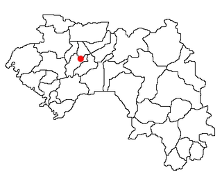
Mitty, Guinea is a town and sub-prefecture in the Dalaba Prefecture in the Mamou Region of western Guinea.

Gongoret Sub-prefecture and town in Mamou Region, Guinea

Gongoret is a town and sub-prefecture in the Mamou Prefecture in the Mamou Region of Guinea.

Konkouré Sub-prefecture and town in Mamou Region, Guinea

For the river having its source near the town, see Konkouré River

Ouré-Kaba Sub-prefecture and town in Mamou Region, Guinea

Ouré-Kaba is a town and sub-prefecture in the Mamou Prefecture in the Mamou Region of Guinea.

Porédaka Sub-prefecture and town in Mamou Region, Guinea

Porédaka is a town and sub-prefecture in the Mamou Prefecture in the Mamou Region of Guinea. It is located roughly 55 kilometres (34 mi) northeast of Mamou. The Battle of Porédaka took place here on 13 November 1896, during which French colonial troops decisively defeated the last forces of the Imamate of Futa Jallon, after which Futa Jallon was annexed into Senegambia.

Saramoussaya Sub-prefecture and town in Mamou Region, Guinea

Saramoussaya is a town and sub-prefecture in the Mamou Prefecture in the Mamou Region of Guinea.

Soyah Sub-prefecture and town in Mamou Region, Guinea

Soyah is a town and sub-prefecture in the Mamou Prefecture in the Mamou Region of Guinea.

Tolo, Guinea Sub-prefecture and town in Mamou Region, Guinea

Tolo, Guinea is a town and sub-prefecture in the Mamou Prefecture in the Mamou Region of Guinea.

Bourouwal-Tappé Sub-prefecture and town in Mamou Region, Guinea

Bourouwal-Tappé is a town and sub-prefecture in the Pita Prefecture in the Mamou Region of northern-central Guinea.

Gongore Sub-prefecture and town in Mamou Region, Guinea

Gongore is a town and sub-prefecture in the Pita Prefecture in the Mamou Region of northern-central Guinea.

Maci, Guinea Sub-prefecture and town in Mamou Region, Guinea

Maci, Guinea is a town and sub-prefecture in the Pita Prefecture in the Mamou Region of northern-central Guinea.

Ninguélandé Sub-prefecture and town in Mamou Region, Guinea

Ninguélandé is a town and sub-prefecture in the Pita Prefecture in the Mamou Region of northern-central Guinea.

References

  1. "Subprefectures of Guinea". Statoids. Retrieved April 19, 2009.

Coordinates: 10°45′N11°48′W / 10.750°N 11.800°W / 10.750; -11.800

Geographic coordinate system Coordinate system

A geographic coordinate system is a coordinate system that enables every location on Earth to be specified by a set of numbers, letters or symbols. The coordinates are often chosen such that one of the numbers represents a vertical position and two or three of the numbers represent a horizontal position; alternatively, a geographic position may be expressed in a combined three-dimensional Cartesian vector. A common choice of coordinates is latitude, longitude and elevation. To specify a location on a plane requires a map projection.