Related Research Articles

West Carroll Parish is a parish located in the northeastern part of the U.S. state of Louisiana. As of the 2020 census, the population was 9,751. The parish seat is Oak Grove. The parish was founded in 1877, when Carroll Parish was divided.

Union Parish is a parish located in the north central section of the U.S. state of Louisiana. As of the 2020 census, the population was 21,107. The parish seat is Farmerville. The parish was created on March 13, 1839, from a section of Ouachita Parish. Its boundaries have changed four times since then.

Ouachita Parish is located in the northern part of the U.S. state of Louisiana. As of the 2020 census, the population was 160,368. The parish seat is Monroe. The parish was formed in 1807.

Lincoln Parish is a parish located in the U.S. state of Louisiana. As of the 2020 census, the population was 48,396. The parish seat is Ruston. The parish was created on February 24, 1873, from parts of Bienville, Claiborne, Union, and Jackson parishes, and its boundaries have changed only once. This makes Lincoln Parish one of the Reconstruction parishes.

Jackson Parish is a parish in the northern part of the U.S. state of Louisiana. As of the 2020 census, the population was 15,031. The parish seat is Jonesboro. The parish was formed in 1845 from parts of Claiborne, Ouachita, and Union Parishes. In the twentieth century, this part of the state had several small industrial mill towns, such as Jonesboro.

Claiborne Parish is a parish located in the northwestern section of the U.S. state of Louisiana. The parish was formed in 1828, and was named for the first Louisiana governor, William C. C. Claiborne. As of the 2020 census, the population was 14,170. The parish seat is Homer.

Caldwell Parish is a parish located in the U.S. state of Louisiana. As of 2020, its population was 9,645. The parish seat is Columbia.

Bienville Parish is a parish located in the northwestern portion of the U.S. state of Louisiana. At the 2020 census, the population was 12,981. The parish seat is Arcadia.

Columbia is a town in, and the parish seat of, Caldwell Parish, Louisiana, United States. The population was 277 in 2020.

Grambling is a city in Lincoln Parish, Louisiana, United States. The population was 5,239 in 2020. The city is home to Grambling State University and is part of the Ruston micropolitan statistical area.

Vienna is a town in Lincoln Parish, Louisiana, United States. The population was 483 in 2020.

Glenmora is a town in Rapides Parish, Louisiana, United States. It is part of the Alexandria, Louisiana Metropolitan Statistical Area. The population was 1,342 at the 2010 census.

Oak Grove is the parish seat of West Carroll Parish in northeastern Louisiana, United States. The population was 1,441 at the 2020 United States census.

Pioneer is a village in West Carroll Parish, Louisiana, United States. The population was 171 at the 2000 census.

Downsville is a village in Lincoln and Union parishes in the U.S. state of Louisiana. The population as of the 2010 census was 143, an increase from 118 in the 2000 census.
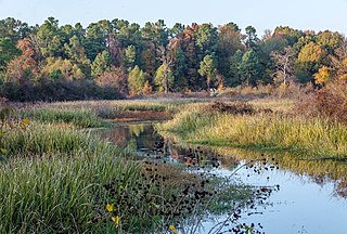
Bayou Bartholomew is the longest bayou in the world, meandering approximately 364 miles (586 km) between the U.S. states of Arkansas and Louisiana. It contains over 100 aquatic species making it the second most diverse stream in North America. Known for its excellent bream, catfish, and crappie fishing, portions of the bayou are considered some of the best kept secrets of Arkansas anglers. It starts northwest of the city of Pine Bluff, Arkansas, in the Hardin community, winds through parts of Jefferson, Lincoln, Desha, Drew, Chicot, and Ashley counties in Arkansas, and Morehouse Parish, Louisiana, and eventually enters the Ouachita River after passing the northernmost tip of Ouachita Parish, near Sterlington, Louisiana. The bayou serves as the primary border separating the Arkansas Delta from the Arkansas Timberlands.
Pleasant Hill is an unincorporated community in Lincoln Parish, Louisiana, United States.
Ansley is an unincorporated community in Jackson Parish, Louisiana, United States.
Barnet Springs is an unincorporated community in Lincoln Parish, Louisiana, United States.
Antioch is an unincorporated community in Lincoln Parish, Louisiana, United States.
References
Municipalities and communities of Lincoln Parish, Louisiana, United States | ||
|---|---|---|
| Cities |  | |
| Towns | ||
| Villages | ||
| Unincorporated communities | ||
| Footnotes | ‡This populated place also has portions in an adjacent parish or parishes | |
32°29′47″N92°51′57″W / 32.49639°N 92.86583°W
| | This Louisiana state location article is a stub. You can help Wikipedia by expanding it. |