Oak Grove Cemetery (Bath, Maine)

Last updated
Oak Grove Cemetery
Oak Grove Bath.jpeg
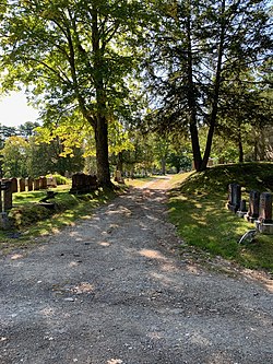
Range 1 at Oak Grove Cemetery, looking south
Details
Location
Oak Grove Avenue
Bath, Maine
Country United States
Coordinates 43°55′28″N69°49′50″W / 43.9243558°N 69.8304209°W / 43.9243558; -69.8304209 Coordinates: 43°55′28″N69°49′50″W / 43.9243558°N 69.8304209°W / 43.9243558; -69.8304209
TypePublic municipal
Owned byCity of Bath [1]
Find a Grave Oak Grove Cemetery

Oak Grove Cemetery (originally the Sewall Burying Ground) [2] is an historic cemetery located in Bath, Maine. Its oldest headstone bears the date January 22, 1777. [2] The cemetery was purchased from the heirs of Charles Sewall in 1872. [2]

Contents

The cemetery is situated on Oak Grove Avenue near Maple Grove Cemetery. These cemeteries are considered two of Bath's "big three", the other one being Calvary Cemetery, [3] just north of downtown.

A portion of the cemetery close to Oak Grove Avenue is given to the Jewish Beth Israel Cemetery. It contains 96 burial spaces. [4]

Whiskeag Trail traverses a portion of the cemetery, crossing Old Brunswick Road at its southern boundary. [5] It crosses the cemetery's bridge that spans the Rockland Branch railroad.

Notable burials

Related Research Articles

<span class="mw-page-title-main">Bath, Maine</span> City in Maine, United States

Bath is a city in Sagadahoc County, Maine, in the United States. The population was 8,766 at the 2020 census. It is the county seat of Sagadahoc County, which includes one city and 10 towns. The city is popular with tourists, many drawn by its 19th-century architecture. It is home to the Bath Iron Works and Heritage Days Festival, held annually on the Fourth of July weekend. It is commonly known as "The City of Ships" because of all the sailing ships that were built in the Bath shipyards. Bath is part of the metropolitan statistical area of Greater Portland.

<span class="mw-page-title-main">Nyack, New York</span> Village in New York, United States

Nyack is a village located primarily in the town of Orangetown in Rockland County, New York, United States. Incorporated in 1872, it retains a very small western section in Clarkstown. The village had a population of 7,265 as of the 2020 census. It is a suburb of New York City lying approximately 15 miles (24 km) north of the Manhattan boundary near the west bank of the Hudson River, situated north of South Nyack, east of Central Nyack, south of Upper Nyack, and southeast of Valley Cottage.

<span class="mw-page-title-main">McArthur–Burney Falls Memorial State Park</span> State park in California, United States

McArthur–Burney Falls Memorial State Park is the second oldest state park in the California State Parks system, located approximately 6 miles (9.7 km) north of Burney, California. The park offers camping, fishing, watersports, hiking and horseback riding facilities. The park is mainly known for the waterfall, Burney Falls, at the entrance of the park. Wildlife in the park includes bass, trout, Steller's jay, squirrels, woodpeckers, deer, and on rare occasion, black bear.

<span class="mw-page-title-main">Arthur Sewall</span> American politician (1835–1900)

Arthur Sewall was an American shipbuilder from Maine, best known as the Democratic nominee for Vice President of the United States in 1896, running mate to William Jennings Bryan. From 1888 to 1896, he served as a member of the Democratic National Committee and unsuccessfully ran for Maine's Senate seat against Eugene Hale. The only elective offices Sewall held were as councilman and alderman in the town of Bath, Maine.

<span class="mw-page-title-main">Harold M. Sewall</span> American politician and diplomat

Harold Marsh Sewall was an American politician and diplomat.

<span class="mw-page-title-main">National Register of Historic Places listings in New York</span>

Buildings, sites, districts, and objects in New York listed on the National Register of Historic Places:

This is a list of trails in Ithaca, New York.

<span class="mw-page-title-main">Schuylkill River Trail</span> Multi-use trail in Pennsylvania, United States

The Schuylkill River Trail is a multi-use trail along the banks of the Schuylkill River in southeastern Pennsylvania. Partially complete as of 2018, the trail is ultimately planned to run about 140 miles (230 km) from the river's headwaters in Schuylkill County to Fort Mifflin in Philadelphia.

The Lexington and West Cambridge Railroad was a railroad company chartered in 1845 and opened in 1846 that operated in eastern Massachusetts. It and its successors provided passenger service until 1977 and freight service until 1980 or early 1981.

<span class="mw-page-title-main">Kew Gardens station (LIRR)</span> Long Island Rail Road station in Queens, New York

Kew Gardens is a station on the Main Line of the Long Island Rail Road (LIRR). It is located in the Kew Gardens neighborhood of Queens, New York City, near Austin Street and Lefferts Boulevard. The station is located within the City Terminal Zone, part of LIRR fare zone 1. It contains four tracks and two side platforms for the outermost tracks.

<span class="mw-page-title-main">Main Line (Long Island Rail Road)</span> Long Island Rail Road branch

The Main Line is a rail line owned and operated by the Long Island Rail Road in the U.S. state of New York. It begins as a two-track line at the Long Island City station in Long Island City, Queens, and runs along the middle of Long Island about 95 miles (153 km) to the Greenport station in Greenport, Suffolk County. A mile east of the Long Island City station, the four tracks of the East River Tunnels join the two tracks from Long Island City; most Main Line trains use these tunnels rather than running to or from Long Island City.

<span class="mw-page-title-main">U.S. Route 1 in Pennsylvania</span> Highway in Pennsylvania

U.S. Route 1 (US 1) is a major north–south U.S. Route, extending from Key West, Florida, in the south to Fort Kent, Maine, at the Canadian border in the north. In the U.S. state of Pennsylvania, US 1 runs for 81 miles (130 km) from the Maryland state line near Nottingham northeast to the New Jersey state line at the Delaware River in Morrisville, through the southeastern portion of the state. The route runs southwest to northeast and serves as a major arterial road through the city of Philadelphia and for many of the suburbs in the Delaware Valley metropolitan area. South of Philadelphia, the road mostly follows the alignment of the Baltimore Pike. Within Philadelphia, it mostly follows Roosevelt Boulevard. North of Philadelphia, US 1 parallels the route of the Lincoln Highway. Several portions of US 1 in Pennsylvania are freeway, including from near the Maryland state line to Kennett Square, the bypass of Media, the concurrency with Interstate 76 and the Roosevelt Expressway in Philadelphia, and between Bensalem Township and the New Jersey state line.

<span class="mw-page-title-main">Sumner Sewall</span> American politician, 58th Governor of Maine (1897–1965)

Sumner Sewall was an American Republican politician and airline executive who served as the 58th Governor of Maine from 1941 to 1945. He began his aviation career during World War I as a fighter ace.

<span class="mw-page-title-main">U.S. Route 1 in Maine</span> State highway in eastern Maine, US

U.S. Route 1 (US 1) in the U.S. state of Maine is a major north–south U.S. Route serving the eastern part of the state. It parallels the Atlantic Ocean from New Hampshire north through Portland, Brunswick, and Belfast to Calais, and then the St. Croix River and the rest of the Canada–U.S. border via Houlton to Fort Kent. The portion along the ocean, known as the Coastal Route, provides a scenic alternate to Interstate 95 (I-95).

<span class="mw-page-title-main">Rockland Branch</span>

The Rockland Branch is a railroad from Brunswick, Maine to Rockland, Maine. A charter was granted in 1849 to build a railway from the Portland and Kennebec Railroad on the west side of the Kennebec River to Rockland. Construction through the rocky headlands of the Atlantic coast proved more expensive than anticipated. The Knox and Lincoln Railroad commenced service to Rockland in 1871 using a ferry to cross the Kennebec River between Bath and Woolwich. The Knox and Lincoln was leased by Maine Central Railroad in 1891, and became Maine Central's Rockland Branch in 1901. Maine Central purchased the Samoset destination hotel in nearby Glen Cove in 1912, and offered direct passenger service for summer visitors from the large eastern cities. Carlton bridge was completed in 1927 to carry the railroad and U.S. Route 1 over the Kennebec River. Maine Central sold the Samoset hotel in 1941, and the last Maine Central passenger train to Rockland was on 4 April 1959. The State of Maine purchased the branch in 1987 to prevent abandonment. The line has subsequently been operated by the Maine Coast Railroad, the Maine Eastern Railroad, and, beginning in 2016, the Central Maine and Quebec Railway. In 2019, Canadian Pacific Railway agreed to purchase the Central Maine and Quebec, thereby inheriting the operation of the Rockland Branch. The acquisition was completed on June 3, 2020.

<span class="mw-page-title-main">Watertown Branch Railroad</span> Former rail right of way being converted to multi use path

The Watertown Branch Railroad was a branch loop of the Fitchburg Railroad that was meant to serve the town of Watertown and the City of Waltham, Middlesex County, Massachusetts, as an independent short line railroad; it also serviced the Watertown Arsenal. The line has been formally abandoned and portions have been converted into a rail trail, the Watertown-Cambridge Greenway. A section from School Street to Arlington Street in Watertown was completed first. A small portion in Waltham has been converted into a park called Chemistry Station Park after the railroad station once located there. Construction of an extension to Fresh Pond Reservation in Cambridge began in the summer of 2018 and was completed in June 2022.

<span class="mw-page-title-main">Evergreen Branch</span> Former Long Island Rail Road branch

The Evergreen Branch was a branch of the Long Island Rail Road (LIRR) that ran in Brooklyn and part of Queens in New York City. The line, at its fullest extent, ran between Greenpoint, Brooklyn and Ridgewood, Queens. The line consisted of two leased portions. The first portion, between Greenpoint and Jefferson Street, was leased from the Glendale and East River Railroad. The second portion, from Jefferson Street to Ridgewood, was leased from the Brooklyn and Rockaway Beach Railroad Company, and was known as the Evergreen Branch, a name later extended to the rest of the line.

Yale Heights is a neighborhood in the Southwest District of Baltimore, located between Beechfield (west) and Irvington (east). Most of its homes were built in 1955 as a development of two-bedroom, brick townhouses. Its population in 2008 was estimated at 2,916.

The Auburn Trail is a multi-use rail trail located principally in the towns of Victor and Farmington, Ontario County, New York (USA). It is approximately 11 miles (18 km) long and maintained by the Towns of Victor and Farmington and Victor Hiking Trails. The trail mostly follows the alignment of the Auburn and Rochester Railroad. Additional disconnected portions of the Auburn trail are found in the Towns of Pittsford and Brighton, Monroe County, NY. A detailed description and map of the Auburn Trail are available from Victor Hiking Trails.

<span class="mw-page-title-main">Thorne Head Preserve</span>

Thorne Head Preserve is a 96 acre property administered by Kennebec Estuary Land Trust (KELT) located at the extreme end of High Street in north Bath, Maine which includes half a mile of shoreline alongside Whiskeag Creek and the Kennebec River. The land was purchased in 2000.

References