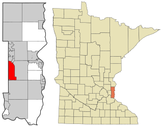
Oakdale is a city in Washington County, Minnesota, United States. It is a suburb of Saint Paul and is on the eastern side of the Twin Cities Metropolitan area. The population was 28,303 at the 2020 census. Oakdale is the 36th largest city in Minnesota by population.

Chester is a small rural city in Chester County, South Carolina, United States. The population was 5,607 at the 2010 census, down from 6,476 at the 2000 census. It is the county seat of Chester County.

Cross Hill is a town in Laurens County, South Carolina, United States. The population was 507 at the 2010 census. It is part of the Greenville–Mauldin–Easley Metropolitan Statistical Area.
Seven Oaks is a census-designated place (CDP) in Lexington County, South Carolina, United States, 8 miles (13 km) northwest of downtown Columbia, the state capital. The population of the CDP was 15,144 at the 2010 census. It is part of the Columbia Metropolitan Statistical Area.

Newport is a census-designated place in York County, South Carolina. Most of Newport is annexed into the city of Rock Hill, while parts are still located in unincorporated York County, but Newport is still considered to be a census-designated place. The census of 2010 showed the population to be 4,136. During the 2000 Census, the population was 4,033.
Wyandotte, is a neighborhood on the southside of Louisville, Kentucky, United States. Its modern boundaries are Longfield Avenue to the north, Taylor Boulevard to the west, I-264 to the south, and Southern Parkway to the east. The opening of Iroquois Park in the early 1890s created a huge demand for suburban homes south of Louisville. The Coleman-Bush company had begun selling lots in a subdivision called Oakdale in late 1890. Oakdale was one of many middle-class communities created at this time, facilitated by the southward extension of streetcar lines.
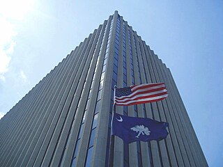
Jefferson Square, an office complex in downtown Columbia, South Carolina, is the headquarters of the state's Department of Health and Human Services which oversees the Medicaid program for South Carolinians. Located at 1801 Main St. in the city's historic Arsenal Hill neighborhood, the complex includes a 15-story, 150,000 sq ft (14,000 m2) office tower and a two-story courtyard plaza. Also on the Jefferson Square block are the offices of Wilson-Kibler real estate, two parking garages, a parking lot, and the Arsenal Hill Associate Reformed Presbyterian Church.

WRHI is a news/talk radio station in Rock Hill, South Carolina. It broadcasts on AM frequency 1340 kHz with a simulcast on 100.1 FM and is under ownership of OTS Media Group. Its studios and transmitter are both located separately in Rock Hill.
Eagle Field is a soccer-specific stadium located in Rock Hill, South Carolina, United States, on the campus of Winthrop University.

WCOS-FM is a commercial radio station in Columbia, South Carolina. It airs a country music radio format and is owned by iHeartMedia, Inc. The station goes by the name 97-5 WCOS and its current slogan is "Today's Best Country and Your All-Time Favorites." Its studios and offices are on Graystone Boulevard in Columbia near Interstate 126.
WNSC-FM is a National Public Radio station in Rock Hill, South Carolina. A member of South Carolina Public Radio, it carries programming from South Carolina Public Radio's all-news network.

Salt Springs is a Syracuse, New York neighborhood, located in the northeastern corner of the city. It corresponds to Onondaga County Census Tract xx.
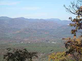
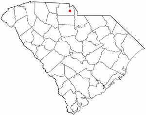
Tamassee is an unincorporated community and census-designated place (CDP) located in northwestern Oconee County, South Carolina, United States. It was first listed as a CDP in the 2020 census with a population of 60.
Tirzah is an unincorporated community in York County, South Carolina, United States. The elevation of Tirzah is 705 ft. The community is halfway between the city of York and Rock Hill.
Oakdale Air Force Station is a United States Air Force General Surveillance Radar station. It is located 1.3 miles (2.1 km) east of the Pittsburgh suburb of Oakdale, Pennsylvania. It was closed in 1969.
Smith or Smiths Turnout is an unincorporated community in southern York County, South Carolina located south of Rock Hill and northwest of Edgemoor near the Chester County line. The elevation of Smith is 531 feet.
Ebenezer or Ebenezerville is a neighborhood of Rock Hill, South Carolina located at latitude 34.957 and longitude -81.046 along Ebenezer Road in the northern part of the city. Ebenezer was a town in northern York County, South Carolina until it was unincorporated and annexed into the city of Rock Hill in the late 1960s. The elevation of the neighborhood is 686 feet above sea level.

Boyd Hill was an unincorporated community in western York County, South Carolina, but was annexed into the city of Rock Hill in the late 1940s. Boyd Hill is now a neighborhood of Rock Hill located at latitude 34.9396, longitude -81.0442 off of Cherry Road in the southwestern portion of the city. The elevation of the neighborhood is 641 feet.
Mallet is a region of Rio de Janeiro, but not officially recognized as a neighborhood.

